Washington West Topo Map Missouri
To zoom in, hover over the map of Washington West
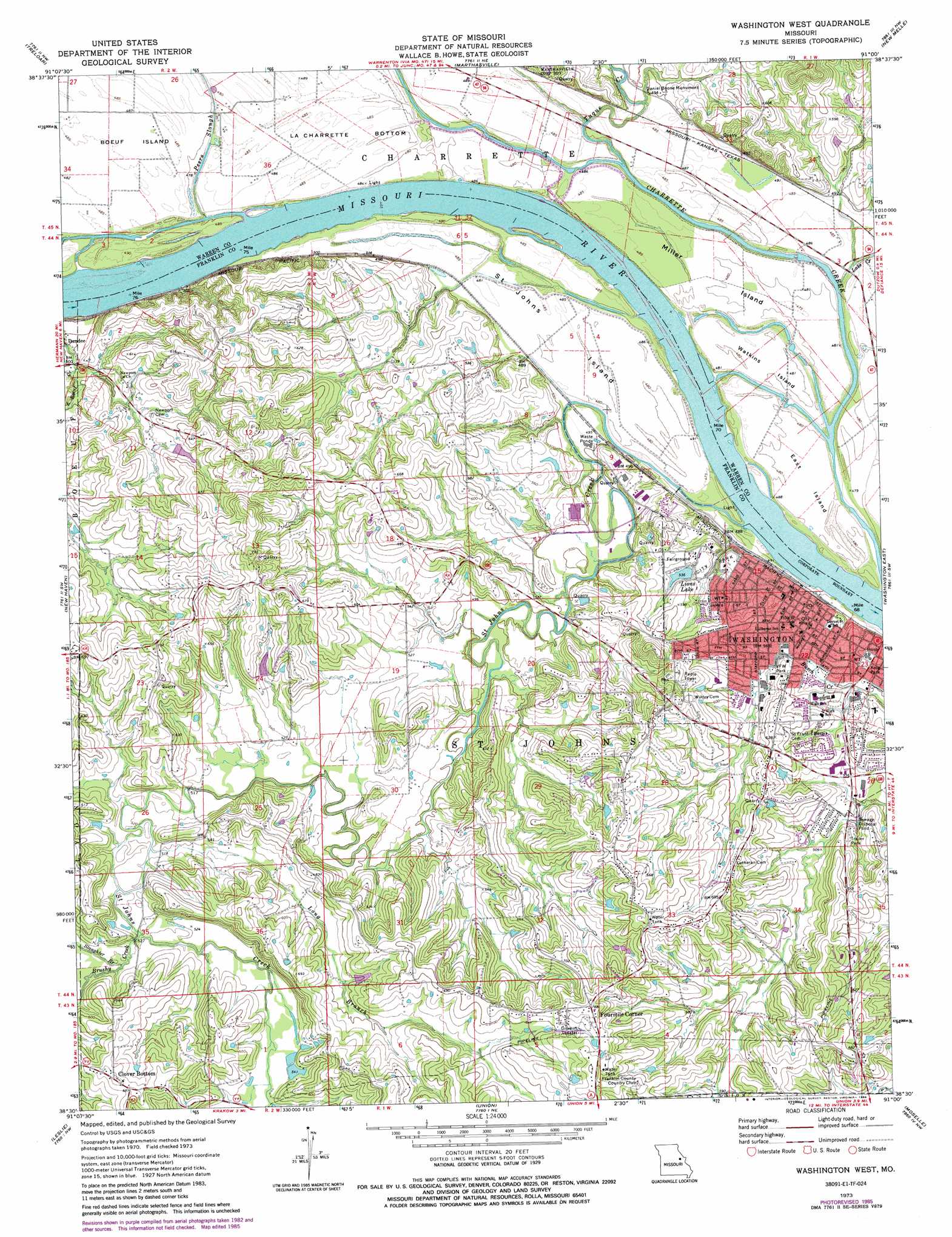
USGS Topo Quad 38091e1 - 1:24,000 scale
| Topo Map Name: | Washington West |
| USGS Topo Quad ID: | 38091e1 |
| Print Size: | ca. 21 1/4" wide x 27" high |
| Southeast Coordinates: | 38.5° N latitude / 91° W longitude |
| Map Center Coordinates: | 38.5625° N latitude / 91.0625° W longitude |
| U.S. State: | MO |
| Filename: | o38091e1.jpg |
| Download Map JPG Image: | Washington West topo map 1:24,000 scale |
| Map Type: | Topographic |
| Topo Series: | 7.5´ |
| Map Scale: | 1:24,000 |
| Source of Map Images: | United States Geological Survey (USGS) |
| Alternate Map Versions: |
Washington West MO 1973, updated 1974 Download PDF Buy paper map Washington West MO 1973, updated 1986 Download PDF Buy paper map Washington West MO 2012 Download PDF Buy paper map Washington West MO 2015 Download PDF Buy paper map |
1:24,000 Topo Quads surrounding Washington West
Jonesburg |
Warrenton |
Wright City |
Foristell |
Wentzville |
Berger |
Treloar |
Marthasville |
New Melle |
Defiance |
Dissen |
New Haven |
Washington West |
Washington East |
Labadie |
Gerald |
Leslie |
Union |
Moselle |
Gray Summit |
Strain |
Spring Bluff |
Stanton |
Saint Clair |
Lonedell |
> Back to 38091e1 at 1:100,000 scale
> Back to 38090a1 at 1:250,000 scale
> Back to U.S. Topo Maps home
Washington West topo map: Gazetteer
Washington West: Airports
Lost Umlaut Farm Airport elevation 147m 482′Washington West: Areas
Saint Johns Island elevation 147m 482′Washington West: Dams
Lions Lake Dam elevation 163m 534′Washington West: Islands
East Island elevation 146m 479′Miller Island elevation 146m 479′
Watkins Island elevation 146m 479′
Washington West: Parks
Daniel Boone Monument elevation 152m 498′Krog Park elevation 167m 547′
Washington West: Populated Places
Clover Bottom elevation 209m 685′Dundee elevation 151m 495′
Fourmile Corner elevation 234m 767′
Washington elevation 168m 551′
Washington West: Post Offices
Washington Main Post Office elevation 164m 538′Washington Post Office - Downtown Station elevation 165m 541′
Washington West: Reservoirs
Lions Lake elevation 164m 538′Washington Lions Lake elevation 163m 534′
Washington Water Storage Tank elevation 207m 679′
Washington West: Streams
Brushy Creek elevation 156m 511′Lake Creek elevation 144m 472′
Long Branch elevation 155m 508′
Peers Slough elevation 146m 479′
Saint Johns Creek elevation 144m 472′
Slaughter Branch elevation 158m 518′
Tuque Creek elevation 144m 472′
Whisky Creek elevation 162m 531′
Washington West digital topo map on disk
Buy this Washington West topo map showing relief, roads, GPS coordinates and other geographical features, as a high-resolution digital map file on DVD: