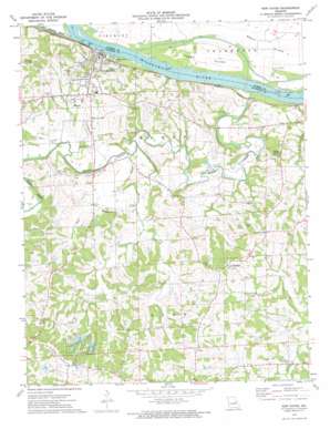
New Haven Topo Map Missouri
To zoom in, hover over the map of New Haven
USGS Topo Quad 38091e2 - 1:24,000 scale
| Topo Map Name: | New Haven |
| USGS Topo Quad ID: | 38091e2 |
| Print Size: | ca. 21 1/4" wide x 27" high |
| Southeast Coordinates: | 38.5° N latitude / 91.125° W longitude |
| Map Center Coordinates: | 38.5625° N latitude / 91.1875° W longitude |
| U.S. State: | MO |
| Filename: | o38091e2.jpg |
| Download Map JPG Image: | New Haven topo map 1:24,000 scale |
| Map Type: | Topographic |
| Topo Series: | 7.5´ |
| Map Scale: | 1:24,000 |
| Source of Map Images: | United States Geological Survey (USGS) |
| Alternate Map Versions: |
New Haven MO 1973, updated 1975 Download PDF Buy paper map New Haven MO 2012 Download PDF Buy paper map New Haven MO 2015 Download PDF Buy paper map |
1:24,000 Topo Quads surrounding New Haven
> Back to 38091e1 at 1:100,000 scale
> Back to 38090a1 at 1:250,000 scale
> Back to U.S. Topo Maps home
New Haven topo map: Gazetteer
New Haven: Areas
Boeuf Island elevation 150m 492′New Haven: Dams
Deppermann Lake Dam elevation 207m 679′Luecker Lake Dam elevation 201m 659′
Newton Lake Dam elevation 198m 649′
Schepp Lake Dam elevation 217m 711′
Stallman Lake Dam elevation 238m 780′
Struebbes Dam elevation 161m 528′
Whispering Valley Lake Number 1 Dam elevation 209m 685′
Whispering Valley Lake Number 2 Dam elevation 207m 679′
Whispering Valley Lake Number 3 Dam elevation 214m 702′
New Haven: Islands
Goose Island elevation 149m 488′New Haven: Populated Places
Baltimore Settlement elevation 228m 748′Campbellton elevation 236m 774′
Kiel elevation 227m 744′
Lyon elevation 235m 770′
New Haven elevation 206m 675′
New Haven: Reservoirs
Robert Stallman Lake elevation 238m 780′Struebbes Lake elevation 161m 528′
Whispering Valley Lake elevation 209m 685′
New Haven: Streams
Big Berger Creek elevation 151m 495′Boeuf Creek elevation 150m 492′
Bucklick Creek elevation 158m 518′
Little Boeuf Creek elevation 148m 485′
Mud Creek elevation 156m 511′
Pin Oak Creek elevation 152m 498′
Wildcat Creek elevation 153m 501′
New Haven: Summits
Enoch Knob elevation 228m 748′New Haven digital topo map on disk
Buy this New Haven topo map showing relief, roads, GPS coordinates and other geographical features, as a high-resolution digital map file on DVD:


