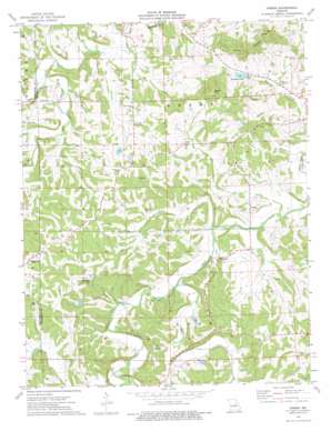
Dissen Topo Map Missouri
To zoom in, hover over the map of Dissen
USGS Topo Quad 38091e3 - 1:24,000 scale
| Topo Map Name: | Dissen |
| USGS Topo Quad ID: | 38091e3 |
| Print Size: | ca. 21 1/4" wide x 27" high |
| Southeast Coordinates: | 38.5° N latitude / 91.25° W longitude |
| Map Center Coordinates: | 38.5625° N latitude / 91.3125° W longitude |
| U.S. State: | MO |
| Filename: | o38091e3.jpg |
| Download Map JPG Image: | Dissen topo map 1:24,000 scale |
| Map Type: | Topographic |
| Topo Series: | 7.5´ |
| Map Scale: | 1:24,000 |
| Source of Map Images: | United States Geological Survey (USGS) |
| Alternate Map Versions: |
Dissen MO 1973, updated 1975 Download PDF Buy paper map Dissen MO 2012 Download PDF Buy paper map Dissen MO 2015 Download PDF Buy paper map |
1:24,000 Topo Quads surrounding Dissen
> Back to 38091e1 at 1:100,000 scale
> Back to 38090a1 at 1:250,000 scale
> Back to U.S. Topo Maps home
Dissen topo map: Gazetteer
Dissen: Dams
Koch Lake Dam elevation 197m 646′Laschke Lake Dam elevation 206m 675′
Meyer Lake Dam elevation 186m 610′
Roadside Lake Dam elevation 191m 626′
Sellenriek Dam elevation 199m 652′
Strubberg Lake Dam elevation 176m 577′
Dissen: Populated Places
Detmold elevation 177m 580′Dissen elevation 196m 643′
Kohl City elevation 192m 629′
Senate Grove (historical) elevation 233m 764′
Stony Hill elevation 247m 810′
Dissen: Ranges
Etlah Knobs elevation 221m 725′Dissen: Reservoirs
Ben J Koch Lake elevation 197m 646′Chester Mayer Lake elevation 186m 610′
Roadside Lake elevation 190m 623′
Dissen: Streams
Big Branch elevation 159m 521′Cedar Fork elevation 163m 534′
Fork Creek elevation 159m 521′
Prairie Fork elevation 159m 521′
Dissen: Summits
Kaiser Hill elevation 280m 918′Dissen digital topo map on disk
Buy this Dissen topo map showing relief, roads, GPS coordinates and other geographical features, as a high-resolution digital map file on DVD:


