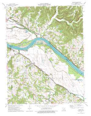
Berger Topo Map Missouri
To zoom in, hover over the map of Berger
USGS Topo Quad 38091f3 - 1:24,000 scale
| Topo Map Name: | Berger |
| USGS Topo Quad ID: | 38091f3 |
| Print Size: | ca. 21 1/4" wide x 27" high |
| Southeast Coordinates: | 38.625° N latitude / 91.25° W longitude |
| Map Center Coordinates: | 38.6875° N latitude / 91.3125° W longitude |
| U.S. State: | MO |
| Filename: | o38091f3.jpg |
| Download Map JPG Image: | Berger topo map 1:24,000 scale |
| Map Type: | Topographic |
| Topo Series: | 7.5´ |
| Map Scale: | 1:24,000 |
| Source of Map Images: | United States Geological Survey (USGS) |
| Alternate Map Versions: |
Berger MO 1974, updated 1975 Download PDF Buy paper map Berger MO 2012 Download PDF Buy paper map Berger MO 2015 Download PDF Buy paper map |
1:24,000 Topo Quads surrounding Berger
> Back to 38091e1 at 1:100,000 scale
> Back to 38090a1 at 1:250,000 scale
> Back to U.S. Topo Maps home
Berger topo map: Gazetteer
Berger: Areas
Northeastern Ozarks elevation 165m 541′Berger: Dams
Oetting Lake Dam elevation 181m 593′Parsons Lake Dam elevation 176m 577′
Sky Ranch Lake Dam elevation 177m 580′
Berger: Flats
Berger Bottom elevation 153m 501′Berger: Islands
Rush Island elevation 153m 501′Berger: Populated Places
Berger elevation 169m 554′Bernheimer elevation 153m 501′
Case elevation 156m 511′
Etlah elevation 157m 515′
Gore elevation 155m 508′
Berger: Streams
Clear Branch elevation 152m 498′Cullum Branch elevation 151m 495′
Little Berger Creek elevation 151m 495′
Little Lost Creek elevation 155m 508′
Lost Creek elevation 151m 495′
Loutre Slough elevation 151m 495′
Massie Creek elevation 151m 495′
Pryors Branch elevation 151m 495′
Wilsons Branch elevation 164m 538′
Berger digital topo map on disk
Buy this Berger topo map showing relief, roads, GPS coordinates and other geographical features, as a high-resolution digital map file on DVD:


