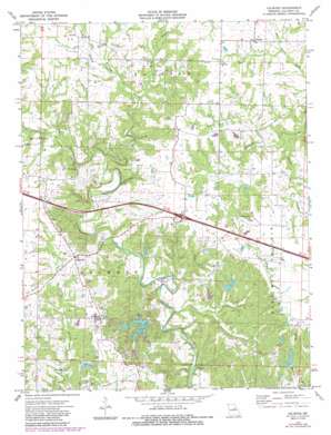
Calwood Topo Map Missouri
To zoom in, hover over the map of Calwood
USGS Topo Quad 38091h7 - 1:24,000 scale
| Topo Map Name: | Calwood |
| USGS Topo Quad ID: | 38091h7 |
| Print Size: | ca. 21 1/4" wide x 27" high |
| Southeast Coordinates: | 38.875° N latitude / 91.75° W longitude |
| Map Center Coordinates: | 38.9375° N latitude / 91.8125° W longitude |
| U.S. State: | MO |
| Filename: | o38091h7.jpg |
| Download Map JPG Image: | Calwood topo map 1:24,000 scale |
| Map Type: | Topographic |
| Topo Series: | 7.5´ |
| Map Scale: | 1:24,000 |
| Source of Map Images: | United States Geological Survey (USGS) |
| Alternate Map Versions: |
Calwood MO 1973, updated 1975 Download PDF Buy paper map Calwood MO 1973, updated 1986 Download PDF Buy paper map Calwood MO 2012 Download PDF Buy paper map Calwood MO 2015 Download PDF Buy paper map |
1:24,000 Topo Quads surrounding Calwood
> Back to 38091e1 at 1:100,000 scale
> Back to 38090a1 at 1:250,000 scale
> Back to U.S. Topo Maps home
Calwood topo map: Gazetteer
Calwood: Areas
Tates Prairie elevation 253m 830′Calwood: Dams
Dolnick Lake Dam elevation 229m 751′Heinrichsmeyer Lake Dam elevation 214m 702′
Hrin Lake Dam elevation 211m 692′
Leisure Lake Dam elevation 202m 662′
Leisure Lake East Dam elevation 217m 711′
Leisure Lake South Dam elevation 234m 767′
Leisure Lake West Dam elevation 216m 708′
Marti Lake Dam elevation 240m 787′
Phillips Lake Dam elevation 239m 784′
Sullivan Lake Dam elevation 206m 675′
Wilson Dam elevation 240m 787′
Calwood: Populated Places
Bachelor elevation 252m 826′Calwood elevation 245m 803′
Calwood: Reservoirs
Leisure Lake elevation 205m 672′Calwood: Streams
Bragg Branch elevation 207m 679′Clarks Branch elevation 217m 711′
Harrison Branch elevation 203m 666′
Hunt Branch elevation 220m 721′
Yates Branch elevation 226m 741′
Calwood digital topo map on disk
Buy this Calwood topo map showing relief, roads, GPS coordinates and other geographical features, as a high-resolution digital map file on DVD:


