Kingdom City Topo Map Missouri
To zoom in, hover over the map of Kingdom City
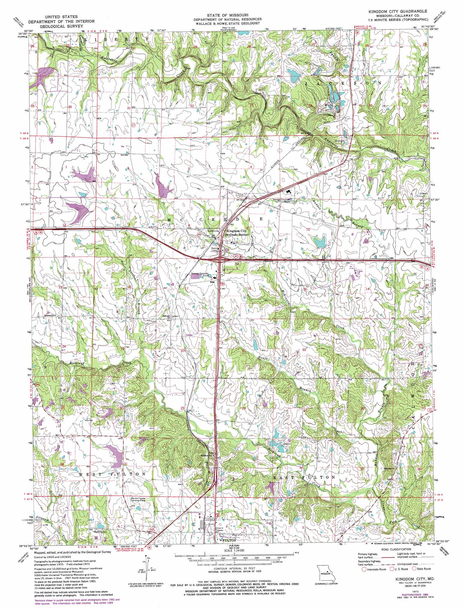
USGS Topo Quad 38091h8 - 1:24,000 scale
| Topo Map Name: | Kingdom City |
| USGS Topo Quad ID: | 38091h8 |
| Print Size: | ca. 21 1/4" wide x 27" high |
| Southeast Coordinates: | 38.875° N latitude / 91.875° W longitude |
| Map Center Coordinates: | 38.9375° N latitude / 91.9375° W longitude |
| U.S. State: | MO |
| Filename: | o38091h8.jpg |
| Download Map JPG Image: | Kingdom City topo map 1:24,000 scale |
| Map Type: | Topographic |
| Topo Series: | 7.5´ |
| Map Scale: | 1:24,000 |
| Source of Map Images: | United States Geological Survey (USGS) |
| Alternate Map Versions: |
Kingdom City MO 1973, updated 1975 Download PDF Buy paper map Kingdom City MO 1973, updated 1986 Download PDF Buy paper map Kingdom City MO 2012 Download PDF Buy paper map Kingdom City MO 2015 Download PDF Buy paper map |
1:24,000 Topo Quads surrounding Kingdom City
Centralia |
Centralia Ne |
Mexico West |
Mexico East |
Laddonia |
Hallsville |
Hatton |
Auxvasse |
Mexico Se |
Martinsburg |
Millersburg |
Millersburg Ne |
Kingdom City |
Calwood |
Williamsburg |
Millersburg Sw |
Guthrie |
Fulton |
Reform |
Readsville |
Jefferson City Nw |
New Bloomfield |
Mokane West |
Mokane East |
Morrison |
> Back to 38091e1 at 1:100,000 scale
> Back to 38090a1 at 1:250,000 scale
> Back to U.S. Topo Maps home
Kingdom City topo map: Gazetteer
Kingdom City: Dams
Atkinson Lake Dam elevation 258m 846′Atkinson Lake Dam elevation 260m 853′
Backer Dam elevation 221m 725′
Baker Lake Dam elevation 258m 846′
Borman Lake Dam elevation 268m 879′
Guthrie Lake Dam elevation 261m 856′
Lehenbaur Lake Section 25 Dam elevation 251m 823′
McCredie Experiment Station Dam elevation 246m 807′
Renner Dam elevation 229m 751′
Kingdom City: Populated Places
Callaway elevation 245m 803′Calleaway elevation 240m 787′
Kingdom City elevation 259m 849′
McCredie elevation 261m 856′
Kingdom City: Reservoirs
Baker Lake elevation 258m 846′Guthrie Lake elevation 261m 856′
McCredie Watershed W-1 Reservoir elevation 246m 807′
Kingdom City: Streams
Allen Branch elevation 238m 780′Bynum Creek elevation 215m 705′
Houfs Branch elevation 207m 679′
Leeper Branch elevation 239m 784′
Maddox Branch elevation 201m 659′
McKinney Creek elevation 213m 698′
Richland Creek elevation 201m 659′
Rocky Branch elevation 243m 797′
Sallees Branch elevation 228m 748′
Kingdom City digital topo map on disk
Buy this Kingdom City topo map showing relief, roads, GPS coordinates and other geographical features, as a high-resolution digital map file on DVD: