Brays Topo Map Missouri
To zoom in, hover over the map of Brays
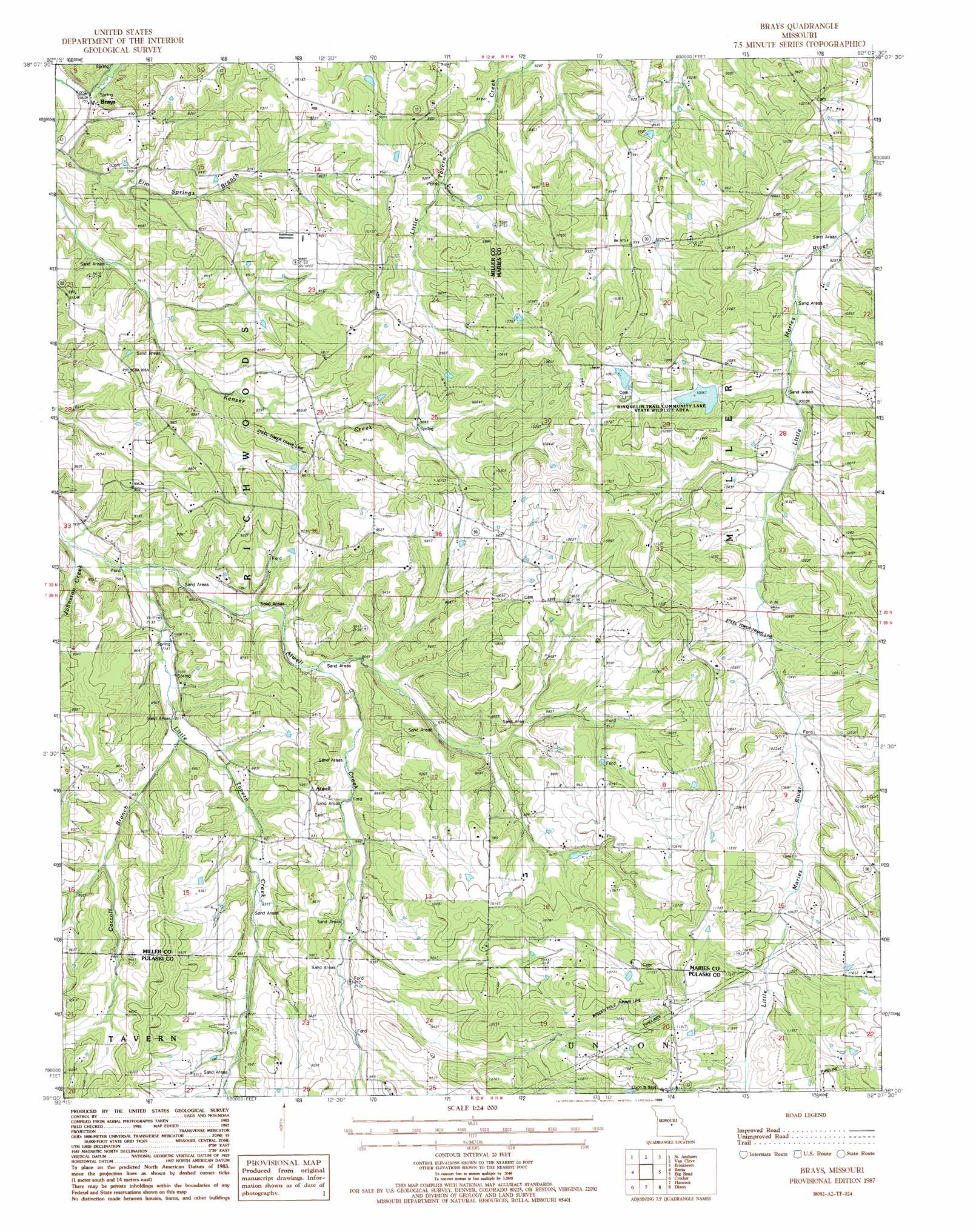
USGS Topo Quad 38092a2 - 1:24,000 scale
| Topo Map Name: | Brays |
| USGS Topo Quad ID: | 38092a2 |
| Print Size: | ca. 21 1/4" wide x 27" high |
| Southeast Coordinates: | 38° N latitude / 92.125° W longitude |
| Map Center Coordinates: | 38.0625° N latitude / 92.1875° W longitude |
| U.S. State: | MO |
| Filename: | o38092a2.jpg |
| Download Map JPG Image: | Brays topo map 1:24,000 scale |
| Map Type: | Topographic |
| Topo Series: | 7.5´ |
| Map Scale: | 1:24,000 |
| Source of Map Images: | United States Geological Survey (USGS) |
| Alternate Map Versions: |
Brays MO 1987, updated 1988 Download PDF Buy paper map Brays MO 2011 Download PDF Buy paper map Brays MO 2015 Download PDF Buy paper map |
1:24,000 Topo Quads surrounding Brays
Eugene |
Saint Elizabeth |
Meta |
Argyle |
Freeburg |
Tuscumbia |
Saint Anthony |
Van Cleve |
Brinktown |
Vienna |
Brumley |
Iberia |
Brays |
Big Bend |
Nagogami Lodge |
Conns Creek |
Crocker |
Hancock |
Dixon |
Newburg |
Richland |
Ozark Springs |
Waynesville |
Devils Elbow |
Kaintuck Hollow |
> Back to 38092a1 at 1:100,000 scale
> Back to 38092a1 at 1:250,000 scale
> Back to U.S. Topo Maps home
Brays topo map: Gazetteer
Brays: Dams
Saber Lake Dam elevation 300m 984′Share Lake Dam elevation 322m 1056′
Brays: Parks
Rinquelin Trail Community Lake State Wildlife Area elevation 310m 1017′Brays: Populated Places
Atwell elevation 286m 938′Brays elevation 224m 734′
Traderight elevation 299m 980′
Brays: Reservoirs
Joe Hanauer Lake elevation 300m 984′Brays: Streams
Atwell Creek elevation 227m 744′Carroll Creek elevation 238m 780′
Johnston Creek elevation 226m 741′
Brays digital topo map on disk
Buy this Brays topo map showing relief, roads, GPS coordinates and other geographical features, as a high-resolution digital map file on DVD: