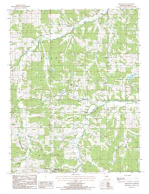
Brinktown Topo Map Missouri
To zoom in, hover over the map of Brinktown
USGS Topo Quad 38092b1 - 1:24,000 scale
| Topo Map Name: | Brinktown |
| USGS Topo Quad ID: | 38092b1 |
| Print Size: | ca. 21 1/4" wide x 27" high |
| Southeast Coordinates: | 38.125° N latitude / 92° W longitude |
| Map Center Coordinates: | 38.1875° N latitude / 92.0625° W longitude |
| U.S. State: | MO |
| Filename: | o38092b1.jpg |
| Download Map JPG Image: | Brinktown topo map 1:24,000 scale |
| Map Type: | Topographic |
| Topo Series: | 7.5´ |
| Map Scale: | 1:24,000 |
| Source of Map Images: | United States Geological Survey (USGS) |
| Alternate Map Versions: |
Brinktown MO 1987, updated 1988 Download PDF Buy paper map Brinktown MO 2011 Download PDF Buy paper map Brinktown MO 2015 Download PDF Buy paper map |
1:24,000 Topo Quads surrounding Brinktown
> Back to 38092a1 at 1:100,000 scale
> Back to 38092a1 at 1:250,000 scale
> Back to U.S. Topo Maps home
Brinktown topo map: Gazetteer
Brinktown: Dams
Blake Lake Dam elevation 293m 961′Danube Corporation Lower Dam elevation 251m 823′
Danube Corporation Upper Dam elevation 256m 839′
Hoban Lake Dam elevation 259m 849′
Kleffner Lake Dam elevation 282m 925′
Nepomuceno Lake Dam elevation 277m 908′
Wilson Lake Dam elevation 295m 967′
Brinktown: Populated Places
Brinktown elevation 322m 1056′Ozark Junction elevation 286m 938′
Venus elevation 247m 810′
Brinktown: Reservoirs
Charwood Lake elevation 251m 823′Number 68 Lake elevation 259m 849′
Peter Markuly Lake elevation 293m 961′
Brinktown: Streams
Krone Branch elevation 241m 790′Long Branch elevation 230m 754′
Mag Creek elevation 235m 770′
Rodgers Creek elevation 257m 843′
Brinktown digital topo map on disk
Buy this Brinktown topo map showing relief, roads, GPS coordinates and other geographical features, as a high-resolution digital map file on DVD:


