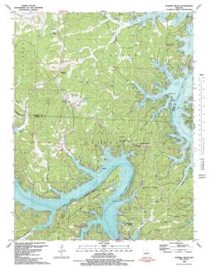
Sunrise Beach Topo Map Missouri
To zoom in, hover over the map of Sunrise Beach
USGS Topo Quad 38092b7 - 1:24,000 scale
| Topo Map Name: | Sunrise Beach |
| USGS Topo Quad ID: | 38092b7 |
| Print Size: | ca. 21 1/4" wide x 27" high |
| Southeast Coordinates: | 38.125° N latitude / 92.75° W longitude |
| Map Center Coordinates: | 38.1875° N latitude / 92.8125° W longitude |
| U.S. State: | MO |
| Filename: | o38092b7.jpg |
| Download Map JPG Image: | Sunrise Beach topo map 1:24,000 scale |
| Map Type: | Topographic |
| Topo Series: | 7.5´ |
| Map Scale: | 1:24,000 |
| Source of Map Images: | United States Geological Survey (USGS) |
| Alternate Map Versions: |
Purvis MO 1934 Download PDF Buy paper map Purvis MO 1934 Download PDF Buy paper map Sunrise Beach MO 1959, updated 1960 Download PDF Buy paper map Sunrise Beach MO 1959, updated 1972 Download PDF Buy paper map Sunrise Beach MO 1959, updated 1982 Download PDF Buy paper map Sunrise Beach MO 1983, updated 1983 Download PDF Buy paper map Sunrise Beach MO 1983, updated 1983 Download PDF Buy paper map Sunrise Beach MO 2011 Download PDF Buy paper map Sunrise Beach MO 2015 Download PDF Buy paper map |
1:24,000 Topo Quads surrounding Sunrise Beach
> Back to 38092a1 at 1:100,000 scale
> Back to 38092a1 at 1:250,000 scale
> Back to U.S. Topo Maps home
Sunrise Beach topo map: Gazetteer
Sunrise Beach: Airports
Mistwood Airport elevation 242m 793′Sunrise Beach: Bays
Buck Creek Cove elevation 201m 659′Cozy Cove elevation 201m 659′
Easter Hollow Cove elevation 201m 659′
Moonlight Bay elevation 201m 659′
North Buck Creek Cove elevation 201m 659′
Still Water Bay elevation 201m 659′
Sunrise Beach: Bends
Porter Mill Bend elevation 248m 813′Sunrise Beach: Capes
Galena Point elevation 202m 662′Sagamo Point elevation 207m 679′
Stevens Point elevation 202m 662′
Sunrise Beach: Cliffs
Folsom Bluff elevation 226m 741′Sunrise Beach: Islands
Twin Islands elevation 201m 659′Sunrise Beach: Populated Places
Buck Creek elevation 253m 830′Cape Galena (historical) elevation 201m 659′
Hurricane Deck elevation 234m 767′
Laurie elevation 294m 964′
Purvis elevation 214m 702′
Sunrise Beach elevation 258m 846′
Sunrise Beach: Streams
Brush Creek elevation 201m 659′Buck Creek elevation 202m 662′
Camp Branch elevation 202m 662′
Dry Branch elevation 202m 662′
Mill Creek elevation 202m 662′
North Fork Buck Creek elevation 218m 715′
South Fork Mill Creek elevation 202m 662′
Spring Cove elevation 202m 662′
Sunrise Beach: Valleys
Alcorn Hollow elevation 202m 662′Cape Hollow elevation 201m 659′
Deicel Hollow elevation 202m 662′
Jenkins Hollow elevation 203m 666′
John Hill Hollow elevation 205m 672′
Kinchlow Hollow elevation 201m 659′
Little Kinchlow Hollow elevation 202m 662′
Lynch Hollow elevation 201m 659′
McFarland Hollow elevation 205m 672′
Porter Mill Hollow elevation 213m 698′
Possum Hollow elevation 201m 659′
Staley Hollow elevation 201m 659′
Sugartree Hollow elevation 209m 685′
Welcher Hollow elevation 205m 672′
Sunrise Beach digital topo map on disk
Buy this Sunrise Beach topo map showing relief, roads, GPS coordinates and other geographical features, as a high-resolution digital map file on DVD:


