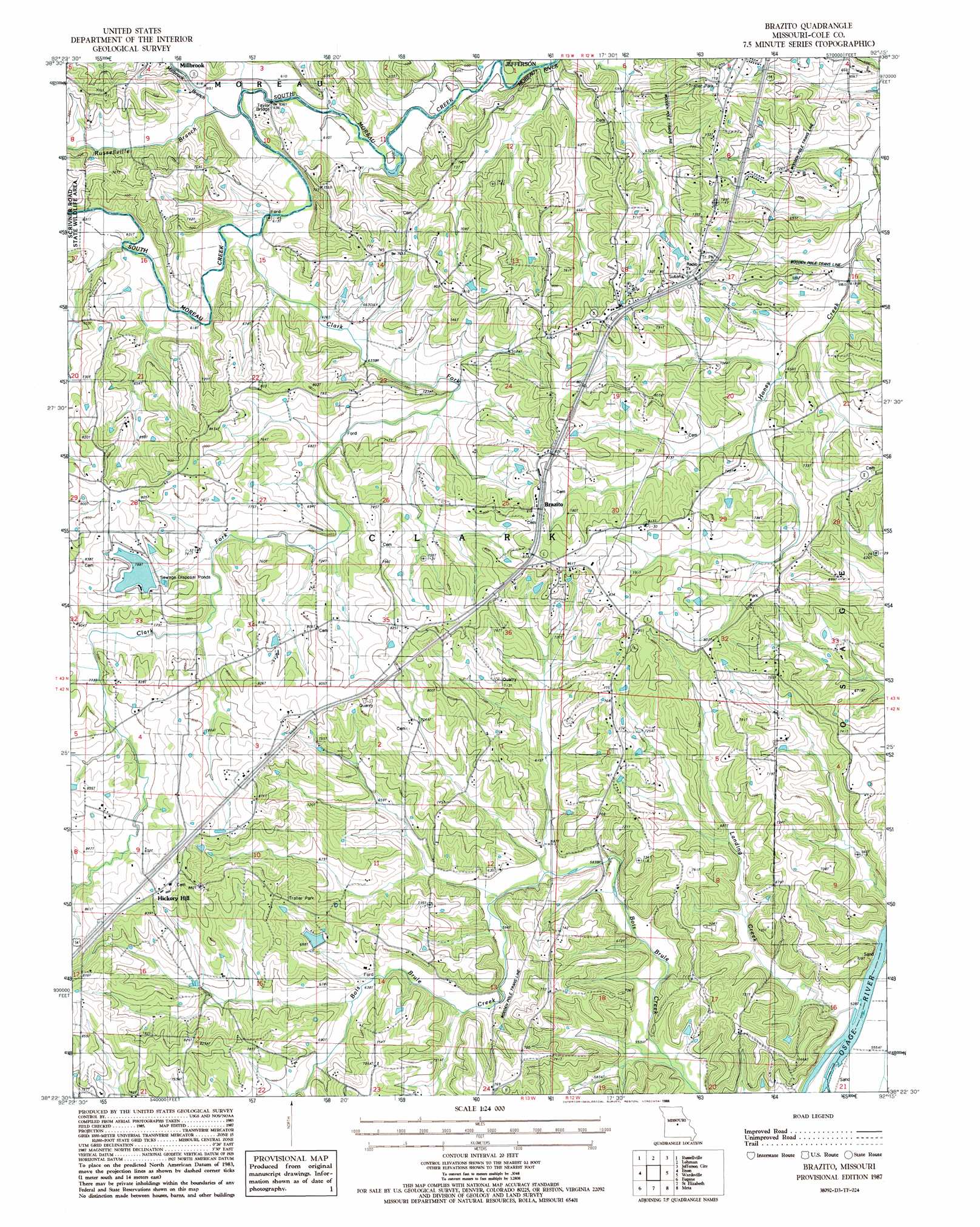
Brazito Topo Map Missouri
To zoom in, hover over the map of Brazito
USGS Topo Quad 38092d3 - 1:24,000 scale
| Topo Map Name: | Brazito |
| USGS Topo Quad ID: | 38092d3 |
| Print Size: | ca. 21 1/4" wide x 27" high |
| Southeast Coordinates: | 38.375° N latitude / 92.25° W longitude |
| Map Center Coordinates: | 38.4375° N latitude / 92.3125° W longitude |
| U.S. State: | MO |
| Filename: | o38092d3.jpg |
| Download Map JPG Image: | Brazito topo map 1:24,000 scale |
| Map Type: | Topographic |
| Topo Series: | 7.5´ |
| Map Scale: | 1:24,000 |
| Source of Map Images: | United States Geological Survey (USGS) |
| Alternate Map Versions: |
Brazito MO 1987, updated 1988 Download PDF Buy paper map Brazito MO 2011 Download PDF Buy paper map Brazito MO 2015 Download PDF Buy paper map |
1:24,000 Topo Quads surrounding Brazito
California North |
Centertown Nw |
Hartsburg |
Jefferson City Nw |
New Bloomfield |
California South |
Russellville |
Lohman |
Jefferson City |
Osage City |
Olean |
Enon |
Brazito |
Wardsville |
Westphalia West |
Eldon |
Eugene |
Saint Elizabeth |
Meta |
Argyle |
Bagnell |
Tuscumbia |
Saint Anthony |
Van Cleve |
Brinktown |
> Back to 38092a1 at 1:100,000 scale
> Back to 38092a1 at 1:250,000 scale
> Back to U.S. Topo Maps home
Brazito topo map: Gazetteer
Brazito: Bridges
Taylor Bridge elevation 181m 593′Brazito: Dams
Lake Carmel Dam elevation 240m 787′Mar-Kay Lake Dam elevation 213m 698′
Number 848 Dam elevation 191m 626′
Starr Lake Dam elevation 244m 800′
Brazito: Populated Places
Bass elevation 253m 830′Brazito elevation 247m 810′
Hickory Hill elevation 269m 882′
Millbrook elevation 192m 629′
Brazito: Reservoirs
Lake Carmel elevation 240m 787′Patterson Lake elevation 213m 698′
Brazito: Streams
Clark Fork elevation 188m 616′Landing Creek elevation 164m 538′
Millbrook Branch elevation 183m 600′
North Moreau Creek elevation 183m 600′
Russellville Branch elevation 186m 610′
Brazito digital topo map on disk
Buy this Brazito topo map showing relief, roads, GPS coordinates and other geographical features, as a high-resolution digital map file on DVD: