Florence Topo Map Missouri
To zoom in, hover over the map of Florence
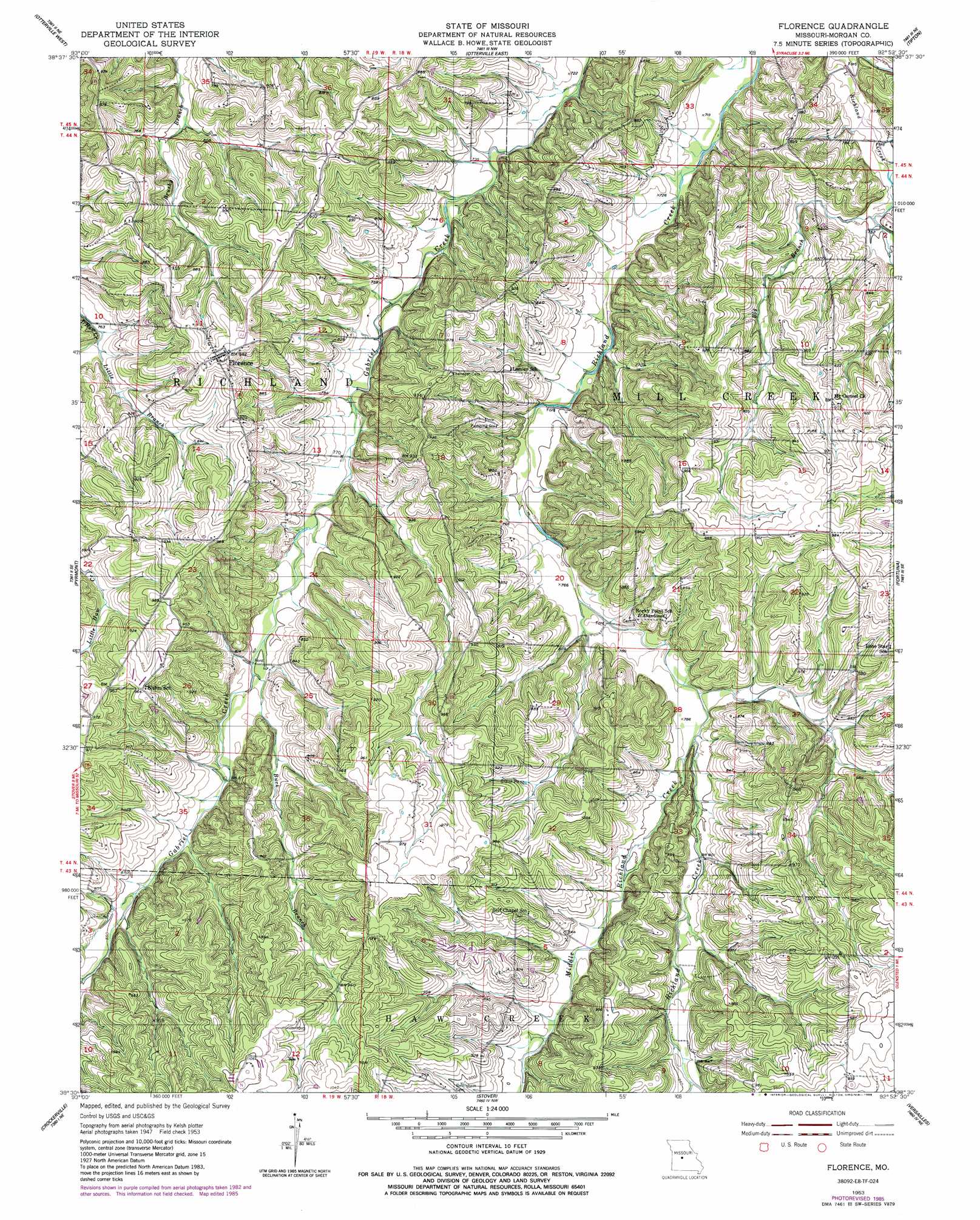
USGS Topo Quad 38092e8 - 1:24,000 scale
| Topo Map Name: | Florence |
| USGS Topo Quad ID: | 38092e8 |
| Print Size: | ca. 21 1/4" wide x 27" high |
| Southeast Coordinates: | 38.5° N latitude / 92.875° W longitude |
| Map Center Coordinates: | 38.5625° N latitude / 92.9375° W longitude |
| U.S. State: | MO |
| Filename: | o38092e8.jpg |
| Download Map JPG Image: | Florence topo map 1:24,000 scale |
| Map Type: | Topographic |
| Topo Series: | 7.5´ |
| Map Scale: | 1:24,000 |
| Source of Map Images: | United States Geological Survey (USGS) |
| Alternate Map Versions: |
Florence MO 1953, updated 1954 Download PDF Buy paper map Florence MO 1953, updated 1986 Download PDF Buy paper map Florence MO 2011 Download PDF Buy paper map Florence MO 2015 Download PDF Buy paper map |
1:24,000 Topo Quads surrounding Florence
Beaman |
Clifton City |
Pilot Grove South |
Bunceton |
Lone Elm |
Sedalia East |
Otterville West |
Otterville East |
Tipton |
Clarksburg |
Bahner |
Pyrmont |
Florence |
Fortuna |
Latham |
Cole Camp |
Crockerville |
Stover |
Versailles |
Barnett |
Lakeview Heights |
Boylers Mill |
Proctor Creek |
Gravois Mills |
Rocky Mount |
> Back to 38092e1 at 1:100,000 scale
> Back to 38092a1 at 1:250,000 scale
> Back to U.S. Topo Maps home
Florence topo map: Gazetteer
Florence: Dams
Number 742 Dam elevation 228m 748′Florence: Populated Places
Florence elevation 289m 948′Florence: Streams
Big Branch elevation 225m 738′Buck Branch elevation 309m 1013′
Little Branch elevation 232m 761′
Middle Richland Creek elevation 238m 780′
Florence digital topo map on disk
Buy this Florence topo map showing relief, roads, GPS coordinates and other geographical features, as a high-resolution digital map file on DVD: