Otterville East Topo Map Missouri
To zoom in, hover over the map of Otterville East
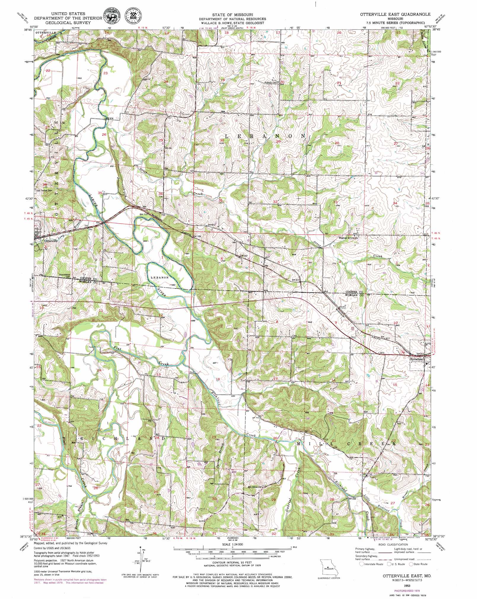
USGS Topo Quad 38092f8 - 1:24,000 scale
| Topo Map Name: | Otterville East |
| USGS Topo Quad ID: | 38092f8 |
| Print Size: | ca. 21 1/4" wide x 27" high |
| Southeast Coordinates: | 38.625° N latitude / 92.875° W longitude |
| Map Center Coordinates: | 38.6875° N latitude / 92.9375° W longitude |
| U.S. State: | MO |
| Filename: | o38092f8.jpg |
| Download Map JPG Image: | Otterville East topo map 1:24,000 scale |
| Map Type: | Topographic |
| Topo Series: | 7.5´ |
| Map Scale: | 1:24,000 |
| Source of Map Images: | United States Geological Survey (USGS) |
| Alternate Map Versions: |
Otterville East MO 1953, updated 1954 Download PDF Buy paper map Otterville East MO 1953, updated 1979 Download PDF Buy paper map Otterville East MO 2011 Download PDF Buy paper map Otterville East MO 2015 Download PDF Buy paper map |
1:24,000 Topo Quads surrounding Otterville East
Longwood |
Nelson |
Pilot Grove North |
Billingsville |
Boonville |
Beaman |
Clifton City |
Pilot Grove South |
Bunceton |
Lone Elm |
Sedalia East |
Otterville West |
Otterville East |
Tipton |
Clarksburg |
Bahner |
Pyrmont |
Florence |
Fortuna |
Latham |
Cole Camp |
Crockerville |
Stover |
Versailles |
Barnett |
> Back to 38092e1 at 1:100,000 scale
> Back to 38092a1 at 1:250,000 scale
> Back to U.S. Topo Maps home
Otterville East topo map: Gazetteer
Otterville East: Dams
Lawson Lake Dam elevation 216m 708′Otterville East: Populated Places
Byberry (historical) elevation 244m 800′Otterville East: Reservoirs
Bonze and Hoffmann Lake elevation 216m 708′Otterville East: Streams
Brushy Branch elevation 209m 685′Flat Creek elevation 204m 669′
Gabriel Creek elevation 208m 682′
Little Richland Creek elevation 210m 688′
Long Branch elevation 201m 659′
McNeal Branch elevation 222m 728′
Messer Creek elevation 216m 708′
Otter Creek elevation 199m 652′
Richland Creek elevation 204m 669′
Spring Branch elevation 206m 675′
Otterville East digital topo map on disk
Buy this Otterville East topo map showing relief, roads, GPS coordinates and other geographical features, as a high-resolution digital map file on DVD: