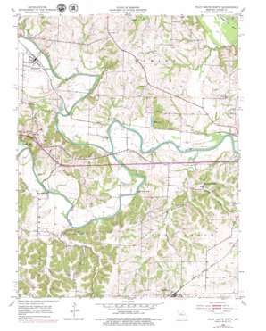
Pilot Grove North Topo Map Missouri
To zoom in, hover over the map of Pilot Grove North
USGS Topo Quad 38092h8 - 1:24,000 scale
| Topo Map Name: | Pilot Grove North |
| USGS Topo Quad ID: | 38092h8 |
| Print Size: | ca. 21 1/4" wide x 27" high |
| Southeast Coordinates: | 38.875° N latitude / 92.875° W longitude |
| Map Center Coordinates: | 38.9375° N latitude / 92.9375° W longitude |
| U.S. State: | MO |
| Filename: | o38092h8.jpg |
| Download Map JPG Image: | Pilot Grove North topo map 1:24,000 scale |
| Map Type: | Topographic |
| Topo Series: | 7.5´ |
| Map Scale: | 1:24,000 |
| Source of Map Images: | United States Geological Survey (USGS) |
| Alternate Map Versions: |
Pilot Grove North MO 1953, updated 1954 Download PDF Buy paper map Pilot Grove North MO 1953, updated 1979 Download PDF Buy paper map Pilot Grove North MO 2011 Download PDF Buy paper map Pilot Grove North MO 2015 Download PDF Buy paper map |
1:24,000 Topo Quads surrounding Pilot Grove North
> Back to 38092e1 at 1:100,000 scale
> Back to 38092a1 at 1:250,000 scale
> Back to U.S. Topo Maps home
Pilot Grove North topo map: Gazetteer
Pilot Grove North: Bends
Slaughterhouse Bend elevation 181m 593′Pilot Grove North: Bridges
Bryant Bottom Bridge elevation 183m 600′Dicks Bridge elevation 179m 587′
Roberts Bluff Bridge elevation 179m 587′
Pilot Grove North: Dams
Fenical Lake Dam elevation 211m 692′Pilot Grove North: Lakes
Widel Lake elevation 183m 600′Wilson Lake elevation 182m 597′
Pilot Grove North: Populated Places
Blackwater elevation 192m 629′Chouteau Springs elevation 187m 613′
Corioli (historical) elevation 189m 620′
Pilot Grove North: Streams
Blackwater River elevation 180m 590′Brush Creek elevation 180m 590′
Chouteau Branch elevation 180m 590′
Chouteau Creek elevation 180m 590′
Flat Creek elevation 181m 593′
Salt Branch elevation 181m 593′
Pilot Grove North digital topo map on disk
Buy this Pilot Grove North topo map showing relief, roads, GPS coordinates and other geographical features, as a high-resolution digital map file on DVD:


