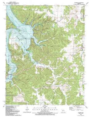
Iconium Topo Map Missouri
To zoom in, hover over the map of Iconium
USGS Topo Quad 38093a5 - 1:24,000 scale
| Topo Map Name: | Iconium |
| USGS Topo Quad ID: | 38093a5 |
| Print Size: | ca. 21 1/4" wide x 27" high |
| Southeast Coordinates: | 38° N latitude / 93.5° W longitude |
| Map Center Coordinates: | 38.0625° N latitude / 93.5625° W longitude |
| U.S. State: | MO |
| Filename: | o38093a5.jpg |
| Download Map JPG Image: | Iconium topo map 1:24,000 scale |
| Map Type: | Topographic |
| Topo Series: | 7.5´ |
| Map Scale: | 1:24,000 |
| Source of Map Images: | United States Geological Survey (USGS) |
| Alternate Map Versions: |
Iconium MO 1940, updated 1963 Download PDF Buy paper map Iconium MO 1940, updated 1967 Download PDF Buy paper map Iconium MO 1944 Download PDF Buy paper map Iconium MO 1991, updated 1991 Download PDF Buy paper map Iconium MO 2011 Download PDF Buy paper map Iconium MO 2014 Download PDF Buy paper map |
1:24,000 Topo Quads surrounding Iconium
> Back to 38093a1 at 1:100,000 scale
> Back to 38092a1 at 1:250,000 scale
> Back to U.S. Topo Maps home
Iconium topo map: Gazetteer
Iconium: Areas
Square Prairie elevation 291m 954′Iconium: Basins
Big Sink Hole (historical) elevation 287m 941′Iconium: Bends
Horseshoe Bend elevation 215m 705′Iconium: Cliffs
Cedar Point elevation 242m 793′Iconium: Dams
Roth Lake Dam elevation 264m 866′Iconium: Parks
Weaubleau Creek State Wildlife Area elevation 242m 793′Iconium: Populated Places
Corbin (historical) elevation 219m 718′Harper elevation 284m 931′
Iconium elevation 284m 931′
Iconium: Post Offices
Catherine Post Office elevation 285m 935′Iconium: Streams
Bear Creek elevation 215m 705′Briley Creek elevation 215m 705′
Carey Branch elevation 239m 784′
Wolf Creek elevation 216m 708′
Iconium: Valleys
Blalock Hollow elevation 215m 705′Collins Hollow elevation 219m 718′
Debeker Hollow elevation 219m 718′
Garrison Hollow elevation 220m 721′
Moore Hollow elevation 215m 705′
Reynolds Hollow elevation 241m 790′
Rooke Hollow elevation 239m 784′
Snyder Hollow elevation 256m 839′
Suitor Hollow elevation 215m 705′
Wisener Hollow elevation 218m 715′
Iconium digital topo map on disk
Buy this Iconium topo map showing relief, roads, GPS coordinates and other geographical features, as a high-resolution digital map file on DVD:


