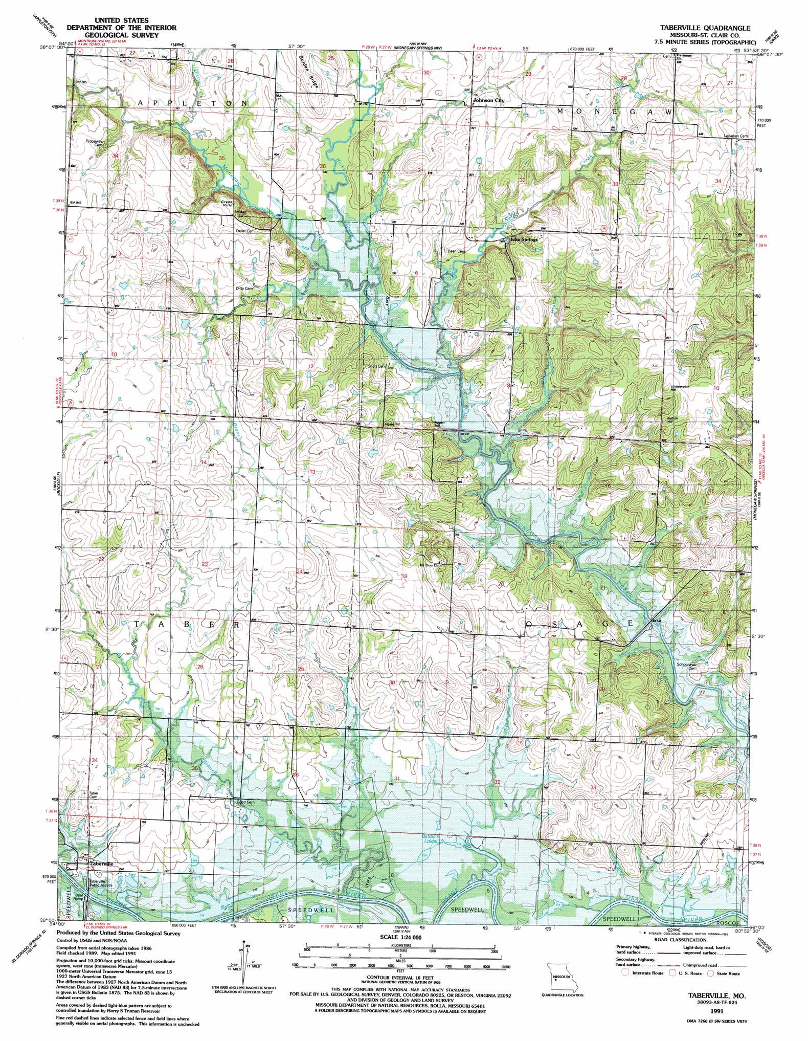
Taberville Topo Map Missouri
To zoom in, hover over the map of Taberville
USGS Topo Quad 38093a8 - 1:24,000 scale
| Topo Map Name: | Taberville |
| USGS Topo Quad ID: | 38093a8 |
| Print Size: | ca. 21 1/4" wide x 27" high |
| Southeast Coordinates: | 38° N latitude / 93.875° W longitude |
| Map Center Coordinates: | 38.0625° N latitude / 93.9375° W longitude |
| U.S. State: | MO |
| Filename: | o38093a8.jpg |
| Download Map JPG Image: | Taberville topo map 1:24,000 scale |
| Map Type: | Topographic |
| Topo Series: | 7.5´ |
| Map Scale: | 1:24,000 |
| Source of Map Images: | United States Geological Survey (USGS) |
| Alternate Map Versions: |
Taberville MO 1938, updated 1966 Download PDF Buy paper map Taberville MO 1940 Download PDF Buy paper map Taberville MO 1955, updated 1955 Download PDF Buy paper map Taberville MO 1991, updated 1992 Download PDF Buy paper map Taberville MO 2011 Download PDF Buy paper map Taberville MO 2015 Download PDF Buy paper map |
1:24,000 Topo Quads surrounding Taberville
Spruce |
Johnstown |
Montrose |
Clinton South |
Gaines |
Pleasant Gap |
Appleton City |
Monegaw Springs Nw |
Ohio |
Lowry City |
Papinsville |
Rockville |
Taberville |
Monegaw Springs |
Osceola |
Harwood |
Eldorado Springs North |
Tiffin |
Roscoe |
Vista |
Dederick |
Eldorado Springs South |
Filley |
Caplinger Mills |
Arnica |
> Back to 38093a1 at 1:100,000 scale
> Back to 38092a1 at 1:250,000 scale
> Back to U.S. Topo Maps home
Taberville topo map: Gazetteer
Taberville: Bends
Whitley Bend elevation 218m 715′Taberville: Lakes
Baldwin Lakes elevation 218m 715′Taberville: Mines
Hays Mine (historical) elevation 233m 764′Old Short Mine (historical) elevation 241m 790′
Taberville: Populated Places
Iuka Springs elevation 229m 751′Johnson City elevation 242m 793′
Taberville elevation 230m 754′
Taberville: Ridges
Golden Ridge elevation 248m 813′Taberville: Streams
Camp Branch elevation 222m 728′Clammer Branch elevation 220m 721′
Ditty Creek elevation 226m 741′
Reid Creek elevation 219m 718′
Ricky Creek elevation 221m 725′
Simms Creek elevation 216m 708′
Taberville: Summits
Grass Hill elevation 253m 830′Hagen Hill elevation 247m 810′
Ogles Hill elevation 241m 790′
Robins Hill elevation 263m 862′
Underwood Hill elevation 267m 875′
Taberville digital topo map on disk
Buy this Taberville topo map showing relief, roads, GPS coordinates and other geographical features, as a high-resolution digital map file on DVD: