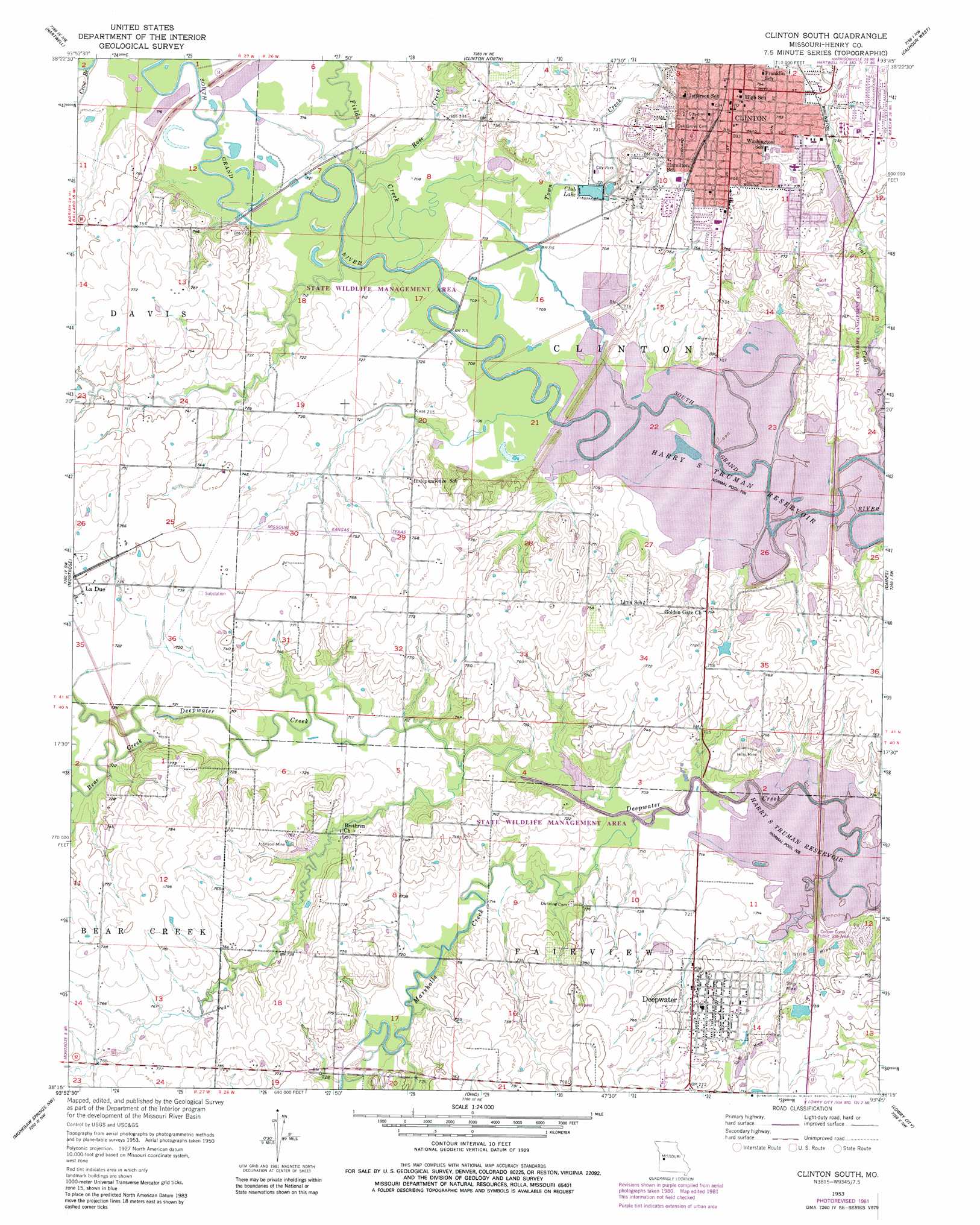
Clinton South Topo Map Missouri
To zoom in, hover over the map of Clinton South
USGS Topo Quad 38093c7 - 1:24,000 scale
| Topo Map Name: | Clinton South |
| USGS Topo Quad ID: | 38093c7 |
| Print Size: | ca. 21 1/4" wide x 27" high |
| Southeast Coordinates: | 38.25° N latitude / 93.75° W longitude |
| Map Center Coordinates: | 38.3125° N latitude / 93.8125° W longitude |
| U.S. State: | MO |
| Filename: | o38093c7.jpg |
| Download Map JPG Image: | Clinton South topo map 1:24,000 scale |
| Map Type: | Topographic |
| Topo Series: | 7.5´ |
| Map Scale: | 1:24,000 |
| Source of Map Images: | United States Geological Survey (USGS) |
| Alternate Map Versions: |
Clinton South MO 1953, updated 1955 Download PDF Buy paper map Clinton South MO 1953, updated 1974 Download PDF Buy paper map Clinton South MO 1953, updated 1982 Download PDF Buy paper map Clinton South MO 2011 Download PDF Buy paper map Clinton South MO 2015 Download PDF Buy paper map |
1:24,000 Topo Quads surrounding Clinton South
Quick City |
Blairstown |
Chilhowee |
Leeton |
Windsor |
Creighton |
Hartwell |
Clinton North |
Calhoun West |
Calhoun East |
Johnstown |
Montrose |
Clinton South |
Gaines |
Leesville |
Appleton City |
Monegaw Springs Nw |
Ohio |
Lowry City |
Valhalla |
Rockville |
Taberville |
Monegaw Springs |
Osceola |
Iconium |
> Back to 38093a1 at 1:100,000 scale
> Back to 38092a1 at 1:250,000 scale
> Back to U.S. Topo Maps home
Clinton South topo map: Gazetteer
Clinton South: Dams
B and L Electric Lake Dam elevation 223m 731′Clinton South Quad Number 1 Dam elevation 219m 718′
Dickey Lake Dam elevation 229m 751′
Dorrance Dam elevation 220m 721′
Goose Lake Dam elevation 215m 705′
Re Mansfield Dam elevation 227m 744′
Skelton Lake Dam elevation 226m 741′
Whitaker Dam elevation 216m 708′
Clinton South: Mines
Hilty Mine elevation 226m 741′Johnson Mine elevation 225m 738′
Clinton South: Parks
Cooper Creek Public Use Area elevation 217m 711′Clinton South: Populated Places
Clinton elevation 245m 803′Deepwater elevation 226m 741′
Clinton South: Reservoirs
Club Lake elevation 219m 718′Goose Lake elevation 215m 705′
June-Bug Lake elevation 229m 751′
Whitaker Lake elevation 216m 708′
Clinton South: Streams
Bear Creek elevation 217m 711′Coal Creek elevation 215m 705′
Crow Branch elevation 217m 711′
Deer Creek elevation 215m 705′
Fields Creek elevation 215m 705′
Marshall Creek elevation 215m 705′
Rose Creek elevation 216m 708′
Town Creek elevation 217m 711′
Clinton South digital topo map on disk
Buy this Clinton South topo map showing relief, roads, GPS coordinates and other geographical features, as a high-resolution digital map file on DVD: