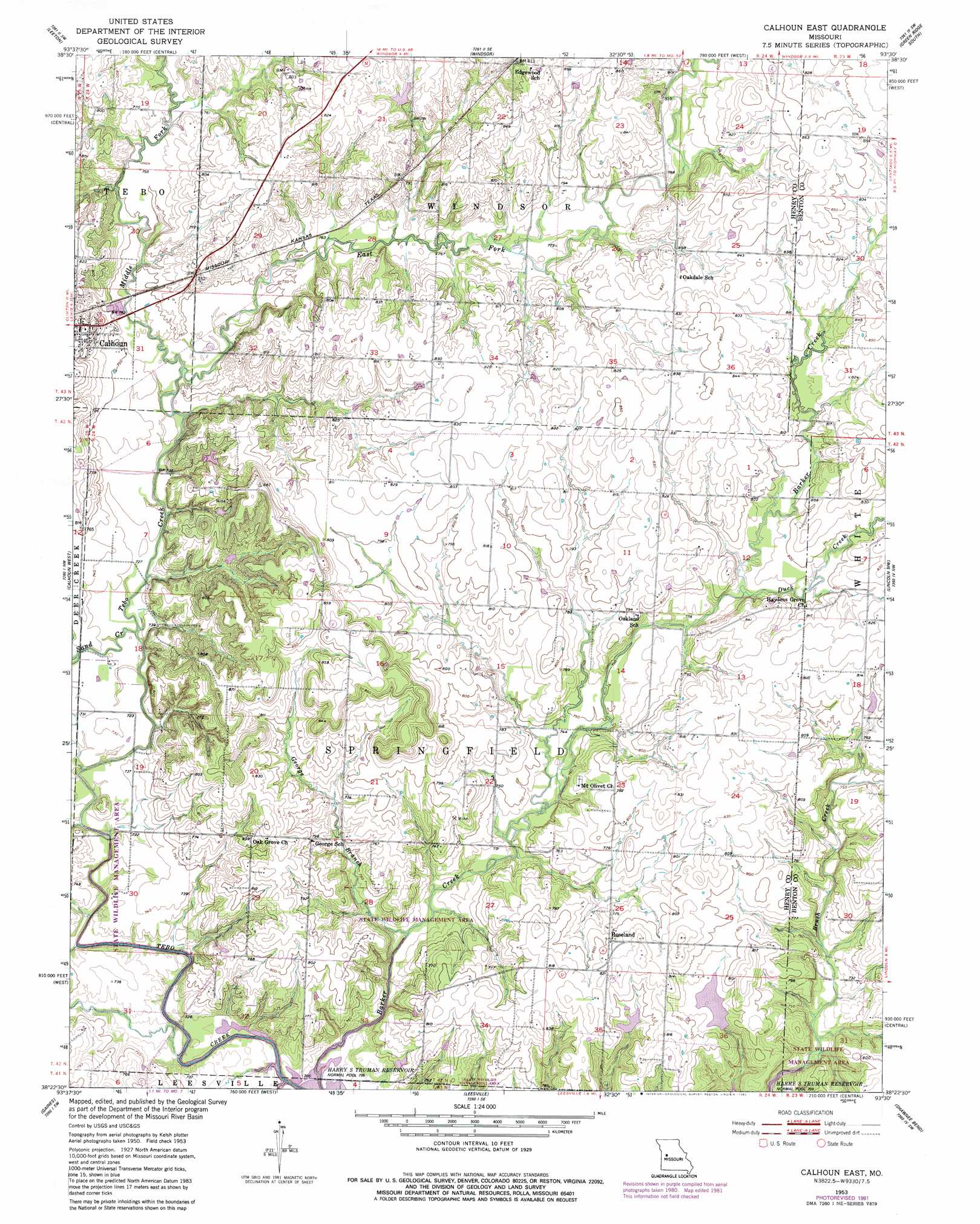
Calhoun East Topo Map Missouri
To zoom in, hover over the map of Calhoun East
USGS Topo Quad 38093d5 - 1:24,000 scale
| Topo Map Name: | Calhoun East |
| USGS Topo Quad ID: | 38093d5 |
| Print Size: | ca. 21 1/4" wide x 27" high |
| Southeast Coordinates: | 38.375° N latitude / 93.5° W longitude |
| Map Center Coordinates: | 38.4375° N latitude / 93.5625° W longitude |
| U.S. State: | MO |
| Filename: | o38093d5.jpg |
| Download Map JPG Image: | Calhoun East topo map 1:24,000 scale |
| Map Type: | Topographic |
| Topo Series: | 7.5´ |
| Map Scale: | 1:24,000 |
| Source of Map Images: | United States Geological Survey (USGS) |
| Alternate Map Versions: |
Calhoun East MO 1953, updated 1955 Download PDF Buy paper map Calhoun East MO 1953, updated 1982 Download PDF Buy paper map Calhoun East MO 2011 Download PDF Buy paper map Calhoun East MO 2015 Download PDF Buy paper map |
1:24,000 Topo Quads surrounding Calhoun East
Centerview |
Cornelia |
Burtville |
Green Ridge North |
Sedalia West |
Chilhowee |
Leeton |
Windsor |
Green Ridge South |
Ionia |
Clinton North |
Calhoun West |
Calhoun East |
Lincoln Nw |
Lincoln |
Clinton South |
Gaines |
Leesville |
Shawnee Bend |
Lincoln Se |
Ohio |
Lowry City |
Valhalla |
Warsaw West |
Warsaw East |
> Back to 38093a1 at 1:100,000 scale
> Back to 38092a1 at 1:250,000 scale
> Back to U.S. Topo Maps home
Calhoun East topo map: Gazetteer
Calhoun East: Dams
Barber Lake Dam elevation 226m 741′Noland Lake Dam elevation 233m 764′
Williams Lake Section 35 Dam elevation 240m 787′
Williams Lake Section 36 Dam elevation 240m 787′
Calhoun East: Populated Places
Roseland elevation 244m 800′Yolo elevation 245m 803′
Calhoun East: Post Offices
Yolo Post Office (historical) elevation 245m 803′Calhoun East: Reservoirs
F Williams Lake elevation 240m 787′Frank William Lake elevation 240m 787′
Calhoun East: Streams
Duck Creek elevation 235m 770′East Fork Tebo Creek elevation 220m 721′
George Branch elevation 216m 708′
Middle Fork Tebo Creek elevation 220m 721′
Nelson Creek elevation 216m 708′
Sand Creek elevation 220m 721′
West Fork Tebo Creek elevation 221m 725′
Calhoun East digital topo map on disk
Buy this Calhoun East topo map showing relief, roads, GPS coordinates and other geographical features, as a high-resolution digital map file on DVD: