Green Ridge South Topo Map Missouri
To zoom in, hover over the map of Green Ridge South
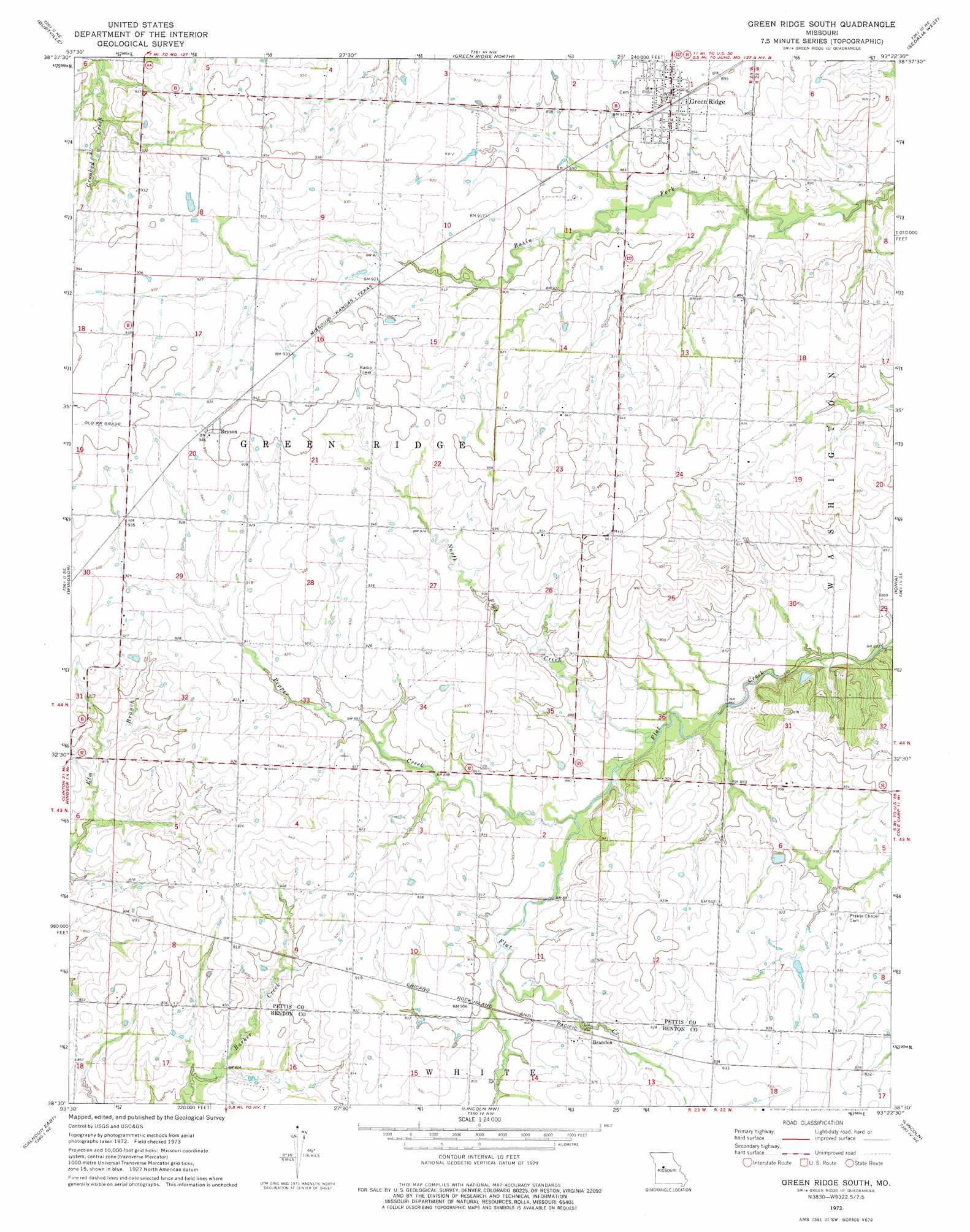
USGS Topo Quad 38093e4 - 1:24,000 scale
| Topo Map Name: | Green Ridge South |
| USGS Topo Quad ID: | 38093e4 |
| Print Size: | ca. 21 1/4" wide x 27" high |
| Southeast Coordinates: | 38.5° N latitude / 93.375° W longitude |
| Map Center Coordinates: | 38.5625° N latitude / 93.4375° W longitude |
| U.S. State: | MO |
| Filename: | o38093e4.jpg |
| Download Map JPG Image: | Green Ridge South topo map 1:24,000 scale |
| Map Type: | Topographic |
| Topo Series: | 7.5´ |
| Map Scale: | 1:24,000 |
| Source of Map Images: | United States Geological Survey (USGS) |
| Alternate Map Versions: |
Green Ridge South MO 1973, updated 1975 Download PDF Buy paper map Green Ridge South MO 2011 Download PDF Buy paper map Green Ridge South MO 2014 Download PDF Buy paper map |
1:24,000 Topo Quads surrounding Green Ridge South
Warrensburg East |
Knob Noster |
La Monte |
Hughesville |
Beaman |
Cornelia |
Burtville |
Green Ridge North |
Sedalia West |
Sedalia East |
Leeton |
Windsor |
Green Ridge South |
Ionia |
Bahner |
Calhoun West |
Calhoun East |
Lincoln Nw |
Lincoln |
Cole Camp |
Gaines |
Leesville |
Shawnee Bend |
Lincoln Se |
Lakeview Heights |
> Back to 38093e1 at 1:100,000 scale
> Back to 38092a1 at 1:250,000 scale
> Back to U.S. Topo Maps home
Green Ridge South topo map: Gazetteer
Green Ridge South: Dams
Steve Smith Lake Dam elevation 268m 879′Green Ridge South: Populated Places
Brandon elevation 282m 925′Bryson elevation 290m 951′
Green Ridge elevation 275m 902′
Green Ridge South: Streams
North Flat Creek elevation 262m 859′Pepper Creek elevation 265m 869′
Green Ridge South digital topo map on disk
Buy this Green Ridge South topo map showing relief, roads, GPS coordinates and other geographical features, as a high-resolution digital map file on DVD: