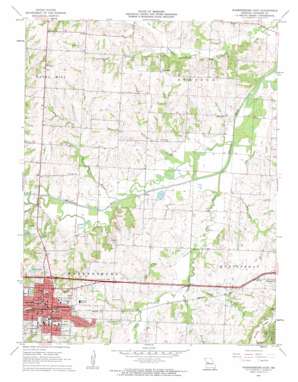
Warrensburg East Topo Map Missouri
To zoom in, hover over the map of Warrensburg East
USGS Topo Quad 38093g6 - 1:24,000 scale
| Topo Map Name: | Warrensburg East |
| USGS Topo Quad ID: | 38093g6 |
| Print Size: | ca. 21 1/4" wide x 27" high |
| Southeast Coordinates: | 38.75° N latitude / 93.625° W longitude |
| Map Center Coordinates: | 38.8125° N latitude / 93.6875° W longitude |
| U.S. State: | MO |
| Filename: | o38093g6.jpg |
| Download Map JPG Image: | Warrensburg East topo map 1:24,000 scale |
| Map Type: | Topographic |
| Topo Series: | 7.5´ |
| Map Scale: | 1:24,000 |
| Source of Map Images: | United States Geological Survey (USGS) |
| Alternate Map Versions: |
Warrensburg East MO 1962, updated 1963 Download PDF Buy paper map Warrensburg East MO 1962, updated 1963 Download PDF Buy paper map Warrensburg East MO 2011 Download PDF Buy paper map Warrensburg East MO 2014 Download PDF Buy paper map |
1:24,000 Topo Quads surrounding Warrensburg East
> Back to 38093e1 at 1:100,000 scale
> Back to 38092a1 at 1:250,000 scale
> Back to U.S. Topo Maps home
Warrensburg East topo map: Gazetteer
Warrensburg East: Airports
Western Missouri Medical Center Heliport elevation 251m 823′Warrensburg East: Dams
Edmunds Lake Dam elevation 244m 800′Foster Lake Dam elevation 236m 774′
Glazebrooks Lake Dam elevation 222m 728′
Ken-Mar Acres Lake Dam elevation 230m 754′
Reynolds Lake Dam elevation 226m 741′
South Lake Dam elevation 234m 767′
Tackett Lake Dam elevation 231m 757′
Warrensburg East: Parks
Blind Boone Park elevation 237m 777′Grover Park elevation 251m 823′
Shepard Park elevation 249m 816′
Warrensburg East: Populated Places
Blackwater (historical) elevation 253m 830′Warrensburg elevation 263m 862′
Warrensburg East: Reservoirs
Edmunds Lake elevation 244m 800′Glazebrooks Lake elevation 222m 728′
Ken-Mar Acres Lake elevation 230m 754′
Lake Tacket elevation 231m 757′
Reynolds Lake elevation 226m 741′
South Lake elevation 234m 767′
Warrensburg East: Streams
Bear Creek elevation 205m 672′Box Branch elevation 213m 698′
Clear Fork elevation 204m 669′
Colburn Branch elevation 205m 672′
Cottonwood Branch elevation 215m 705′
Ham Branch elevation 203m 666′
Mayes Branch elevation 213m 698′
Post Oak Creek elevation 207m 679′
Warrensburg East digital topo map on disk
Buy this Warrensburg East topo map showing relief, roads, GPS coordinates and other geographical features, as a high-resolution digital map file on DVD:


