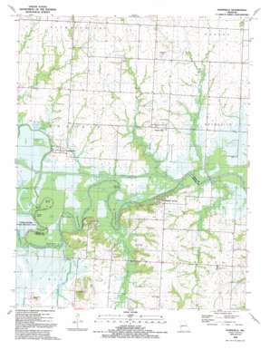
Papinsville Topo Map Missouri
To zoom in, hover over the map of Papinsville
USGS Topo Quad 38094a2 - 1:24,000 scale
| Topo Map Name: | Papinsville |
| USGS Topo Quad ID: | 38094a2 |
| Print Size: | ca. 21 1/4" wide x 27" high |
| Southeast Coordinates: | 38° N latitude / 94.125° W longitude |
| Map Center Coordinates: | 38.0625° N latitude / 94.1875° W longitude |
| U.S. State: | MO |
| Filename: | o38094a2.jpg |
| Download Map JPG Image: | Papinsville topo map 1:24,000 scale |
| Map Type: | Topographic |
| Topo Series: | 7.5´ |
| Map Scale: | 1:24,000 |
| Source of Map Images: | United States Geological Survey (USGS) |
| Alternate Map Versions: |
Papinsville MO 1934 Download PDF Buy paper map Papinsville MO 1934, updated 1955 Download PDF Buy paper map Papinville MO 1991, updated 1991 Download PDF Buy paper map Papinville MO 2011 Download PDF Buy paper map Papinville MO 2014 Download PDF Buy paper map |
1:24,000 Topo Quads surrounding Papinsville
> Back to 38094a1 at 1:100,000 scale
> Back to 38094a1 at 1:250,000 scale
> Back to U.S. Topo Maps home
Papinsville topo map: Gazetteer
Papinsville: Bars
Collins Shoals elevation 219m 718′Papinsville: Bends
Apple Garth Bend elevation 223m 731′Beasley Bend elevation 224m 734′
Burras Bend elevation 223m 731′
Camm Bend elevation 224m 734′
Coyle Bend elevation 224m 734′
Moore Bend elevation 223m 731′
Mosley Bend elevation 224m 734′
Schapeler Bend elevation 221m 725′
South Bend elevation 223m 731′
Papinsville: Bridges
Number 1 Bridge (historical) elevation 218m 715′Number 2 Bridge (historical) elevation 219m 718′
Number 3 Bridge (historical) elevation 219m 718′
Papinsville: Canals
Hirni Slough elevation 223m 731′Marais des Cygnes Drainage Ditch elevation 219m 718′
Papinsville: Cliffs
Belvoir Bluffs elevation 226m 741′Halley Bluffs elevation 248m 813′
Papinsville: Lakes
Bennett Lake elevation 223m 731′Carrico Lake elevation 222m 728′
Collins Lake elevation 219m 718′
Collins Lake elevation 222m 728′
Fix Pond elevation 224m 734′
Grant Pond elevation 221m 725′
Helem Lake elevation 223m 731′
Horseshoe Lake elevation 223m 731′
Kineberger Lake (historical) elevation 223m 731′
Krull Ponds elevation 224m 734′
Logan Lake elevation 221m 725′
Maus Lake elevation 224m 734′
Raps Pond elevation 221m 725′
Steuck Ponds elevation 225m 738′
Papinsville: Populated Places
Indian Springs elevation 244m 800′Papinville elevation 232m 761′
Prairie City elevation 244m 800′
Rocky Ford (historical) elevation 216m 708′
Papinsville: Streams
Hog Slough elevation 219m 718′Ladies Branch elevation 216m 708′
Little Osage River elevation 220m 721′
Marais des Cygnes River elevation 220m 721′
McKenzie Creek elevation 220m 721′
Pecan Slough elevation 220m 721′
Shaw Branch elevation 216m 708′
Willow Branch elevation 216m 708′
Papinsville: Summits
Blue Mound elevation 282m 925′Hammer Hill elevation 257m 843′
Papinsville digital topo map on disk
Buy this Papinsville topo map showing relief, roads, GPS coordinates and other geographical features, as a high-resolution digital map file on DVD:


