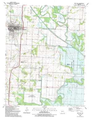
Rich Hill Topo Map Missouri
To zoom in, hover over the map of Rich Hill
USGS Topo Quad 38094a3 - 1:24,000 scale
| Topo Map Name: | Rich Hill |
| USGS Topo Quad ID: | 38094a3 |
| Print Size: | ca. 21 1/4" wide x 27" high |
| Southeast Coordinates: | 38° N latitude / 94.25° W longitude |
| Map Center Coordinates: | 38.0625° N latitude / 94.3125° W longitude |
| U.S. State: | MO |
| Filename: | o38094a3.jpg |
| Download Map JPG Image: | Rich Hill topo map 1:24,000 scale |
| Map Type: | Topographic |
| Topo Series: | 7.5´ |
| Map Scale: | 1:24,000 |
| Source of Map Images: | United States Geological Survey (USGS) |
| Alternate Map Versions: |
Rich Hill MO 1936 Download PDF Buy paper map Rich Hill MO 1955, updated 1955 Download PDF Buy paper map Rich Hill MO 1963, updated 1963 Download PDF Buy paper map Rich Hill MO 1991, updated 1991 Download PDF Buy paper map Rich Hill MO 2011 Download PDF Buy paper map Rich Hill MO 2014 Download PDF Buy paper map |
1:24,000 Topo Quads surrounding Rich Hill
> Back to 38094a1 at 1:100,000 scale
> Back to 38094a1 at 1:250,000 scale
> Back to U.S. Topo Maps home
Rich Hill topo map: Gazetteer
Rich Hill: Airports
Schooley Airport elevation 241m 790′Rich Hill: Areas
Ripgut Prairie Natural Area elevation 226m 741′Rich Hill: Bends
Baker Bend elevation 224m 734′Daugherty Bend elevation 226m 741′
He Bend elevation 226m 741′
Rich Hill: Dams
Beisley Lake North Dam elevation 232m 761′Beisley Lake South Dam elevation 228m 748′
Eastland Lake Dam elevation 243m 797′
Miller Lake Dam elevation 228m 748′
Rich Hill: Lakes
Bagley Lake elevation 226m 741′Bailey Lake elevation 226m 741′
Cresap Lake elevation 222m 728′
Dollar Lake (historical) elevation 224m 734′
Goose Lake elevation 223m 731′
Lake Lona (historical) elevation 222m 728′
Maple Slash elevation 226m 741′
Prairie Lake elevation 223m 731′
South Slash (historical) elevation 223m 731′
West Slash elevation 223m 731′
Wolf Lake (historical) elevation 224m 734′
Rich Hill: Mines
Jonnum Mines (historical) elevation 235m 770′Rich Hill: Parks
Park Place elevation 247m 810′Prospect Park elevation 242m 793′
Rich Hill: Populated Places
Arthur elevation 232m 761′Carbon Center elevation 236m 774′
Panama elevation 238m 780′
Rich Hill elevation 244m 800′
Rich Hill: Ranges
Philbrick Hills elevation 238m 780′Rich Hill: Reservoirs
Beisley Lake - North elevation 232m 761′Beisley Lake - South elevation 228m 748′
Eastland Lake elevation 243m 797′
Miller Lake elevation 228m 748′
Rich Hill: Streams
Back and Forth Slough elevation 226m 741′Bee Branch elevation 220m 721′
Broad Waters Muddy Creek elevation 223m 731′
Crooked Branch elevation 220m 721′
Double Branch elevation 223m 731′
Eggelson Slough elevation 223m 731′
Hightower Creek elevation 223m 731′
Mission Branch elevation 223m 731′
Muddy Creek elevation 221m 725′
Sycamore Branch elevation 225m 738′
Willow Branch elevation 227m 744′
Rich Hill: Summits
Deer Mound elevation 226m 741′Rich Hill: Swamps
Ingram Slash (historical) elevation 224m 734′Rich Hill digital topo map on disk
Buy this Rich Hill topo map showing relief, roads, GPS coordinates and other geographical features, as a high-resolution digital map file on DVD:


