Sprague Topo Map Missouri
To zoom in, hover over the map of Sprague
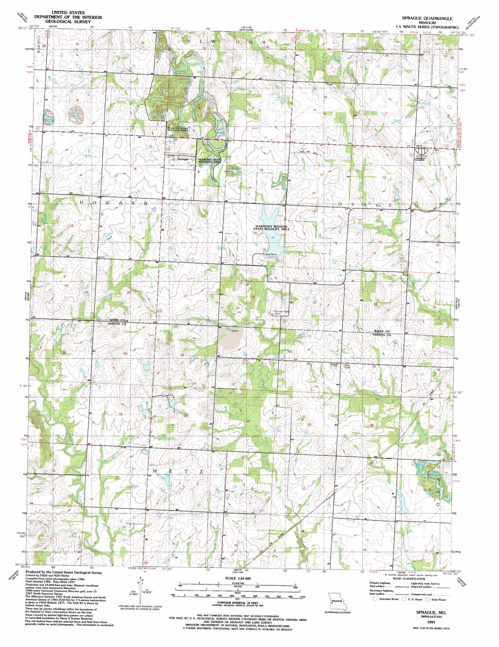
USGS Topo Quad 38094a4 - 1:24,000 scale
| Topo Map Name: | Sprague |
| USGS Topo Quad ID: | 38094a4 |
| Print Size: | ca. 21 1/4" wide x 27" high |
| Southeast Coordinates: | 38° N latitude / 94.375° W longitude |
| Map Center Coordinates: | 38.0625° N latitude / 94.4375° W longitude |
| U.S. State: | MO |
| Filename: | o38094a4.jpg |
| Download Map JPG Image: | Sprague topo map 1:24,000 scale |
| Map Type: | Topographic |
| Topo Series: | 7.5´ |
| Map Scale: | 1:24,000 |
| Source of Map Images: | United States Geological Survey (USGS) |
| Alternate Map Versions: |
Sprague MO 1942 Download PDF Buy paper map Sprague MO 1991, updated 1991 Download PDF Buy paper map Sprague MO 2011 Download PDF Buy paper map Sprague MO 2015 Download PDF Buy paper map |
1:24,000 Topo Quads surrounding Sprague
Boicourt |
Amoret |
Virginia |
Butler |
Spruce |
Pleasanton |
Worland |
New Home |
Butler & Vic |
Pleasant Gap |
Prescott |
Hume |
Sprague |
Rich Hill |
Papinsville |
Hammond |
Richards |
Metz |
Horton |
Harwood |
Fort Scott |
Deerfield |
Moundville |
Nevada |
Dederick |
> Back to 38094a1 at 1:100,000 scale
> Back to 38094a1 at 1:250,000 scale
> Back to U.S. Topo Maps home
Sprague topo map: Gazetteer
Sprague: Dams
Mononame 64 Dam elevation 257m 843′Pohl-Harner Lake Dam elevation 244m 800′
Sprague: Parks
Harmony Mission Wildlife Area elevation 263m 862′Peabody Wildlife Area elevation 281m 921′
Sprague: Populated Places
Sprague elevation 282m 925′Sprague: Streams
Cottonwood Creek elevation 229m 751′Rutledge Creek elevation 235m 770′
West Fork Pryor Creek elevation 235m 770′
Sprague digital topo map on disk
Buy this Sprague topo map showing relief, roads, GPS coordinates and other geographical features, as a high-resolution digital map file on DVD: