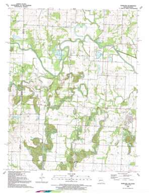
Worland Topo Map Missouri
To zoom in, hover over the map of Worland
USGS Topo Quad 38094b5 - 1:24,000 scale
| Topo Map Name: | Worland |
| USGS Topo Quad ID: | 38094b5 |
| Print Size: | ca. 21 1/4" wide x 27" high |
| Southeast Coordinates: | 38.125° N latitude / 94.5° W longitude |
| Map Center Coordinates: | 38.1875° N latitude / 94.5625° W longitude |
| U.S. States: | MO, KS |
| Filename: | o38094b5.jpg |
| Download Map JPG Image: | Worland topo map 1:24,000 scale |
| Map Type: | Topographic |
| Topo Series: | 7.5´ |
| Map Scale: | 1:24,000 |
| Source of Map Images: | United States Geological Survey (USGS) |
| Alternate Map Versions: |
Worland MO 1938, updated 1954 Download PDF Buy paper map Worland MO 1938, updated 1972 Download PDF Buy paper map Worland MO 1938, updated 1976 Download PDF Buy paper map Worland MO 1940 Download PDF Buy paper map Worland MO 1991, updated 1991 Download PDF Buy paper map Worland MO 2009 Download PDF Buy paper map Worland MO 2011 Download PDF Buy paper map Worland MO 2014 Download PDF Buy paper map |
1:24,000 Topo Quads surrounding Worland
> Back to 38094a1 at 1:100,000 scale
> Back to 38094a1 at 1:250,000 scale
> Back to U.S. Topo Maps home
Worland topo map: Gazetteer
Worland: Bridges
Marble Bridge elevation 226m 741′State Line Bridge elevation 231m 757′
Worland: Populated Places
Foster elevation 258m 846′Rucker elevation 245m 803′
Worland elevation 250m 820′
Worland: Streams
Cottonwood Creek elevation 243m 797′Gillum Creek elevation 230m 754′
Mine Creek elevation 228m 748′
Mine Creek elevation 232m 761′
Mulberry Creek elevation 228m 748′
Pecan Creek elevation 227m 744′
Worland digital topo map on disk
Buy this Worland topo map showing relief, roads, GPS coordinates and other geographical features, as a high-resolution digital map file on DVD:


