Pleasanton Topo Map Kansas
To zoom in, hover over the map of Pleasanton
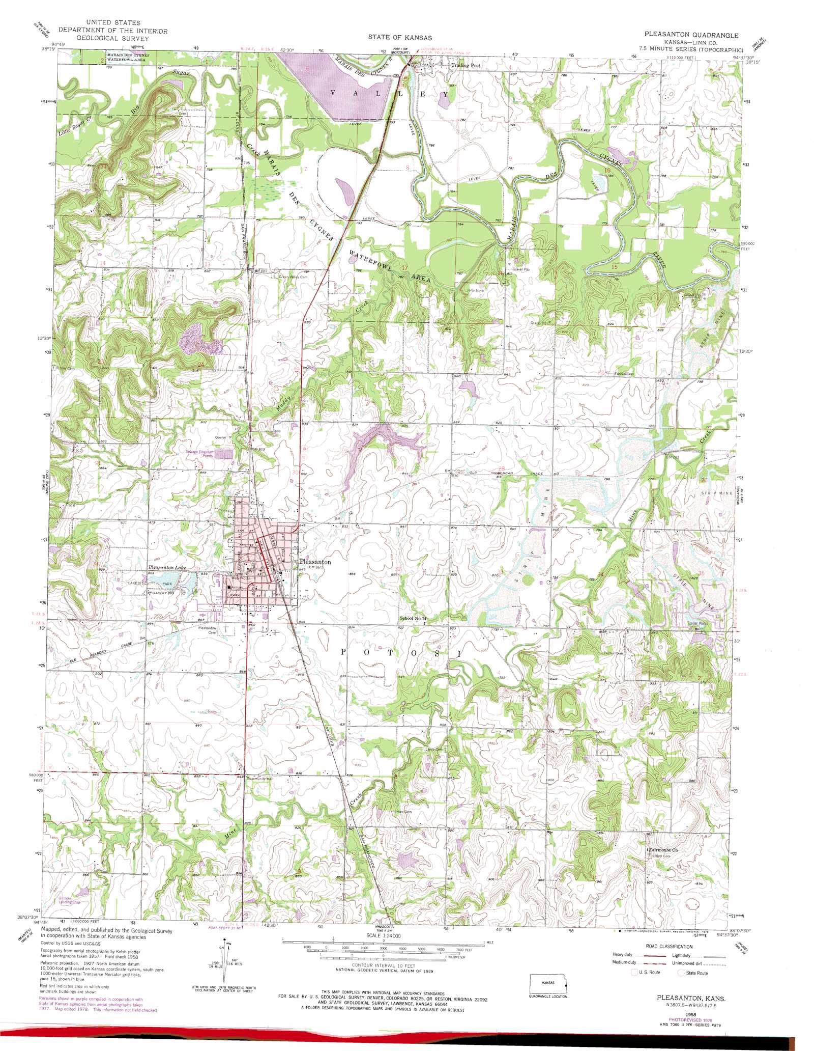
USGS Topo Quad 38094b6 - 1:24,000 scale
| Topo Map Name: | Pleasanton |
| USGS Topo Quad ID: | 38094b6 |
| Print Size: | ca. 21 1/4" wide x 27" high |
| Southeast Coordinates: | 38.125° N latitude / 94.625° W longitude |
| Map Center Coordinates: | 38.1875° N latitude / 94.6875° W longitude |
| U.S. State: | KS |
| Filename: | o38094b6.jpg |
| Download Map JPG Image: | Pleasanton topo map 1:24,000 scale |
| Map Type: | Topographic |
| Topo Series: | 7.5´ |
| Map Scale: | 1:24,000 |
| Source of Map Images: | United States Geological Survey (USGS) |
| Alternate Map Versions: |
Pleasanton KS 1958, updated 1959 Download PDF Buy paper map Pleasanton KS 1958, updated 1978 Download PDF Buy paper map Pleasanton KS 2009 Download PDF Buy paper map Pleasanton KS 2012 Download PDF Buy paper map Pleasanton KS 2016 Download PDF Buy paper map |
1:24,000 Topo Quads surrounding Pleasanton
Osawatomie |
Fontana |
New Lancaster |
Drexel |
Main City |
Parker |
La Cygne |
Boicourt |
Amoret |
Virginia |
Mound City Nw |
Mound City |
Pleasanton |
Worland |
New Home |
Mapleton |
Mantey |
Prescott |
Hume |
Sprague |
Xenia |
Devon |
Hammond |
Richards |
Metz |
> Back to 38094a1 at 1:100,000 scale
> Back to 38094a1 at 1:250,000 scale
> Back to U.S. Topo Maps home
Pleasanton topo map: Gazetteer
Pleasanton: Airports
Gilmore Airport elevation 270m 885′Pleasanton: Dams
Pleasanton City Lake Dam elevation 238m 780′Pleasanton Lake Dam elevation 258m 846′
Pleasanton: Parks
Lakeside Park elevation 258m 846′Mine Creek Battlefield Park elevation 263m 862′
Pleasanton: Populated Places
Pleasanton elevation 262m 859′Trading Post elevation 246m 807′
Pleasanton: Reservoirs
Pleasanton City Lake elevation 238m 780′Pleasanton Lake elevation 258m 846′
Pleasanton: Streams
Big Sugar Creek elevation 232m 761′Little Sugar Creek elevation 233m 764′
Muddy Creek elevation 232m 761′
Pleasanton digital topo map on disk
Buy this Pleasanton topo map showing relief, roads, GPS coordinates and other geographical features, as a high-resolution digital map file on DVD: