Boicourt Topo Map Kansas
To zoom in, hover over the map of Boicourt
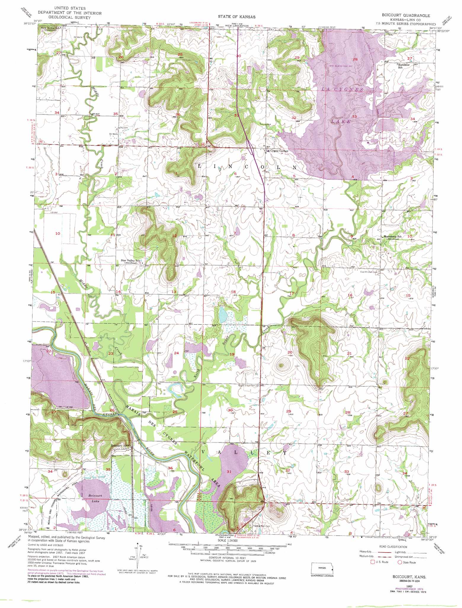
USGS Topo Quad 38094c6 - 1:24,000 scale
| Topo Map Name: | Boicourt |
| USGS Topo Quad ID: | 38094c6 |
| Print Size: | ca. 21 1/4" wide x 27" high |
| Southeast Coordinates: | 38.25° N latitude / 94.625° W longitude |
| Map Center Coordinates: | 38.3125° N latitude / 94.6875° W longitude |
| U.S. State: | KS |
| Filename: | o38094c6.jpg |
| Download Map JPG Image: | Boicourt topo map 1:24,000 scale |
| Map Type: | Topographic |
| Topo Series: | 7.5´ |
| Map Scale: | 1:24,000 |
| Source of Map Images: | United States Geological Survey (USGS) |
| Alternate Map Versions: |
Boicourt KS 1957, updated 1959 Download PDF Buy paper map Boicourt KS 1957, updated 1976 Download PDF Buy paper map Boicourt KS 1986, updated 1986 Download PDF Buy paper map Boicourt KS 2009 Download PDF Buy paper map Boicourt KS 2012 Download PDF Buy paper map Boicourt KS 2015 Download PDF Buy paper map |
1:24,000 Topo Quads surrounding Boicourt
Paola West |
Paola East |
Louisburg |
Freeman |
Everett |
Osawatomie |
Fontana |
New Lancaster |
Drexel |
Main City |
Parker |
La Cygne |
Boicourt |
Amoret |
Virginia |
Mound City Nw |
Mound City |
Pleasanton |
Worland |
New Home |
Mapleton |
Mantey |
Prescott |
Hume |
Sprague |
> Back to 38094a1 at 1:100,000 scale
> Back to 38094a1 at 1:250,000 scale
> Back to U.S. Topo Maps home
Boicourt topo map: Gazetteer
Boicourt: Parks
La Cygne State Fishing Lake and Wildlife Area elevation 256m 839′Marais des Cygnes Waterfowl Area elevation 242m 793′
Boicourt: Populated Places
Boicourt elevation 252m 826′La Cygne Corner elevation 263m 862′
Boicourt: Reservoirs
Boicourt Lake elevation 238m 780′La Cygnes Lake elevation 256m 839′
Boicourt: Streams
Middle Creek elevation 234m 767′North Sugar Creek elevation 233m 764′
Boicourt digital topo map on disk
Buy this Boicourt topo map showing relief, roads, GPS coordinates and other geographical features, as a high-resolution digital map file on DVD: