Dayton Topo Map Missouri
To zoom in, hover over the map of Dayton
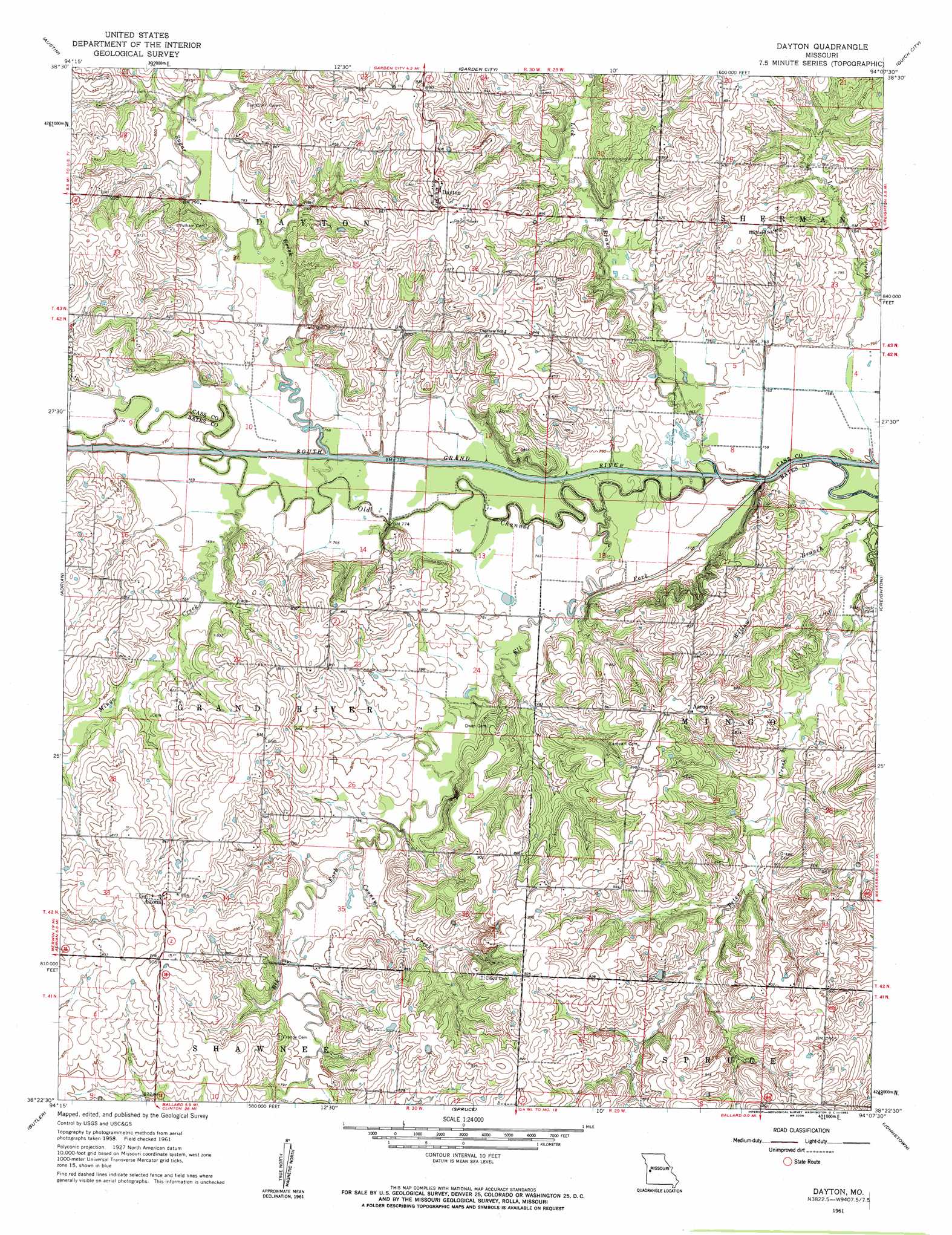
USGS Topo Quad 38094d2 - 1:24,000 scale
| Topo Map Name: | Dayton |
| USGS Topo Quad ID: | 38094d2 |
| Print Size: | ca. 21 1/4" wide x 27" high |
| Southeast Coordinates: | 38.375° N latitude / 94.125° W longitude |
| Map Center Coordinates: | 38.4375° N latitude / 94.1875° W longitude |
| U.S. State: | MO |
| Filename: | o38094d2.jpg |
| Download Map JPG Image: | Dayton topo map 1:24,000 scale |
| Map Type: | Topographic |
| Topo Series: | 7.5´ |
| Map Scale: | 1:24,000 |
| Source of Map Images: | United States Geological Survey (USGS) |
| Alternate Map Versions: |
Dayton MO 1961, updated 1962 Download PDF Buy paper map Dayton MO 2011 Download PDF Buy paper map Dayton MO 2014 Download PDF Buy paper map |
1:24,000 Topo Quads surrounding Dayton
Peculiar |
Harrisonville |
East Lynne |
Kingsville |
Holden |
Everett |
Austin |
Garden City |
Quick City |
Blairstown |
Main City |
Adrian |
Dayton |
Creighton |
Hartwell |
Virginia |
Butler |
Spruce |
Johnstown |
Montrose |
New Home |
Butler & Vic |
Pleasant Gap |
Appleton City |
Monegaw Springs Nw |
> Back to 38094a1 at 1:100,000 scale
> Back to 38094a1 at 1:250,000 scale
> Back to U.S. Topo Maps home
Dayton topo map: Gazetteer
Dayton: Airports
Leos Angus Ranch Airport elevation 279m 915′Dayton: Populated Places
Aaron elevation 272m 892′Altona elevation 275m 902′
Dayton elevation 278m 912′
Dayton: Post Offices
Aaron Post Office (historical) elevation 268m 879′Dayton: Streams
Cooney Creek elevation 237m 777′Elk Fork elevation 227m 744′
Lick Branch elevation 231m 757′
Lost Creek elevation 230m 754′
Mingo Creek elevation 233m 764′
Peter Creek elevation 229m 751′
Sugar Creek elevation 230m 754′
Dayton digital topo map on disk
Buy this Dayton topo map showing relief, roads, GPS coordinates and other geographical features, as a high-resolution digital map file on DVD: