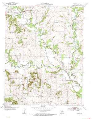
Everett Topo Map Missouri
To zoom in, hover over the map of Everett
USGS Topo Quad 38094e4 - 1:24,000 scale
| Topo Map Name: | Everett |
| USGS Topo Quad ID: | 38094e4 |
| Print Size: | ca. 21 1/4" wide x 27" high |
| Southeast Coordinates: | 38.5° N latitude / 94.375° W longitude |
| Map Center Coordinates: | 38.5625° N latitude / 94.4375° W longitude |
| U.S. State: | MO |
| Filename: | o38094e4.jpg |
| Download Map JPG Image: | Everett topo map 1:24,000 scale |
| Map Type: | Topographic |
| Topo Series: | 7.5´ |
| Map Scale: | 1:24,000 |
| Source of Map Images: | United States Geological Survey (USGS) |
| Alternate Map Versions: |
Everett MO 1953, updated 1955 Download PDF Buy paper map Everett MO 1953, updated 1955 Download PDF Buy paper map Everett MO 2011 Download PDF Buy paper map Everett MO 2014 Download PDF Buy paper map |
1:24,000 Topo Quads surrounding Everett
> Back to 38094e1 at 1:100,000 scale
> Back to 38094a1 at 1:250,000 scale
> Back to U.S. Topo Maps home
Everett topo map: Gazetteer
Everett: Airports
Hart Airport elevation 252m 826′Everett: Dams
Oakland Farms Lake Dam elevation 259m 849′Everett: Populated Places
Everett elevation 265m 869′Everett: Reservoirs
Oakland Farms Lake elevation 259m 849′Everett: Streams
Adams Branch elevation 248m 813′East Branch South Grand River elevation 245m 803′
Owens Creek elevation 249m 816′
Poney Creek elevation 249m 816′
South Fork South Grand River elevation 246m 807′
Everett: Summits
Bieger Mound elevation 291m 954′Christiansen Mound elevation 296m 971′
Dolan Mound elevation 286m 938′
Dorsett Hill elevation 290m 951′
Herrell Hill elevation 298m 977′
Hilltop Mound elevation 286m 938′
Masters Hill elevation 295m 967′
Osburn Mound elevation 292m 958′
Steen Mound elevation 275m 902′
Everett digital topo map on disk
Buy this Everett topo map showing relief, roads, GPS coordinates and other geographical features, as a high-resolution digital map file on DVD:


