Antioch Topo Map Kansas
To zoom in, hover over the map of Antioch
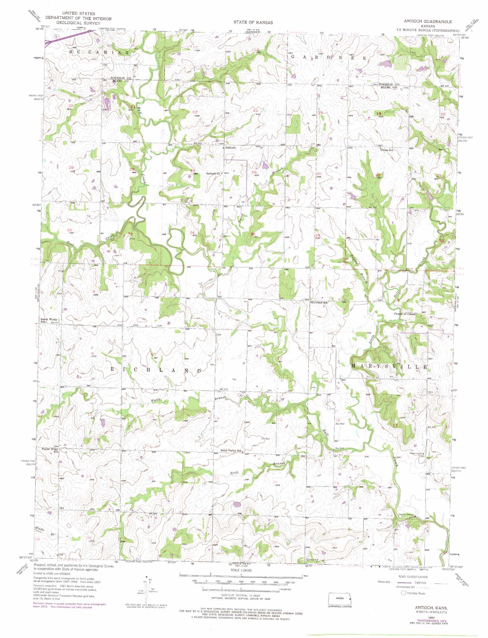
USGS Topo Quad 38094f8 - 1:24,000 scale
| Topo Map Name: | Antioch |
| USGS Topo Quad ID: | 38094f8 |
| Print Size: | ca. 21 1/4" wide x 27" high |
| Southeast Coordinates: | 38.625° N latitude / 94.875° W longitude |
| Map Center Coordinates: | 38.6875° N latitude / 94.9375° W longitude |
| U.S. State: | KS |
| Filename: | o38094f8.jpg |
| Download Map JPG Image: | Antioch topo map 1:24,000 scale |
| Map Type: | Topographic |
| Topo Series: | 7.5´ |
| Map Scale: | 1:24,000 |
| Source of Map Images: | United States Geological Survey (USGS) |
| Alternate Map Versions: |
Antioch KS 1957, updated 1958 Download PDF Buy paper map Antioch KS 1957, updated 1975 Download PDF Buy paper map Antioch KS 2010 Download PDF Buy paper map Antioch KS 2012 Download PDF Buy paper map Antioch KS 2015 Download PDF Buy paper map |
1:24,000 Topo Quads surrounding Antioch
Lawrence East |
Eudora |
De Soto |
Olathe |
Lenexa |
Baldwin City |
Edgerton |
Gardner |
Ocheltree |
Stilwell |
Le Loup |
Wellsville |
Antioch |
Spring Hill |
Bucyrus |
Peoria |
Rantoul |
Paola West |
Paola East |
Louisburg |
Garnett Nw |
Lane |
Osawatomie |
Fontana |
New Lancaster |
> Back to 38094e1 at 1:100,000 scale
> Back to 38094a1 at 1:250,000 scale
> Back to U.S. Topo Maps home
Antioch topo map: Gazetteer
Antioch: Airports
Hayden Farm Airport elevation 325m 1066′Antioch: Populated Places
Antioch elevation 312m 1023′Antioch: Reservoirs
Hillsdale Lake elevation 269m 882′Antioch: Streams
Little Bull Creek elevation 267m 875′Rock Creek elevation 275m 902′
Scott Branch Bull Creek elevation 262m 859′
Smith Branch elevation 274m 898′
Ten Mile Creek elevation 259m 849′
Tuggle Branch elevation 271m 889′
Wade Branch elevation 265m 869′
Antioch digital topo map on disk
Buy this Antioch topo map showing relief, roads, GPS coordinates and other geographical features, as a high-resolution digital map file on DVD: