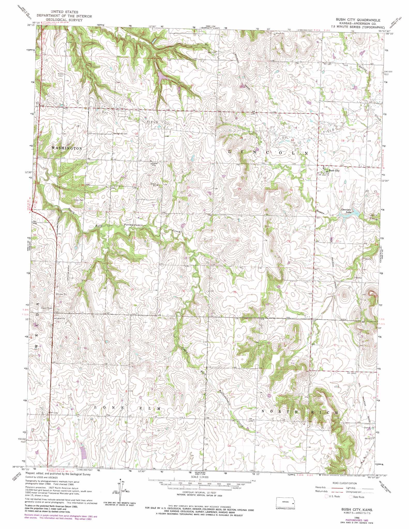
Bush City Topo Map Kansas
To zoom in, hover over the map of Bush City
USGS Topo Quad 38095b2 - 1:24,000 scale
| Topo Map Name: | Bush City |
| USGS Topo Quad ID: | 38095b2 |
| Print Size: | ca. 21 1/4" wide x 27" high |
| Southeast Coordinates: | 38.125° N latitude / 95.125° W longitude |
| Map Center Coordinates: | 38.1875° N latitude / 95.1875° W longitude |
| U.S. State: | KS |
| Filename: | o38095b2.jpg |
| Download Map JPG Image: | Bush City topo map 1:24,000 scale |
| Map Type: | Topographic |
| Topo Series: | 7.5´ |
| Map Scale: | 1:24,000 |
| Source of Map Images: | United States Geological Survey (USGS) |
| Alternate Map Versions: |
Bush City KS 1966, updated 1967 Download PDF Buy paper map Bush City KS 1966, updated 1983 Download PDF Buy paper map Bush City KS 2009 Download PDF Buy paper map Bush City KS 2012 Download PDF Buy paper map Bush City KS 2015 Download PDF Buy paper map |
1:24,000 Topo Quads surrounding Bush City
Williamsburg |
Richmond |
Garnett Nw |
Lane |
Osawatomie |
Harris |
Garnett West |
Garnett East |
Garnett Se |
Parker |
Westphalia |
Welda |
Bush City |
Centerville |
Mound City Nw |
Geneva |
Colony |
Kincaid |
Blue Mound |
Mapleton |
Iola |
La Harpe |
Moran |
Bronson |
Xenia |
> Back to 38095a1 at 1:100,000 scale
> Back to 38094a1 at 1:250,000 scale
> Back to U.S. Topo Maps home
Bush City topo map: Gazetteer
Bush City: Populated Places
Bush City elevation 315m 1033′Bush City: Reservoirs
Garrison Lake elevation 302m 990′Bush City digital topo map on disk
Buy this Bush City topo map showing relief, roads, GPS coordinates and other geographical features, as a high-resolution digital map file on DVD: