Garnett East Topo Map Kansas
To zoom in, hover over the map of Garnett East
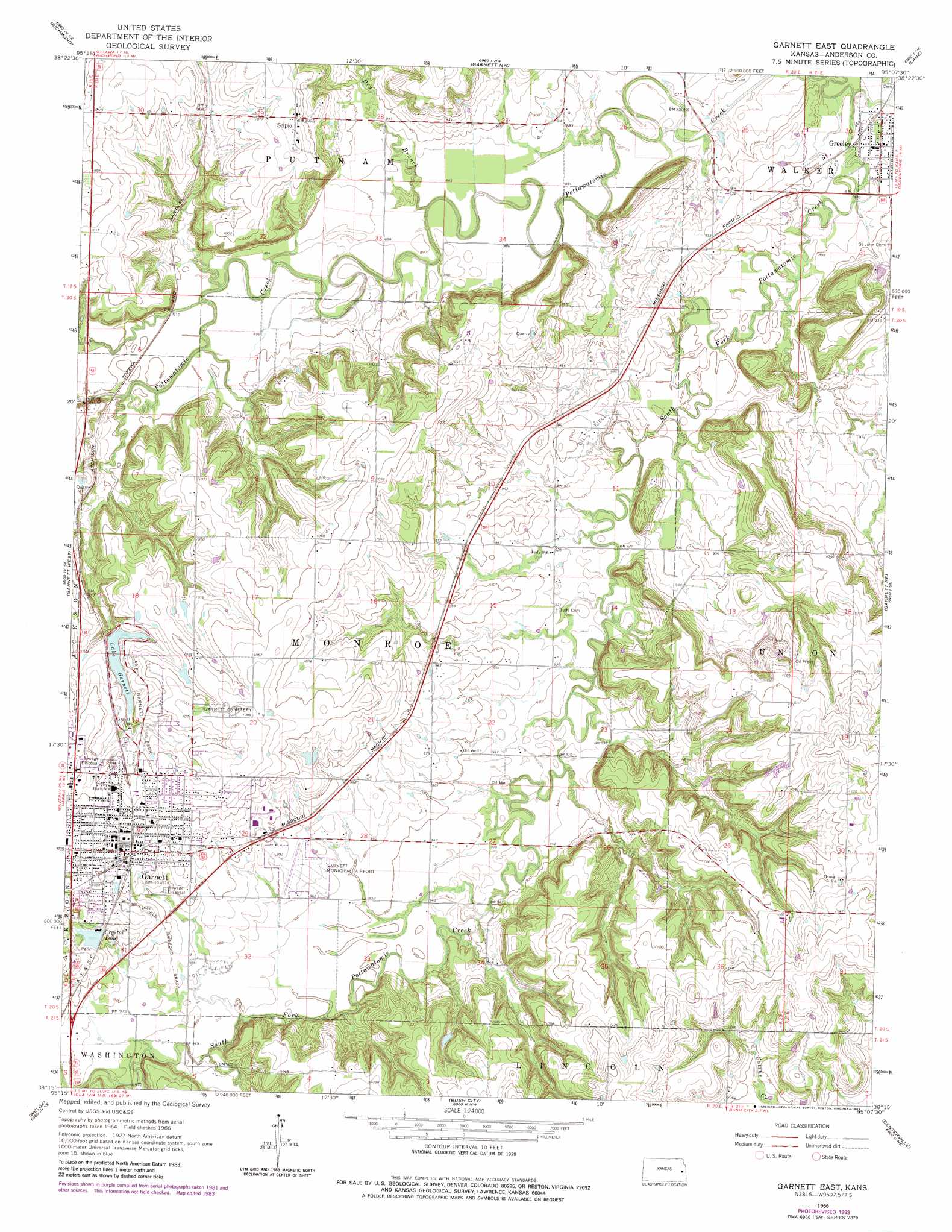
USGS Topo Quad 38095c2 - 1:24,000 scale
| Topo Map Name: | Garnett East |
| USGS Topo Quad ID: | 38095c2 |
| Print Size: | ca. 21 1/4" wide x 27" high |
| Southeast Coordinates: | 38.25° N latitude / 95.125° W longitude |
| Map Center Coordinates: | 38.3125° N latitude / 95.1875° W longitude |
| U.S. State: | KS |
| Filename: | o38095c2.jpg |
| Download Map JPG Image: | Garnett East topo map 1:24,000 scale |
| Map Type: | Topographic |
| Topo Series: | 7.5´ |
| Map Scale: | 1:24,000 |
| Source of Map Images: | United States Geological Survey (USGS) |
| Alternate Map Versions: |
Garnett East KS 1966, updated 1967 Download PDF Buy paper map Garnett East KS 1966, updated 1983 Download PDF Buy paper map Garnett East KS 2009 Download PDF Buy paper map Garnett East KS 2012 Download PDF Buy paper map Garnett East KS 2015 Download PDF Buy paper map |
1:24,000 Topo Quads surrounding Garnett East
Pomona |
Ottawa South |
Peoria |
Rantoul |
Paola West |
Williamsburg |
Richmond |
Garnett Nw |
Lane |
Osawatomie |
Harris |
Garnett West |
Garnett East |
Garnett Se |
Parker |
Westphalia |
Welda |
Bush City |
Centerville |
Mound City Nw |
Geneva |
Colony |
Kincaid |
Blue Mound |
Mapleton |
> Back to 38095a1 at 1:100,000 scale
> Back to 38094a1 at 1:250,000 scale
> Back to U.S. Topo Maps home
Garnett East topo map: Gazetteer
Garnett East: Airports
Garnett Municipal Airport elevation 303m 994′Garnett East: Dams
Garnett City Park Dam elevation 303m 994′Garnett East: Parks
Lake Garnett Park elevation 312m 1023′Garnett East: Populated Places
Garnett elevation 326m 1069′Greeley elevation 273m 895′
Scipio elevation 312m 1023′
Garnett East: Reservoirs
Crystal Lake elevation 309m 1013′Lake Garnett elevation 303m 994′
Garnett East: Streams
Dry Branch elevation 265m 869′Garnett East digital topo map on disk
Buy this Garnett East topo map showing relief, roads, GPS coordinates and other geographical features, as a high-resolution digital map file on DVD: