Richmond Topo Map Kansas
To zoom in, hover over the map of Richmond
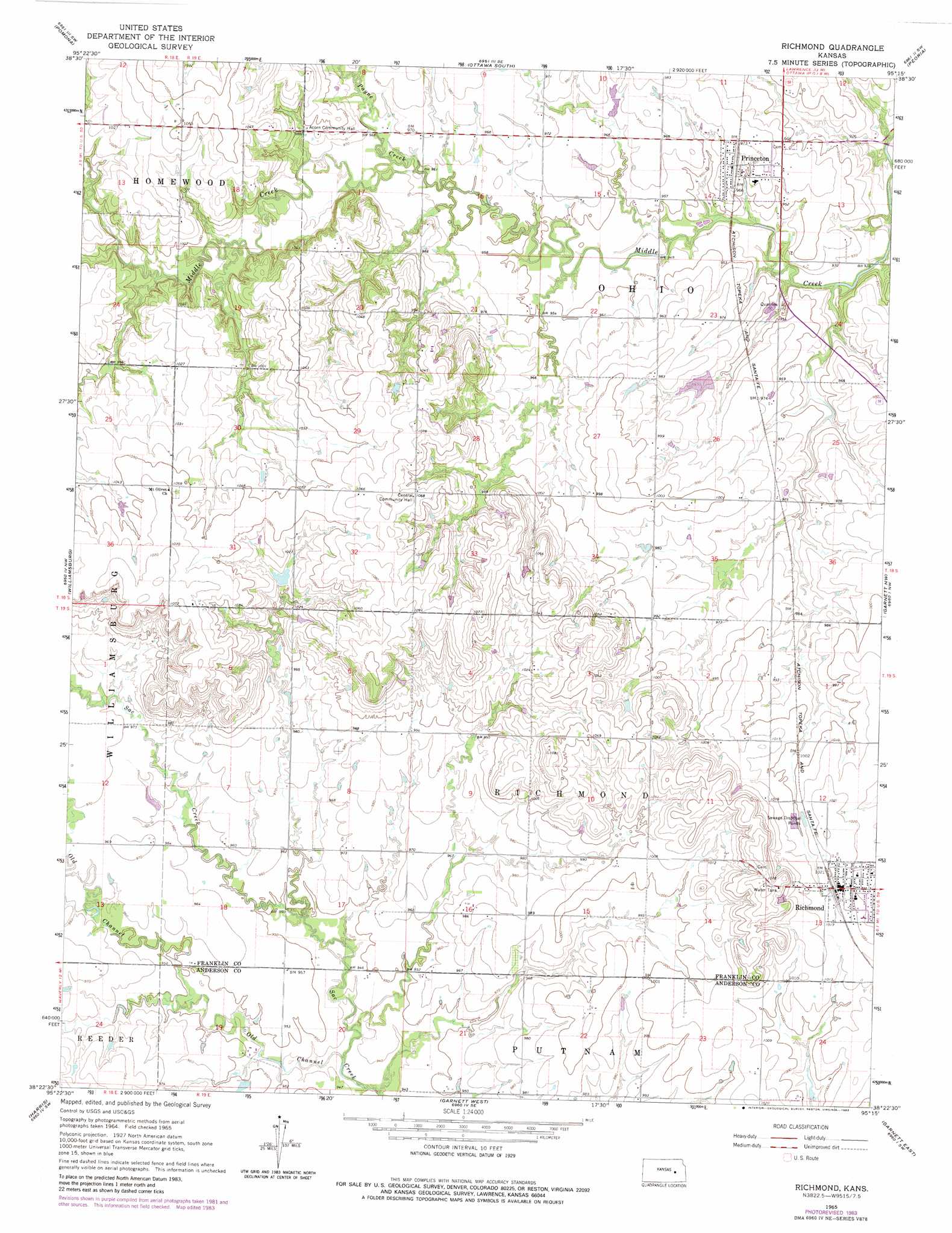
USGS Topo Quad 38095d3 - 1:24,000 scale
| Topo Map Name: | Richmond |
| USGS Topo Quad ID: | 38095d3 |
| Print Size: | ca. 21 1/4" wide x 27" high |
| Southeast Coordinates: | 38.375° N latitude / 95.25° W longitude |
| Map Center Coordinates: | 38.4375° N latitude / 95.3125° W longitude |
| U.S. State: | KS |
| Filename: | o38095d3.jpg |
| Download Map JPG Image: | Richmond topo map 1:24,000 scale |
| Map Type: | Topographic |
| Topo Series: | 7.5´ |
| Map Scale: | 1:24,000 |
| Source of Map Images: | United States Geological Survey (USGS) |
| Alternate Map Versions: |
Richmond KS 1965, updated 1967 Download PDF Buy paper map Richmond KS 1965, updated 1983 Download PDF Buy paper map Richmond KS 2009 Download PDF Buy paper map Richmond KS 2012 Download PDF Buy paper map Richmond KS 2016 Download PDF Buy paper map |
1:24,000 Topo Quads surrounding Richmond
Vassar |
Ottawa Nw |
Ottawa North |
Le Loup |
Wellsville |
Quenemo |
Pomona |
Ottawa South |
Peoria |
Rantoul |
Waverly |
Williamsburg |
Richmond |
Garnett Nw |
Lane |
Waverly Se |
Harris |
Garnett West |
Garnett East |
Garnett Se |
Aliceville |
Westphalia |
Welda |
Bush City |
Centerville |
> Back to 38095a1 at 1:100,000 scale
> Back to 38094a1 at 1:250,000 scale
> Back to U.S. Topo Maps home
Richmond topo map: Gazetteer
Richmond: Channels
Old Channel Sac Creek elevation 284m 931′Richmond: Populated Places
Princeton elevation 295m 967′Richmond elevation 312m 1023′
Richmond: Streams
Payne Creek elevation 290m 951′Richmond digital topo map on disk
Buy this Richmond topo map showing relief, roads, GPS coordinates and other geographical features, as a high-resolution digital map file on DVD: