Waverly Topo Map Kansas
To zoom in, hover over the map of Waverly
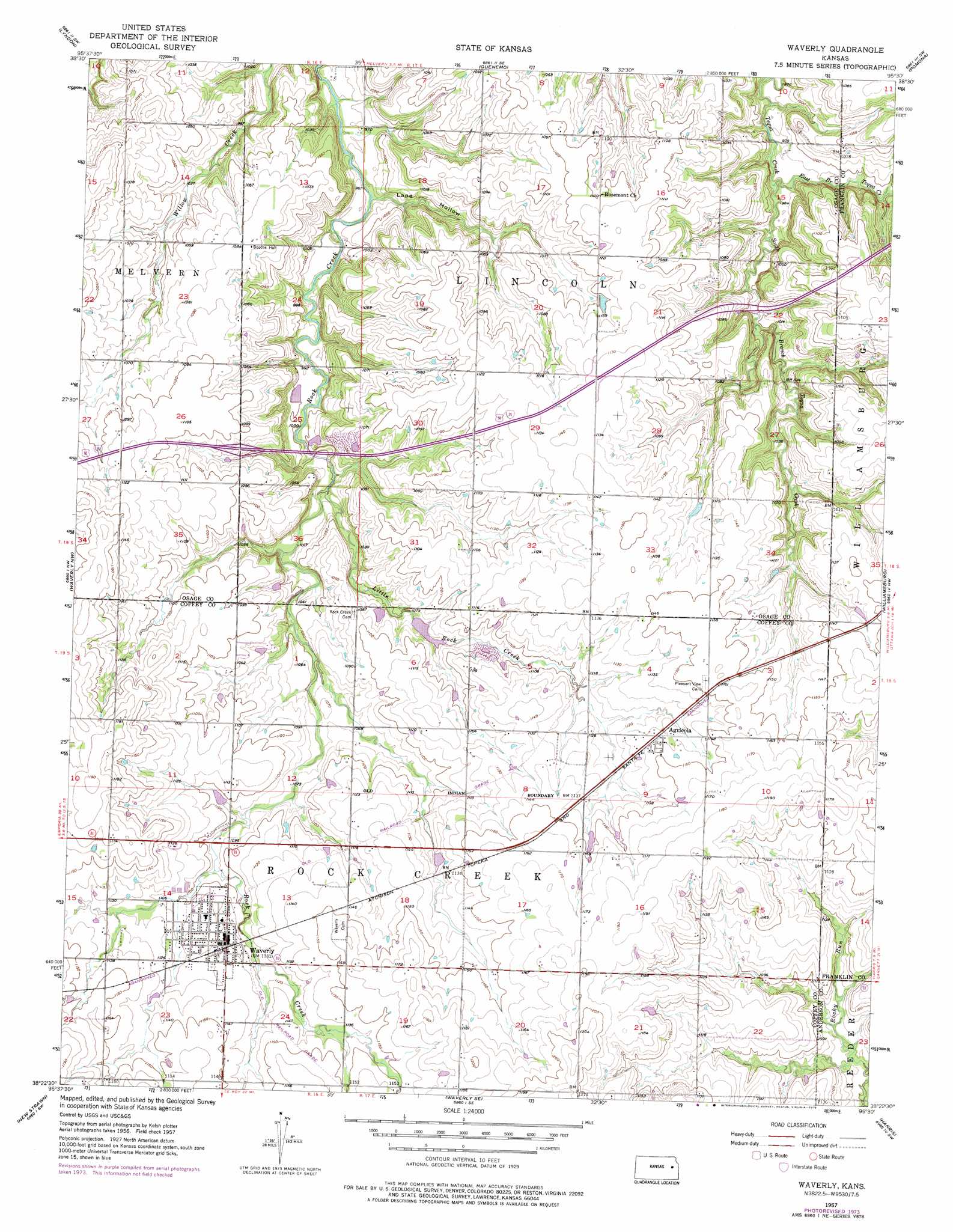
USGS Topo Quad 38095d5 - 1:24,000 scale
| Topo Map Name: | Waverly |
| USGS Topo Quad ID: | 38095d5 |
| Print Size: | ca. 21 1/4" wide x 27" high |
| Southeast Coordinates: | 38.375° N latitude / 95.5° W longitude |
| Map Center Coordinates: | 38.4375° N latitude / 95.5625° W longitude |
| U.S. State: | KS |
| Filename: | o38095d5.jpg |
| Download Map JPG Image: | Waverly topo map 1:24,000 scale |
| Map Type: | Topographic |
| Topo Series: | 7.5´ |
| Map Scale: | 1:24,000 |
| Source of Map Images: | United States Geological Survey (USGS) |
| Alternate Map Versions: |
Waverly KS 1957, updated 1958 Download PDF Buy paper map Waverly KS 1957, updated 1976 Download PDF Buy paper map Waverly KS 2009 Download PDF Buy paper map Waverly KS 2012 Download PDF Buy paper map Waverly KS 2015 Download PDF Buy paper map |
1:24,000 Topo Quads surrounding Waverly
Osage City |
Lyndon Nw |
Vassar |
Ottawa Nw |
Ottawa North |
Osage City Se |
Lyndon |
Quenemo |
Pomona |
Ottawa South |
Lebo |
Waverly Nw |
Waverly |
Williamsburg |
Richmond |
Ottumwa |
New Strawn |
Waverly Se |
Harris |
Garnett West |
John Redmond Dam |
Burlington |
Aliceville |
Westphalia |
Welda |
> Back to 38095a1 at 1:100,000 scale
> Back to 38094a1 at 1:250,000 scale
> Back to U.S. Topo Maps home
Waverly topo map: Gazetteer
Waverly: Airports
Schoolcraft Airport elevation 355m 1164′Waverly: Populated Places
Agricola elevation 346m 1135′Waverly elevation 341m 1118′
Waverly: Streams
East Branch Tequa Creek elevation 295m 967′Little Rock Creek elevation 305m 1000′
South Branch Tequa Creek elevation 295m 967′
Waverly: Valleys
Lane Hollow elevation 293m 961′Waverly digital topo map on disk
Buy this Waverly topo map showing relief, roads, GPS coordinates and other geographical features, as a high-resolution digital map file on DVD: