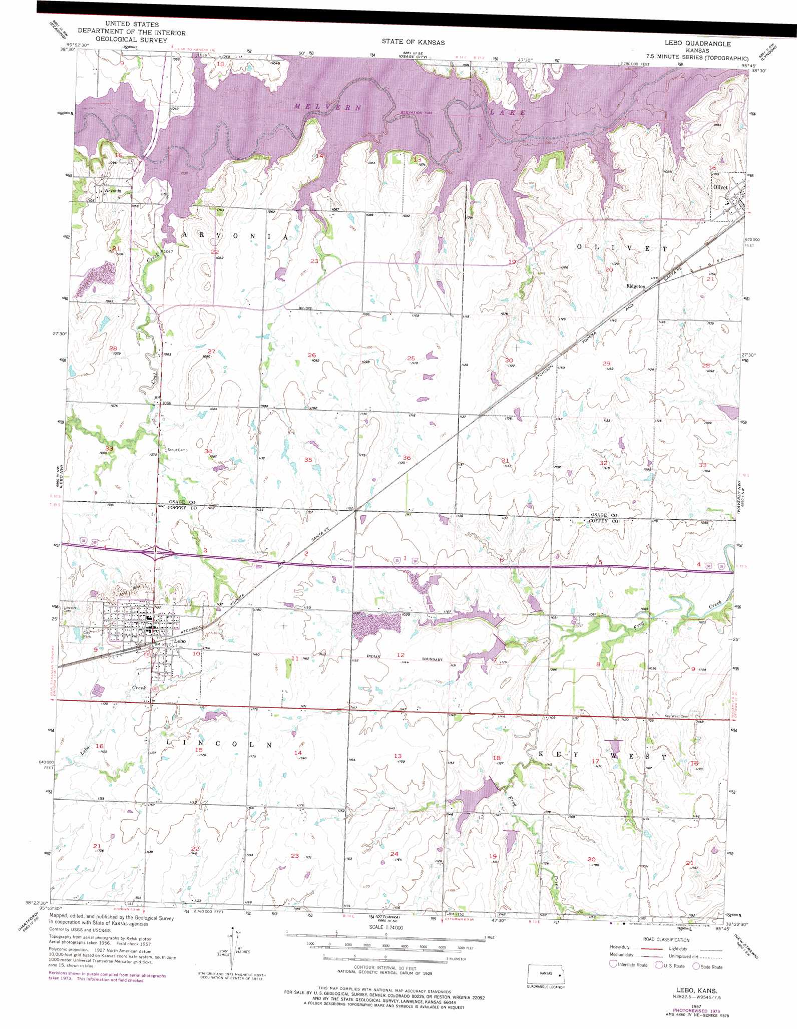
Lebo Topo Map Kansas
To zoom in, hover over the map of Lebo
USGS Topo Quad 38095d7 - 1:24,000 scale
| Topo Map Name: | Lebo |
| USGS Topo Quad ID: | 38095d7 |
| Print Size: | ca. 21 1/4" wide x 27" high |
| Southeast Coordinates: | 38.375° N latitude / 95.75° W longitude |
| Map Center Coordinates: | 38.4375° N latitude / 95.8125° W longitude |
| U.S. State: | KS |
| Filename: | o38095d7.jpg |
| Download Map JPG Image: | Lebo topo map 1:24,000 scale |
| Map Type: | Topographic |
| Topo Series: | 7.5´ |
| Map Scale: | 1:24,000 |
| Source of Map Images: | United States Geological Survey (USGS) |
| Alternate Map Versions: |
Lebo KS 1957, updated 1958 Download PDF Buy paper map Lebo KS 1957, updated 1976 Download PDF Buy paper map Lebo KS 2009 Download PDF Buy paper map Lebo KS 2012 Download PDF Buy paper map Lebo KS 2015 Download PDF Buy paper map |
1:24,000 Topo Quads surrounding Lebo
Admire |
Miller |
Osage City |
Lyndon Nw |
Vassar |
Allen Se |
Reading |
Osage City Se |
Lyndon |
Quenemo |
Lang |
Lebo Nw |
Lebo |
Waverly Nw |
Waverly |
Emporia Se |
Hartford |
Ottumwa |
New Strawn |
Waverly Se |
Madison Ne |
Gridley Nw |
John Redmond Dam |
Burlington |
Aliceville |
> Back to 38095a1 at 1:100,000 scale
> Back to 38094a1 at 1:250,000 scale
> Back to U.S. Topo Maps home
Lebo topo map: Gazetteer
Lebo: Populated Places
Arvonia elevation 336m 1102′Lebo elevation 357m 1171′
Olivet elevation 351m 1151′
Ridgeton elevation 348m 1141′
Lebo: Streams
Cable Creek elevation 316m 1036′Coal Creek elevation 316m 1036′
Little Cable Creek elevation 316m 1036′
Lebo digital topo map on disk
Buy this Lebo topo map showing relief, roads, GPS coordinates and other geographical features, as a high-resolution digital map file on DVD: