Miller Topo Map Kansas
To zoom in, hover over the map of Miller
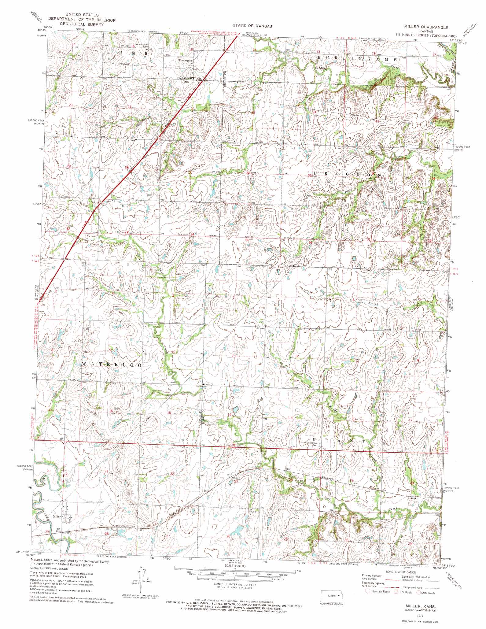
USGS Topo Quad 38095f8 - 1:24,000 scale
| Topo Map Name: | Miller |
| USGS Topo Quad ID: | 38095f8 |
| Print Size: | ca. 21 1/4" wide x 27" high |
| Southeast Coordinates: | 38.625° N latitude / 95.875° W longitude |
| Map Center Coordinates: | 38.6875° N latitude / 95.9375° W longitude |
| U.S. State: | KS |
| Filename: | o38095f8.jpg |
| Download Map JPG Image: | Miller topo map 1:24,000 scale |
| Map Type: | Topographic |
| Topo Series: | 7.5´ |
| Map Scale: | 1:24,000 |
| Source of Map Images: | United States Geological Survey (USGS) |
| Alternate Map Versions: |
Miller KS 1971, updated 1972 Download PDF Buy paper map Miller KS 2009 Download PDF Buy paper map Miller KS 2012 Download PDF Buy paper map Miller KS 2015 Download PDF Buy paper map |
1:24,000 Topo Quads surrounding Miller
Hessdale |
Keene |
Dover |
Auburn |
Wakarusa |
Lake Wabaunsee |
Eskridge |
Harveyville |
Burlingame |
Carbondale |
Allen |
Admire |
Miller |
Osage City |
Lyndon Nw |
Allen Sw |
Allen Se |
Reading |
Osage City Se |
Lyndon |
Emporia |
Lang |
Lebo Nw |
Lebo |
Waverly Nw |
> Back to 38095e1 at 1:100,000 scale
> Back to 38094a1 at 1:250,000 scale
> Back to U.S. Topo Maps home
Miller topo map: Gazetteer
Miller: Airports
Dickson Airport elevation 345m 1131′J V Ranch Airport elevation 361m 1184′
Miller: Populated Places
Miller elevation 342m 1122′Wilmington elevation 360m 1181′
Miller: Streams
Swede Creek elevation 330m 1082′Miller digital topo map on disk
Buy this Miller topo map showing relief, roads, GPS coordinates and other geographical features, as a high-resolution digital map file on DVD: