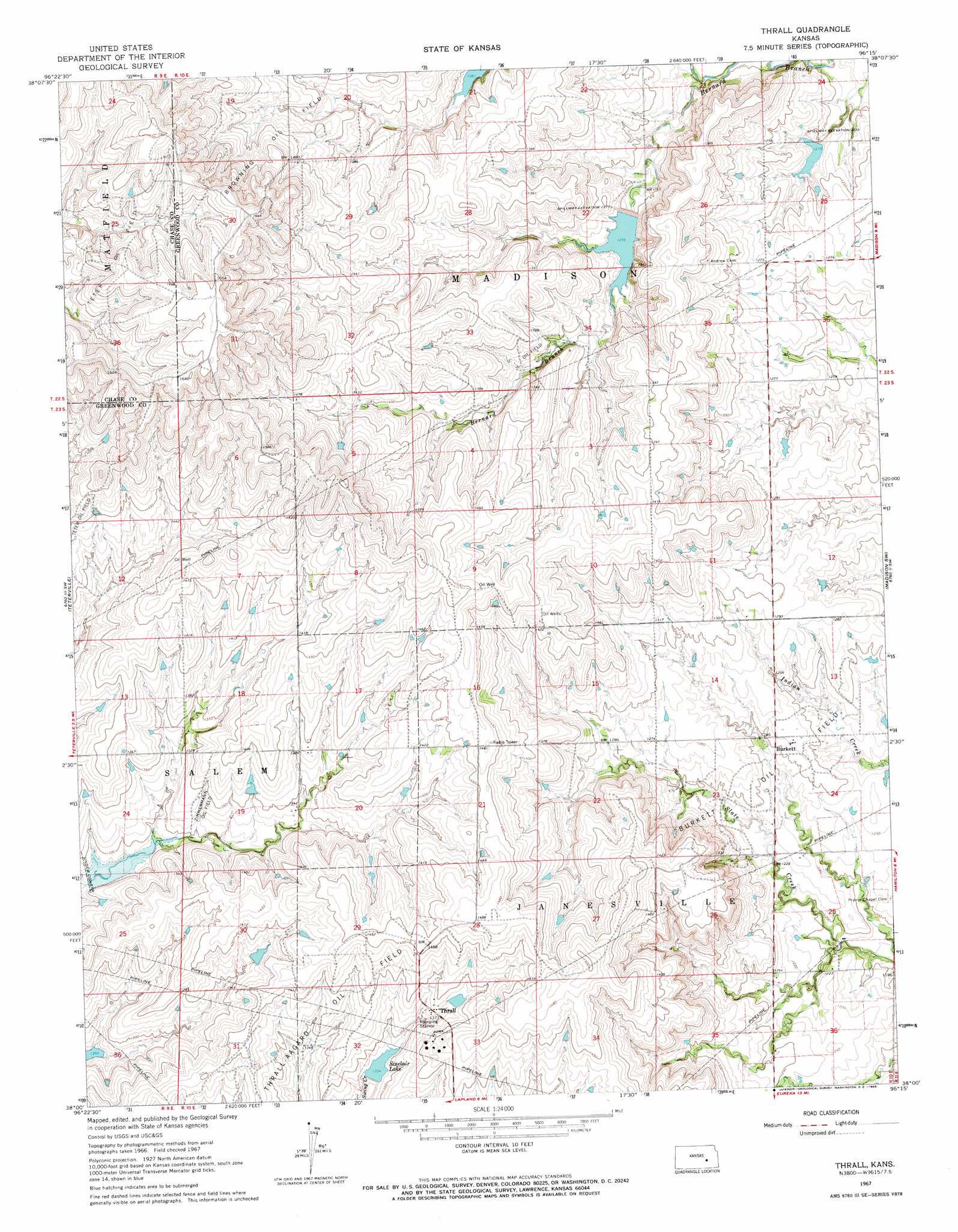
Thrall Topo Map Kansas
To zoom in, hover over the map of Thrall
USGS Topo Quad 38096a3 - 1:24,000 scale
| Topo Map Name: | Thrall |
| USGS Topo Quad ID: | 38096a3 |
| Print Size: | ca. 21 1/4" wide x 27" high |
| Southeast Coordinates: | 38° N latitude / 96.25° W longitude |
| Map Center Coordinates: | 38.0625° N latitude / 96.3125° W longitude |
| U.S. State: | KS |
| Filename: | o38096a3.jpg |
| Download Map JPG Image: | Thrall topo map 1:24,000 scale |
| Map Type: | Topographic |
| Topo Series: | 7.5´ |
| Map Scale: | 1:24,000 |
| Source of Map Images: | United States Geological Survey (USGS) |
| Alternate Map Versions: |
Thrall KS 1967, updated 1968 Download PDF Buy paper map Thrall KS 2009 Download PDF Buy paper map Thrall KS 2012 Download PDF Buy paper map Thrall KS 2015 Download PDF Buy paper map |
1:24,000 Topo Quads surrounding Thrall
Cottonwood Falls |
Gladstone |
Phenis Creek |
Olpe |
Emporia Se |
Matfield Green |
Thrall Nw |
Shaw Creek |
Madison |
Madison Ne |
Matfield Green Se |
Teterville |
Thrall |
Madison Sw |
Lamont |
Rosalia Ne |
Lapland |
Eureka Ne |
Hamilton |
Virgil |
Rosalia |
Reece |
Eureka |
Tonovay |
Neal |
> Back to 38096a1 at 1:100,000 scale
> Back to 38096a1 at 1:250,000 scale
> Back to U.S. Topo Maps home
Thrall topo map: Gazetteer
Thrall: Oilfields
Browning Oil Field elevation 447m 1466′Burkett Oil Field elevation 378m 1240′
Zimmermann Oil Field elevation 405m 1328′
Thrall: Populated Places
Burkett elevation 384m 1259′Thrall elevation 418m 1371′
Thrall: Reservoirs
Sinclair Lake elevation 403m 1322′Thrall: Streams
Bernard Branch elevation 366m 1200′Thrall digital topo map on disk
Buy this Thrall topo map showing relief, roads, GPS coordinates and other geographical features, as a high-resolution digital map file on DVD: