Madison Topo Map Kansas
To zoom in, hover over the map of Madison
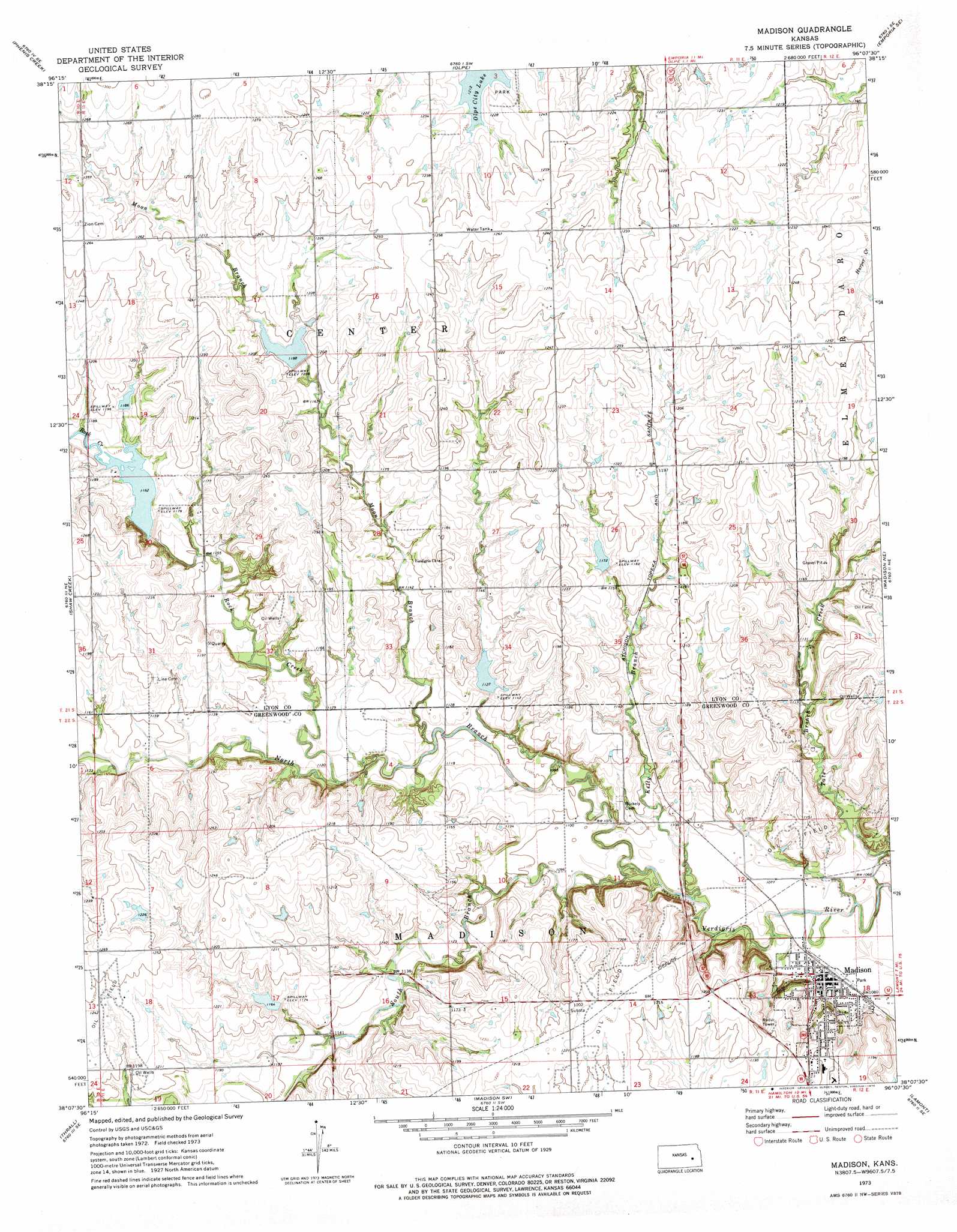
USGS Topo Quad 38096b2 - 1:24,000 scale
| Topo Map Name: | Madison |
| USGS Topo Quad ID: | 38096b2 |
| Print Size: | ca. 21 1/4" wide x 27" high |
| Southeast Coordinates: | 38.125° N latitude / 96.125° W longitude |
| Map Center Coordinates: | 38.1875° N latitude / 96.1875° W longitude |
| U.S. State: | KS |
| Filename: | o38096b2.jpg |
| Download Map JPG Image: | Madison topo map 1:24,000 scale |
| Map Type: | Topographic |
| Topo Series: | 7.5´ |
| Map Scale: | 1:24,000 |
| Source of Map Images: | United States Geological Survey (USGS) |
| Alternate Map Versions: |
Madison KS 1973, updated 1975 Download PDF Buy paper map Madison KS 2010 Download PDF Buy paper map Madison KS 2012 Download PDF Buy paper map Madison KS 2015 Download PDF Buy paper map |
1:24,000 Topo Quads surrounding Madison
Saffordville |
Plymouth |
Emporia |
Lang |
Lebo Nw |
Gladstone |
Phenis Creek |
Olpe |
Emporia Se |
Hartford |
Thrall Nw |
Shaw Creek |
Madison |
Madison Ne |
Gridley Nw |
Teterville |
Thrall |
Madison Sw |
Lamont |
Gridley |
Lapland |
Eureka Ne |
Hamilton |
Virgil |
Quincy |
> Back to 38096a1 at 1:100,000 scale
> Back to 38096a1 at 1:250,000 scale
> Back to U.S. Topo Maps home
Madison topo map: Gazetteer
Madison: Populated Places
Madison elevation 334m 1095′Madison: Streams
Kelly Branch elevation 326m 1069′Moon Branch elevation 335m 1099′
North Branch Verdigris River elevation 326m 1069′
Rock Creek elevation 338m 1108′
South Branch Verdigris River elevation 326m 1069′
Tate Branch Creek elevation 320m 1049′
Madison digital topo map on disk
Buy this Madison topo map showing relief, roads, GPS coordinates and other geographical features, as a high-resolution digital map file on DVD: