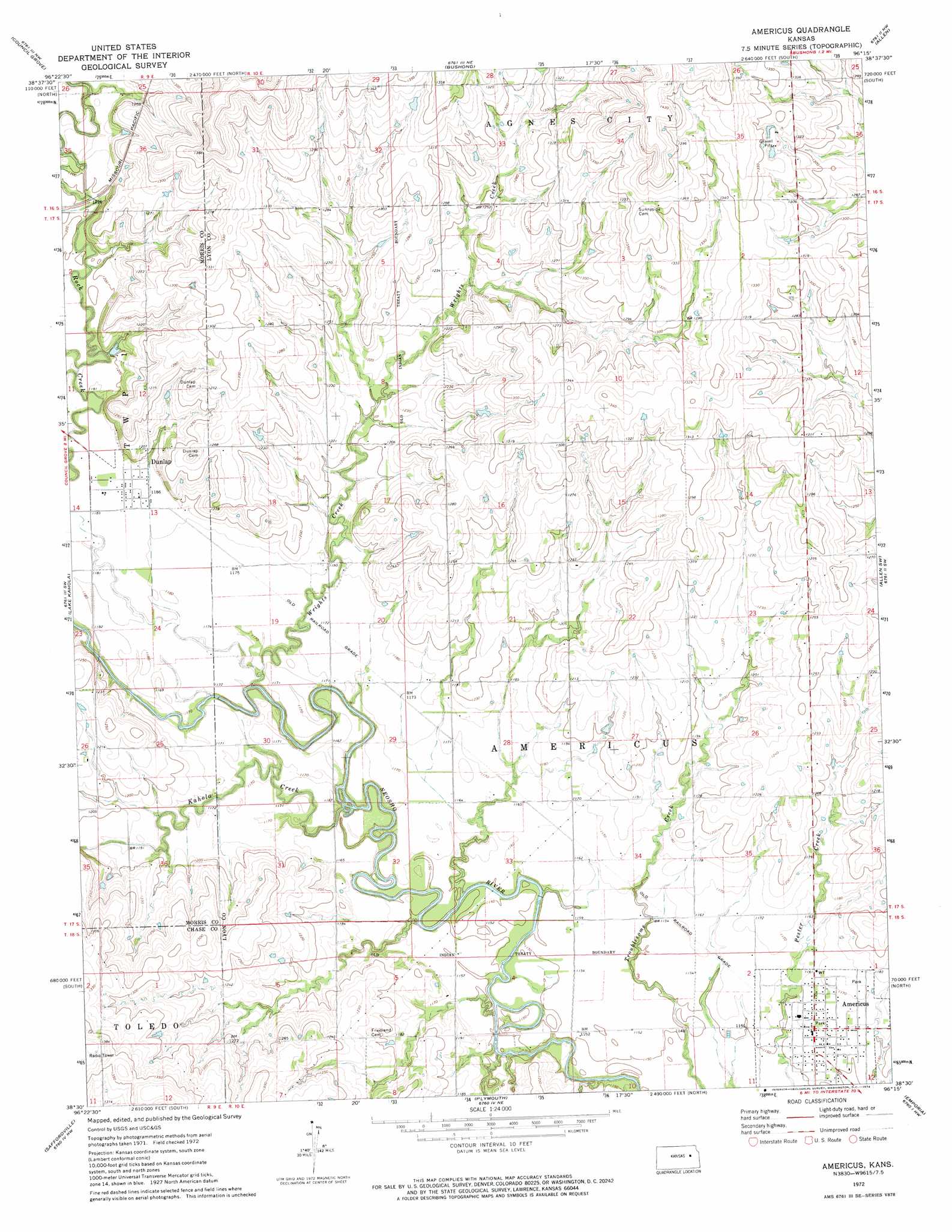
Americus Topo Map Kansas
To zoom in, hover over the map of Americus
USGS Topo Quad 38096e3 - 1:24,000 scale
| Topo Map Name: | Americus |
| USGS Topo Quad ID: | 38096e3 |
| Print Size: | ca. 21 1/4" wide x 27" high |
| Southeast Coordinates: | 38.5° N latitude / 96.25° W longitude |
| Map Center Coordinates: | 38.5625° N latitude / 96.3125° W longitude |
| U.S. State: | KS |
| Filename: | o38096e3.jpg |
| Download Map JPG Image: | Americus topo map 1:24,000 scale |
| Map Type: | Topographic |
| Topo Series: | 7.5´ |
| Map Scale: | 1:24,000 |
| Source of Map Images: | United States Geological Survey (USGS) |
| Alternate Map Versions: |
Americus KS 1972, updated 1974 Download PDF Buy paper map Americus KS 2009 Download PDF Buy paper map Americus KS 2012 Download PDF Buy paper map Americus KS 2015 Download PDF Buy paper map |
1:24,000 Topo Quads surrounding Americus
Dwight |
Alta Vista |
Alta Vista Se |
Lake Wabaunsee |
Eskridge |
Council Grove Lake |
Council Grove |
Bushong |
Allen |
Admire |
Wilsey Se |
Lake Kahola |
Americus |
Allen Sw |
Allen Se |
Strong City |
Saffordville |
Plymouth |
Emporia |
Lang |
Cottonwood Falls |
Gladstone |
Phenis Creek |
Olpe |
Emporia Se |
> Back to 38096e1 at 1:100,000 scale
> Back to 38096a1 at 1:250,000 scale
> Back to U.S. Topo Maps home
Americus topo map: Gazetteer
Americus: Populated Places
Americus elevation 353m 1158′Dunlap elevation 361m 1184′
Americus: Streams
Kahola Creek elevation 351m 1151′Wrights Creek elevation 351m 1151′
Americus digital topo map on disk
Buy this Americus topo map showing relief, roads, GPS coordinates and other geographical features, as a high-resolution digital map file on DVD: