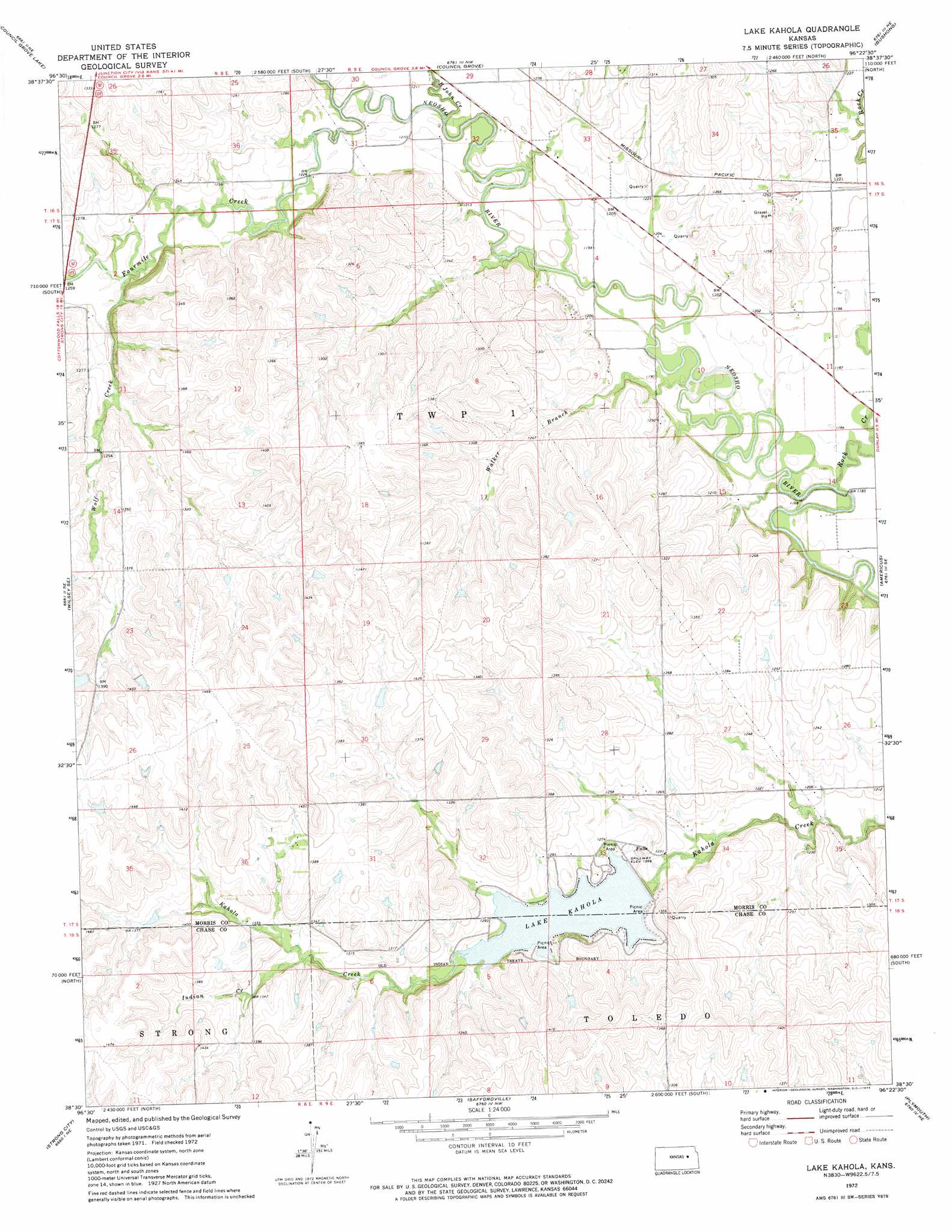
Lake Kahola Topo Map Kansas
To zoom in, hover over the map of Lake Kahola
USGS Topo Quad 38096e4 - 1:24,000 scale
| Topo Map Name: | Lake Kahola |
| USGS Topo Quad ID: | 38096e4 |
| Print Size: | ca. 21 1/4" wide x 27" high |
| Southeast Coordinates: | 38.5° N latitude / 96.375° W longitude |
| Map Center Coordinates: | 38.5625° N latitude / 96.4375° W longitude |
| U.S. State: | KS |
| Filename: | o38096e4.jpg |
| Download Map JPG Image: | Lake Kahola topo map 1:24,000 scale |
| Map Type: | Topographic |
| Topo Series: | 7.5´ |
| Map Scale: | 1:24,000 |
| Source of Map Images: | United States Geological Survey (USGS) |
| Alternate Map Versions: |
Lake Kahola KS 1972, updated 1974 Download PDF Buy paper map Lake Kahola KS 2010 Download PDF Buy paper map Lake Kahola KS 2012 Download PDF Buy paper map Lake Kahola KS 2015 Download PDF Buy paper map |
1:24,000 Topo Quads surrounding Lake Kahola
White City |
Dwight |
Alta Vista |
Alta Vista Se |
Lake Wabaunsee |
Wilsey |
Council Grove Lake |
Council Grove |
Bushong |
Allen |
Diamond Springs |
Wilsey Se |
Lake Kahola |
Americus |
Allen Sw |
Hymer |
Strong City |
Saffordville |
Plymouth |
Emporia |
Elmdale |
Cottonwood Falls |
Gladstone |
Phenis Creek |
Olpe |
> Back to 38096e1 at 1:100,000 scale
> Back to 38096a1 at 1:250,000 scale
> Back to U.S. Topo Maps home
Lake Kahola topo map: Gazetteer
Lake Kahola: Reservoirs
Lake Kahola elevation 387m 1269′Lake Kahola: Streams
Big John Creek elevation 363m 1190′Fourmile Creek elevation 365m 1197′
Indian Creek elevation 399m 1309′
Rock Creek elevation 356m 1167′
Walker Branch elevation 356m 1167′
Wolf Creek elevation 377m 1236′
Lake Kahola digital topo map on disk
Buy this Lake Kahola topo map showing relief, roads, GPS coordinates and other geographical features, as a high-resolution digital map file on DVD: