Burdick Topo Map Kansas
To zoom in, hover over the map of Burdick
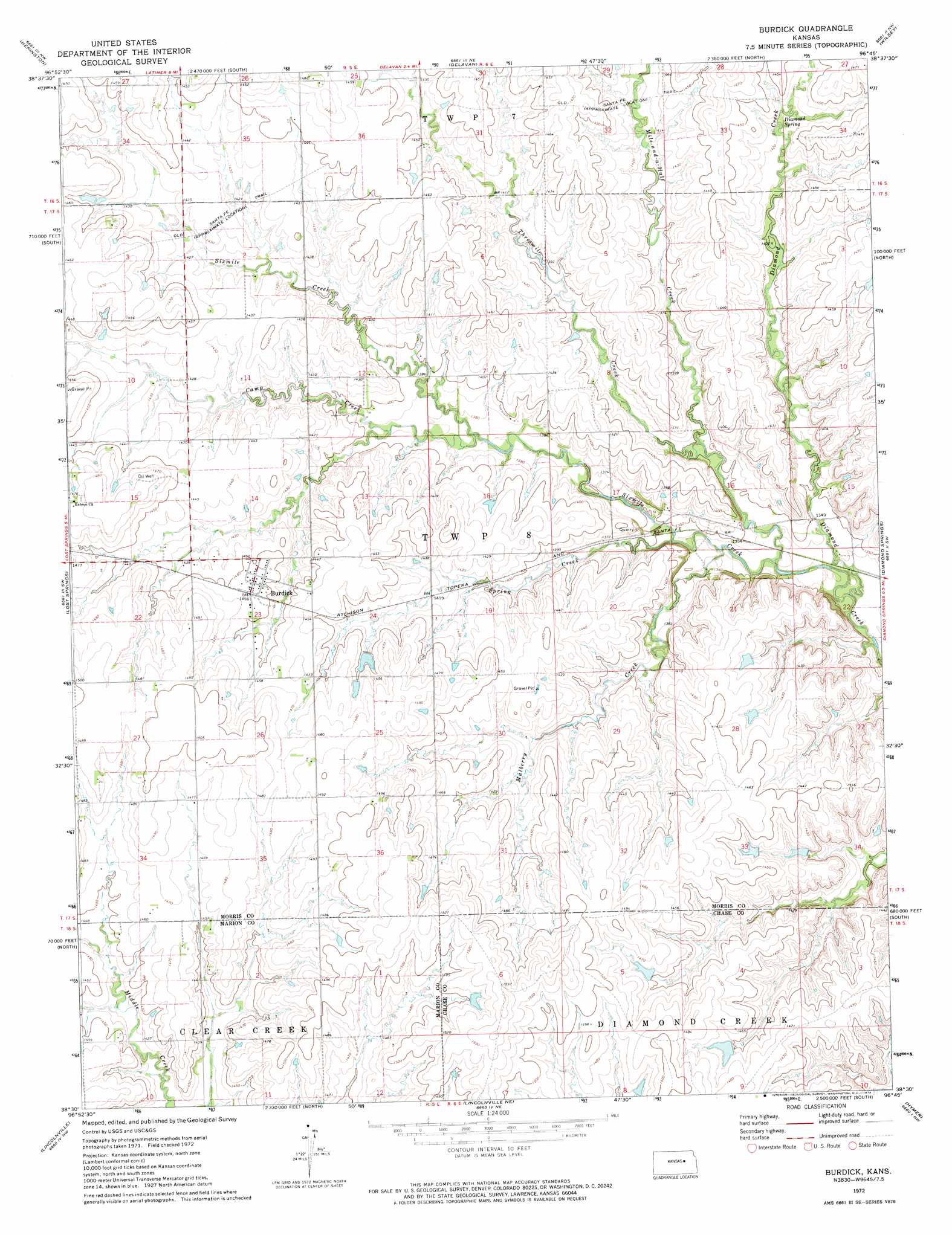
USGS Topo Quad 38096e7 - 1:24,000 scale
| Topo Map Name: | Burdick |
| USGS Topo Quad ID: | 38096e7 |
| Print Size: | ca. 21 1/4" wide x 27" high |
| Southeast Coordinates: | 38.5° N latitude / 96.75° W longitude |
| Map Center Coordinates: | 38.5625° N latitude / 96.8125° W longitude |
| U.S. State: | KS |
| Filename: | o38096e7.jpg |
| Download Map JPG Image: | Burdick topo map 1:24,000 scale |
| Map Type: | Topographic |
| Topo Series: | 7.5´ |
| Map Scale: | 1:24,000 |
| Source of Map Images: | United States Geological Survey (USGS) |
| Alternate Map Versions: |
Burdick KS 1972, updated 1974 Download PDF Buy paper map Burdick KS 2010 Download PDF Buy paper map Burdick KS 2012 Download PDF Buy paper map Burdick KS 2015 Download PDF Buy paper map |
1:24,000 Topo Quads surrounding Burdick
Navarre |
Woodbine |
Skiddy |
White City |
Dwight |
Hope |
Herington |
Delavan |
Wilsey |
Council Grove Lake |
Ramona |
Lost Springs |
Burdick |
Diamond Springs |
Wilsey Se |
Pilsen |
Lincolnville |
Lincolnville Ne |
Hymer |
Strong City |
Marion |
Lincolnville Sw |
Cedar Point |
Elmdale |
Cottonwood Falls |
> Back to 38096e1 at 1:100,000 scale
> Back to 38096a1 at 1:250,000 scale
> Back to U.S. Topo Maps home
Burdick topo map: Gazetteer
Burdick: Populated Places
Burdick elevation 443m 1453′Burdick: Springs
Diamond Spring elevation 434m 1423′Burdick: Streams
Camp Creek elevation 417m 1368′Mile-and-a-Half Creek elevation 409m 1341′
Mulberry Creek elevation 405m 1328′
Sixmile Creek elevation 401m 1315′
Spring Creek elevation 409m 1341′
Threemile Creek elevation 403m 1322′
Burdick digital topo map on disk
Buy this Burdick topo map showing relief, roads, GPS coordinates and other geographical features, as a high-resolution digital map file on DVD: