White City Topo Map Kansas
To zoom in, hover over the map of White City
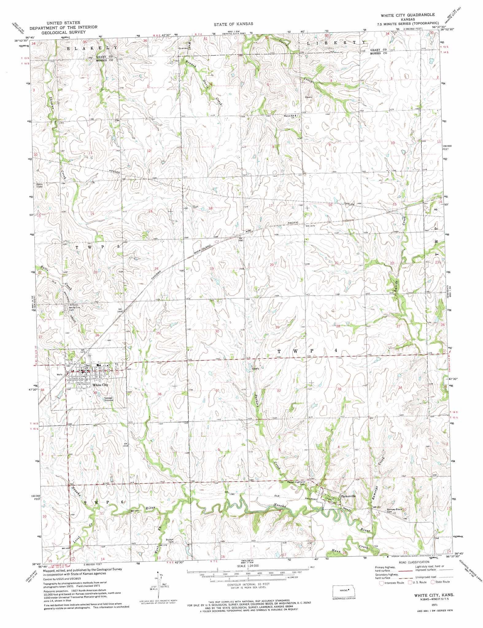
USGS Topo Quad 38096g6 - 1:24,000 scale
| Topo Map Name: | White City |
| USGS Topo Quad ID: | 38096g6 |
| Print Size: | ca. 21 1/4" wide x 27" high |
| Southeast Coordinates: | 38.75° N latitude / 96.625° W longitude |
| Map Center Coordinates: | 38.8125° N latitude / 96.6875° W longitude |
| U.S. State: | KS |
| Filename: | o38096g6.jpg |
| Download Map JPG Image: | White City topo map 1:24,000 scale |
| Map Type: | Topographic |
| Topo Series: | 7.5´ |
| Map Scale: | 1:24,000 |
| Source of Map Images: | United States Geological Survey (USGS) |
| Alternate Map Versions: |
White City KS 1971, updated 1974 Download PDF Buy paper map White City KS 2009 Download PDF Buy paper map White City KS 2012 Download PDF Buy paper map White City KS 2015 Download PDF Buy paper map |
1:24,000 Topo Quads surrounding White City
Milford Dam |
Junction City |
Ogden |
Swede Creek |
Wamego Sw |
Kansas Falls |
Wreford |
White City Nw |
White City Ne |
Volland |
Woodbine |
Skiddy |
White City |
Dwight |
Alta Vista |
Herington |
Delavan |
Wilsey |
Council Grove Lake |
Council Grove |
Lost Springs |
Burdick |
Diamond Springs |
Wilsey Se |
Lake Kahola |
> Back to 38096e1 at 1:100,000 scale
> Back to 38096a1 at 1:250,000 scale
> Back to U.S. Topo Maps home
White City topo map: Gazetteer
White City: Populated Places
Parkerville elevation 413m 1354′White City elevation 448m 1469′
White City: Streams
Haun Creek elevation 402m 1318′Level Creek elevation 419m 1374′
Parkers Creek elevation 405m 1328′
Ramseys Creek elevation 406m 1332′
West Fork Neosho River elevation 414m 1358′
White City digital topo map on disk
Buy this White City topo map showing relief, roads, GPS coordinates and other geographical features, as a high-resolution digital map file on DVD: