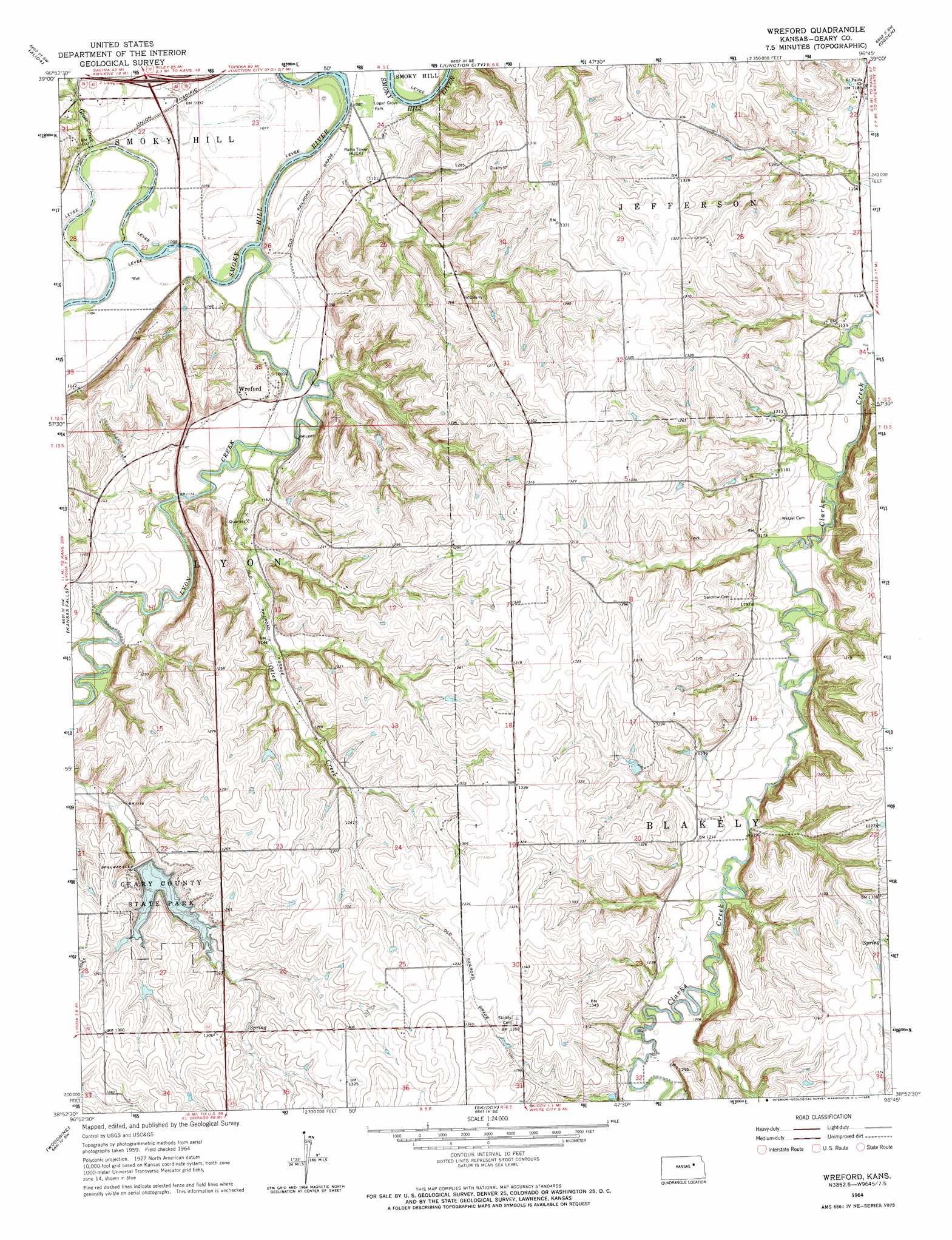
Wreford Topo Map Kansas
To zoom in, hover over the map of Wreford
USGS Topo Quad 38096h7 - 1:24,000 scale
| Topo Map Name: | Wreford |
| USGS Topo Quad ID: | 38096h7 |
| Print Size: | ca. 21 1/4" wide x 27" high |
| Southeast Coordinates: | 38.875° N latitude / 96.75° W longitude |
| Map Center Coordinates: | 38.9375° N latitude / 96.8125° W longitude |
| U.S. State: | KS |
| Filename: | o38096h7.jpg |
| Download Map JPG Image: | Wreford topo map 1:24,000 scale |
| Map Type: | Topographic |
| Topo Series: | 7.5´ |
| Map Scale: | 1:24,000 |
| Source of Map Images: | United States Geological Survey (USGS) |
| Alternate Map Versions: |
Wreford KS 1964, updated 1965 Download PDF Buy paper map Wreford KS 2009 Download PDF Buy paper map Wreford KS 2012 Download PDF Buy paper map Wreford KS 2015 Download PDF Buy paper map |
1:24,000 Topo Quads surrounding Wreford
Wakefield |
Milford |
Fort Riley Ne |
Keats |
Manhattan |
Upland |
Milford Dam |
Junction City |
Ogden |
Swede Creek |
Chapman |
Kansas Falls |
Wreford |
White City Nw |
White City Ne |
Navarre |
Woodbine |
Skiddy |
White City |
Dwight |
Hope |
Herington |
Delavan |
Wilsey |
Council Grove Lake |
> Back to 38096e1 at 1:100,000 scale
> Back to 38096a1 at 1:250,000 scale
> Back to U.S. Topo Maps home
Wreford topo map: Gazetteer
Wreford: Dams
Geary County State Lake Dam elevation 354m 1161′Wreford: Parks
Geary County State Park elevation 367m 1204′Geary State Fishing Lake and Wildlife Area elevation 367m 1204′
Logan Grove Park elevation 328m 1076′
Wreford: Populated Places
Wreford elevation 346m 1135′Wreford: Reservoirs
Geary County State Lake elevation 382m 1253′Wreford: Streams
Davis Creek elevation 344m 1128′Goose Creek elevation 329m 1079′
Lyon Creek elevation 321m 1053′
Otter Creek elevation 328m 1076′
Wreford digital topo map on disk
Buy this Wreford topo map showing relief, roads, GPS coordinates and other geographical features, as a high-resolution digital map file on DVD: