Hutchinson Se Topo Map Kansas
To zoom in, hover over the map of Hutchinson Se
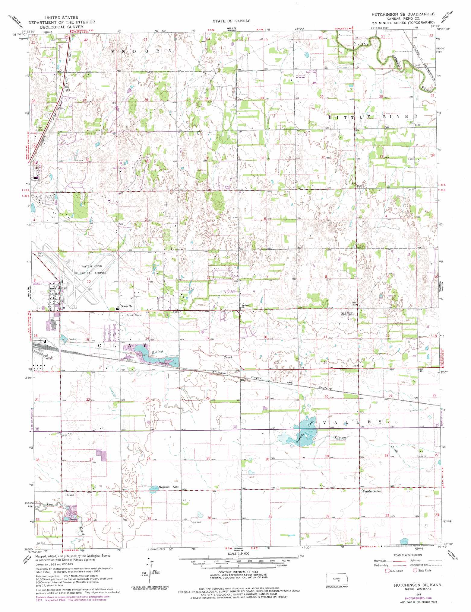
USGS Topo Quad 38097a7 - 1:24,000 scale
| Topo Map Name: | Hutchinson Se |
| USGS Topo Quad ID: | 38097a7 |
| Print Size: | ca. 21 1/4" wide x 27" high |
| Southeast Coordinates: | 38° N latitude / 97.75° W longitude |
| Map Center Coordinates: | 38.0625° N latitude / 97.8125° W longitude |
| U.S. State: | KS |
| Filename: | o38097a7.jpg |
| Download Map JPG Image: | Hutchinson Se topo map 1:24,000 scale |
| Map Type: | Topographic |
| Topo Series: | 7.5´ |
| Map Scale: | 1:24,000 |
| Source of Map Images: | United States Geological Survey (USGS) |
| Alternate Map Versions: |
Hutchinson SE KS 1961, updated 1962 Download PDF Buy paper map Hutchinson SE KS 1961, updated 1978 Download PDF Buy paper map Hutchinson SE KS 2009 Download PDF Buy paper map Hutchinson SE KS 2012 Download PDF Buy paper map Hutchinson SE KS 2015 Download PDF Buy paper map |
1:24,000 Topo Quads surrounding Hutchinson Se
Lyons Se |
Windom Sw |
Conway |
Mcpherson South |
Mcpherson Se |
Nickerson |
Hutchinson Nw |
Buhler |
Halstead Nw |
Moundridge |
Yaggy |
Hutchinson |
Hutchinson Se |
Burrton |
Halstead |
Partridge |
Elmer |
Haven |
Patterson |
Bentley |
Pretty Prairie |
Castleton |
Haven Se |
Mount Hope |
Colwich |
> Back to 38097a1 at 1:100,000 scale
> Back to 38096a1 at 1:250,000 scale
> Back to U.S. Topo Maps home
Hutchinson Se topo map: Gazetteer
Hutchinson Se: Airports
Hutchinson Municipal Airport elevation 462m 1515′Hutchinson Se: Lakes
Magwire Lake elevation 457m 1499′Hutchinson Se: Populated Places
Obeeville elevation 461m 1512′Punkin Center elevation 451m 1479′
Hutchinson Se: Post Offices
Kent Post Office (historical) elevation 457m 1499′Hutchinson Se digital topo map on disk
Buy this Hutchinson Se topo map showing relief, roads, GPS coordinates and other geographical features, as a high-resolution digital map file on DVD: