Moundridge Topo Map Kansas
To zoom in, hover over the map of Moundridge
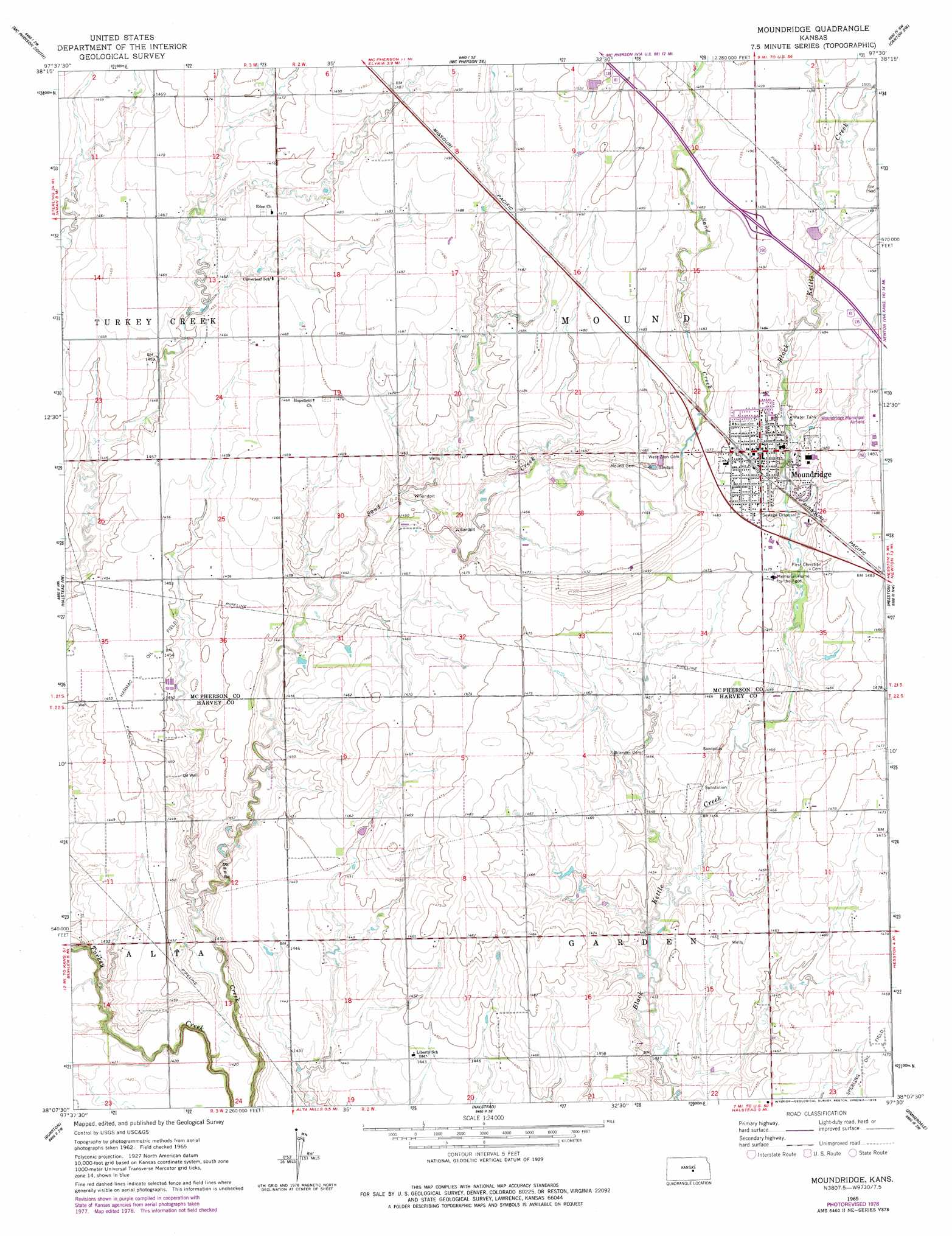
USGS Topo Quad 38097b5 - 1:24,000 scale
| Topo Map Name: | Moundridge |
| USGS Topo Quad ID: | 38097b5 |
| Print Size: | ca. 21 1/4" wide x 27" high |
| Southeast Coordinates: | 38.125° N latitude / 97.5° W longitude |
| Map Center Coordinates: | 38.1875° N latitude / 97.5625° W longitude |
| U.S. State: | KS |
| Filename: | o38097b5.jpg |
| Download Map JPG Image: | Moundridge topo map 1:24,000 scale |
| Map Type: | Topographic |
| Topo Series: | 7.5´ |
| Map Scale: | 1:24,000 |
| Source of Map Images: | United States Geological Survey (USGS) |
| Alternate Map Versions: |
Moundridge KS 1965, updated 1966 Download PDF Buy paper map Moundridge KS 1965, updated 1978 Download PDF Buy paper map Moundridge KS 2009 Download PDF Buy paper map Moundridge KS 2012 Download PDF Buy paper map Moundridge KS 2015 Download PDF Buy paper map |
1:24,000 Topo Quads surrounding Moundridge
Windom Ne |
Mcpherson North |
Galva |
Canton |
Waldeck |
Conway |
Mcpherson South |
Mcpherson Se |
Canton Sw |
Lehigh |
Buhler |
Halstead Nw |
Moundridge |
Hesston |
Goessel |
Hutchinson Se |
Burrton |
Halstead |
Zimmerdale |
Newton |
Haven |
Patterson |
Bentley |
Sedgwick |
Sedgwick Ne |
> Back to 38097a1 at 1:100,000 scale
> Back to 38096a1 at 1:250,000 scale
> Back to U.S. Topo Maps home
Moundridge topo map: Gazetteer
Moundridge: Airports
Moundridge Municipal Airfield elevation 455m 1492′Moundridge: Oilfields
Harmac Oil Field elevation 442m 1450′Sperling Oil Field elevation 446m 1463′
Moundridge: Populated Places
Moundridge elevation 455m 1492′Moundridge digital topo map on disk
Buy this Moundridge topo map showing relief, roads, GPS coordinates and other geographical features, as a high-resolution digital map file on DVD: