Chapman Topo Map Kansas
To zoom in, hover over the map of Chapman
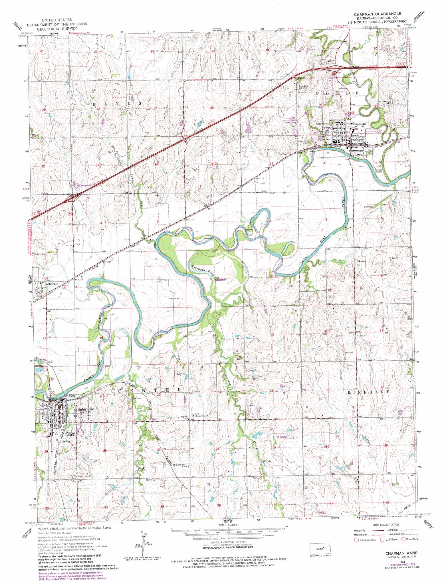
USGS Topo Quad 38097h1 - 1:24,000 scale
| Topo Map Name: | Chapman |
| USGS Topo Quad ID: | 38097h1 |
| Print Size: | ca. 21 1/4" wide x 27" high |
| Southeast Coordinates: | 38.875° N latitude / 97° W longitude |
| Map Center Coordinates: | 38.9375° N latitude / 97.0625° W longitude |
| U.S. State: | KS |
| Filename: | o38097h1.jpg |
| Download Map JPG Image: | Chapman topo map 1:24,000 scale |
| Map Type: | Topographic |
| Topo Series: | 7.5´ |
| Map Scale: | 1:24,000 |
| Source of Map Images: | United States Geological Survey (USGS) |
| Alternate Map Versions: |
Chapman KS 1964, updated 1965 Download PDF Buy paper map Chapman KS 1964, updated 1980 Download PDF Buy paper map Chapman KS 2009 Download PDF Buy paper map Chapman KS 2012 Download PDF Buy paper map Chapman KS 2015 Download PDF Buy paper map |
1:24,000 Topo Quads surrounding Chapman
Longford |
Industry |
Wakefield |
Milford |
Fort Riley Ne |
Manchester |
Buckeye |
Upland |
Milford Dam |
Junction City |
Solomon |
Abilene |
Chapman |
Kansas Falls |
Wreford |
Holland |
Abilene Sw |
Navarre |
Woodbine |
Skiddy |
Carlton |
Elmo |
Hope |
Herington |
Delavan |
> Back to 38097e1 at 1:100,000 scale
> Back to 38096a1 at 1:250,000 scale
> Back to U.S. Topo Maps home
Chapman topo map: Gazetteer
Chapman: Airports
Academy Airport elevation 359m 1177′Prichard Airstrip elevation 352m 1154′
Chapman: Lakes
Terrapin Lake elevation 336m 1102′Chapman: Populated Places
Chapman elevation 340m 1115′Detroit elevation 347m 1138′
Enterprise elevation 352m 1154′
Chapman: Streams
Chapman Creek elevation 329m 1079′Lone Tree Creek elevation 336m 1102′
Chapman digital topo map on disk
Buy this Chapman topo map showing relief, roads, GPS coordinates and other geographical features, as a high-resolution digital map file on DVD: