Ellinwood Sw Topo Map Kansas
To zoom in, hover over the map of Ellinwood Sw
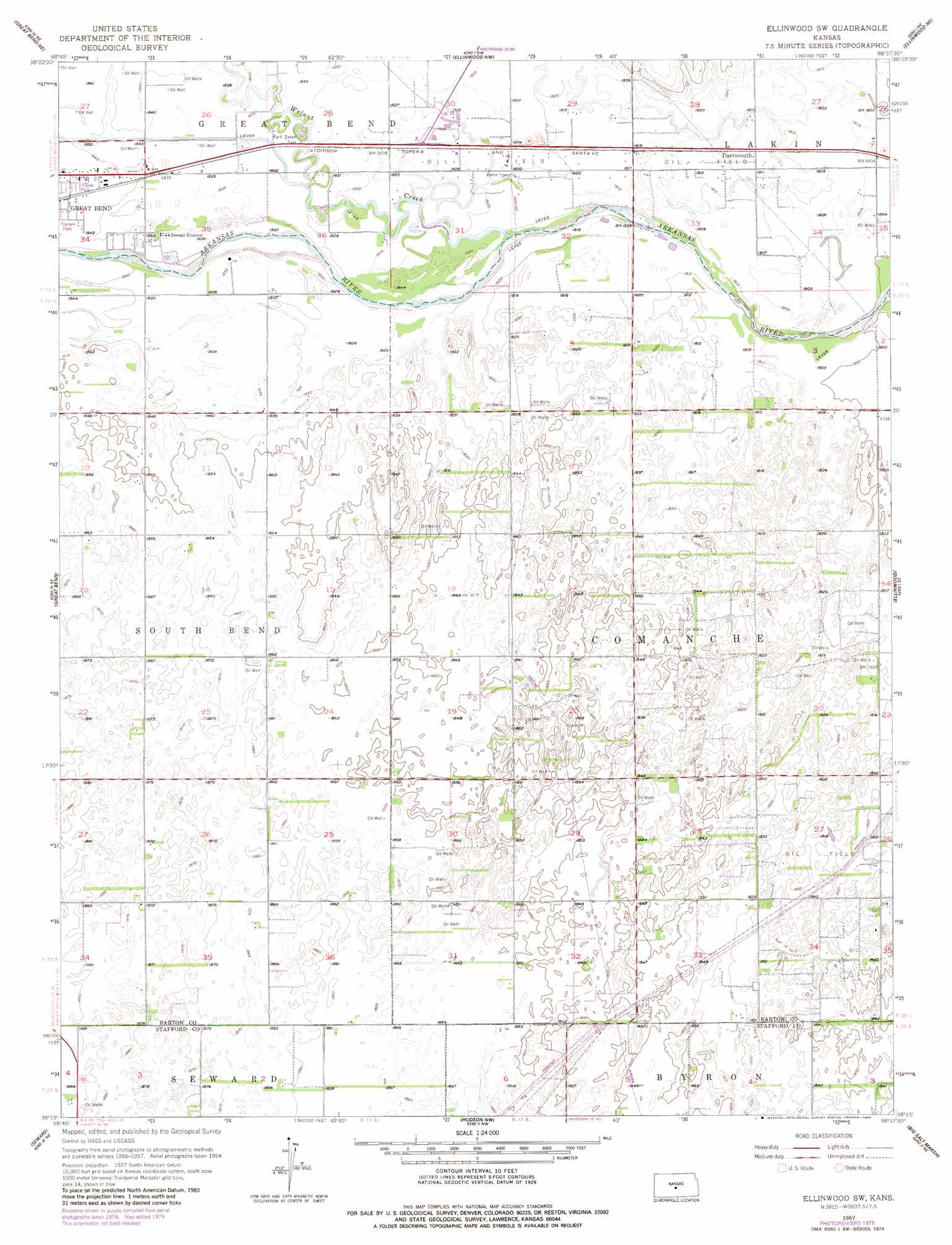
USGS Topo Quad 38098c6 - 1:24,000 scale
| Topo Map Name: | Ellinwood Sw |
| USGS Topo Quad ID: | 38098c6 |
| Print Size: | ca. 21 1/4" wide x 27" high |
| Southeast Coordinates: | 38.25° N latitude / 98.625° W longitude |
| Map Center Coordinates: | 38.3125° N latitude / 98.6875° W longitude |
| U.S. State: | KS |
| Filename: | o38098c6.jpg |
| Download Map JPG Image: | Ellinwood Sw topo map 1:24,000 scale |
| Map Type: | Topographic |
| Topo Series: | 7.5´ |
| Map Scale: | 1:24,000 |
| Source of Map Images: | United States Geological Survey (USGS) |
| Alternate Map Versions: |
Ellinwood SW KS 1957, updated 1958 Download PDF Buy paper map Ellinwood SW KS 1957, updated 1980 Download PDF Buy paper map Ellinwood SW KS 2009 Download PDF Buy paper map Ellinwood SW KS 2012 Download PDF Buy paper map Ellinwood SW KS 2015 Download PDF Buy paper map |
1:24,000 Topo Quads surrounding Ellinwood Sw
Olmitz |
Hoisington |
Redwing |
Claflin |
Holyrood |
Heizer |
Great Bend Ne |
Ellinwood Nw |
Ellinwood Ne |
Chase Nw |
Pawnee Rock |
Great Bend |
Ellinwood Sw |
Ellinwood |
Raymond |
Radium |
Seward |
Hudson Nw |
Big Salt Marsh |
Alden Nw |
Saint John Sw |
Saint John North |
Hudson |
Hudson Se |
Little Salt Marsh |
> Back to 38098a1 at 1:100,000 scale
> Back to 38098a1 at 1:250,000 scale
> Back to U.S. Topo Maps home
Ellinwood Sw topo map: Gazetteer
Ellinwood Sw: Parks
Fort Zarah Park elevation 558m 1830′Ellinwood Sw: Populated Places
Dartmouth elevation 553m 1814′Ellinwood Sw: Streams
Walnut Creek elevation 553m 1814′Ellinwood Sw digital topo map on disk
Buy this Ellinwood Sw topo map showing relief, roads, GPS coordinates and other geographical features, as a high-resolution digital map file on DVD: