Ellsworth Topo Map Kansas
To zoom in, hover over the map of Ellsworth
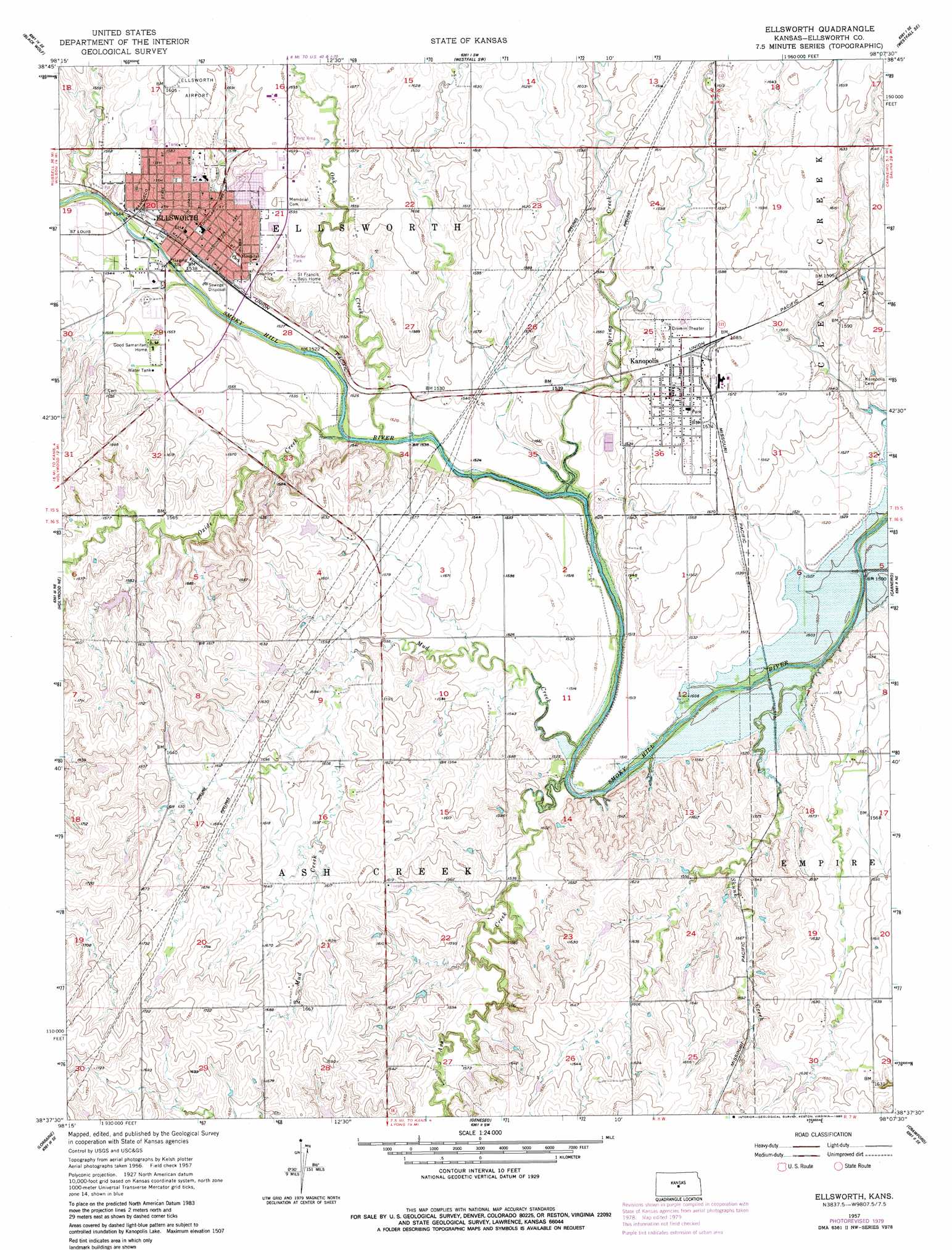
USGS Topo Quad 38098f2 - 1:24,000 scale
| Topo Map Name: | Ellsworth |
| USGS Topo Quad ID: | 38098f2 |
| Print Size: | ca. 21 1/4" wide x 27" high |
| Southeast Coordinates: | 38.625° N latitude / 98.125° W longitude |
| Map Center Coordinates: | 38.6875° N latitude / 98.1875° W longitude |
| U.S. State: | KS |
| Filename: | o38098f2.jpg |
| Download Map JPG Image: | Ellsworth topo map 1:24,000 scale |
| Map Type: | Topographic |
| Topo Series: | 7.5´ |
| Map Scale: | 1:24,000 |
| Source of Map Images: | United States Geological Survey (USGS) |
| Alternate Map Versions: |
Ellsworth KS 1957, updated 1958 Download PDF Buy paper map Ellsworth KS 1957, updated 1980 Download PDF Buy paper map Ellsworth KS 2009 Download PDF Buy paper map Ellsworth KS 2012 Download PDF Buy paper map Ellsworth KS 2015 Download PDF Buy paper map |
1:24,000 Topo Quads surrounding Ellsworth
Wilson Nw |
Wilson Ne |
Westfall Nw |
Westfall |
Juniata |
Wilson |
Black Wolf |
Westfall Sw |
Westfall Se |
Brookville Sw |
Holyrood Nw |
Holyrood Ne |
Ellsworth |
Carneiro |
Venango |
Holyrood |
Lorraine |
Geneseo |
Crawford |
Langley |
Chase Nw |
Chase Ne |
Lyons Nw |
Little River |
Windom |
> Back to 38098e1 at 1:100,000 scale
> Back to 38098a1 at 1:250,000 scale
> Back to U.S. Topo Maps home
Ellsworth topo map: Gazetteer
Ellsworth: Airports
Ellsworth Municipal Airport elevation 489m 1604′Ellsworth: Populated Places
Ellsworth elevation 469m 1538′Kanopolis elevation 483m 1584′
Ellsworth: Streams
Ash Creek elevation 454m 1489′Mud Creek elevation 454m 1489′
Oak Creek elevation 459m 1505′
Oxide Creek elevation 459m 1505′
Skunk Creek elevation 451m 1479′
Spring Creek elevation 457m 1499′
Ellsworth digital topo map on disk
Buy this Ellsworth topo map showing relief, roads, GPS coordinates and other geographical features, as a high-resolution digital map file on DVD: