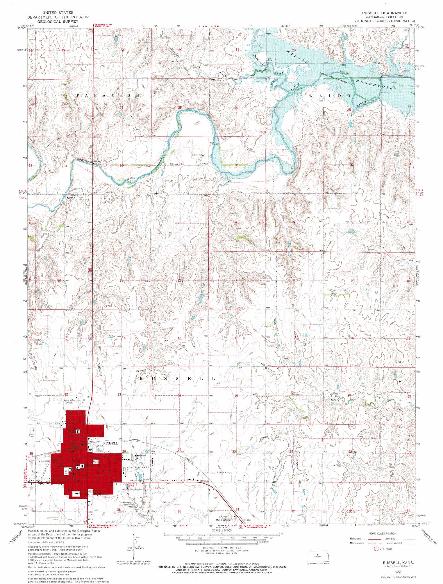
Russell Topo Map Kansas
To zoom in, hover over the map of Russell
USGS Topo Quad 38098h7 - 1:24,000 scale
| Topo Map Name: | Russell |
| USGS Topo Quad ID: | 38098h7 |
| Print Size: | ca. 21 1/4" wide x 27" high |
| Southeast Coordinates: | 38.875° N latitude / 98.75° W longitude |
| Map Center Coordinates: | 38.9375° N latitude / 98.8125° W longitude |
| U.S. State: | KS |
| Filename: | o38098h7.jpg |
| Download Map JPG Image: | Russell topo map 1:24,000 scale |
| Map Type: | Topographic |
| Topo Series: | 7.5´ |
| Map Scale: | 1:24,000 |
| Source of Map Images: | United States Geological Survey (USGS) |
| Alternate Map Versions: |
Russell KS 1967, updated 1968 Download PDF Buy paper map Russell KS 2009 Download PDF Buy paper map Russell KS 2012 Download PDF Buy paper map Russell KS 2015 Download PDF Buy paper map |
1:24,000 Topo Quads surrounding Russell
Natoma |
Paradise Nw |
Paradise Ne |
Vincent |
Meades Ranch |
Fairport |
Paradise |
Waldo |
Luray |
Lucas |
Gorham |
Russell Nw |
Russell |
Dorrance Nw |
Dorrance Ne |
Walker |
Russell Sw |
Homer |
Dorrance Sw |
Dorrance |
Otis Ne |
Galatia |
Susank |
Beaver |
Dubuque |
> Back to 38098e1 at 1:100,000 scale
> Back to 38098a1 at 1:250,000 scale
> Back to U.S. Topo Maps home
Russell topo map: Gazetteer
Russell: Oilfields
Claussen Oil Field elevation 524m 1719′Russell: Parks
Memorial Park elevation 555m 1820′Russell: Populated Places
Russell elevation 557m 1827′Russell: Streams
Boswell Creek elevation 470m 1541′Paradise Creek elevation 470m 1541′
Russell digital topo map on disk
Buy this Russell topo map showing relief, roads, GPS coordinates and other geographical features, as a high-resolution digital map file on DVD: