Russell Nw Topo Map Kansas
To zoom in, hover over the map of Russell Nw
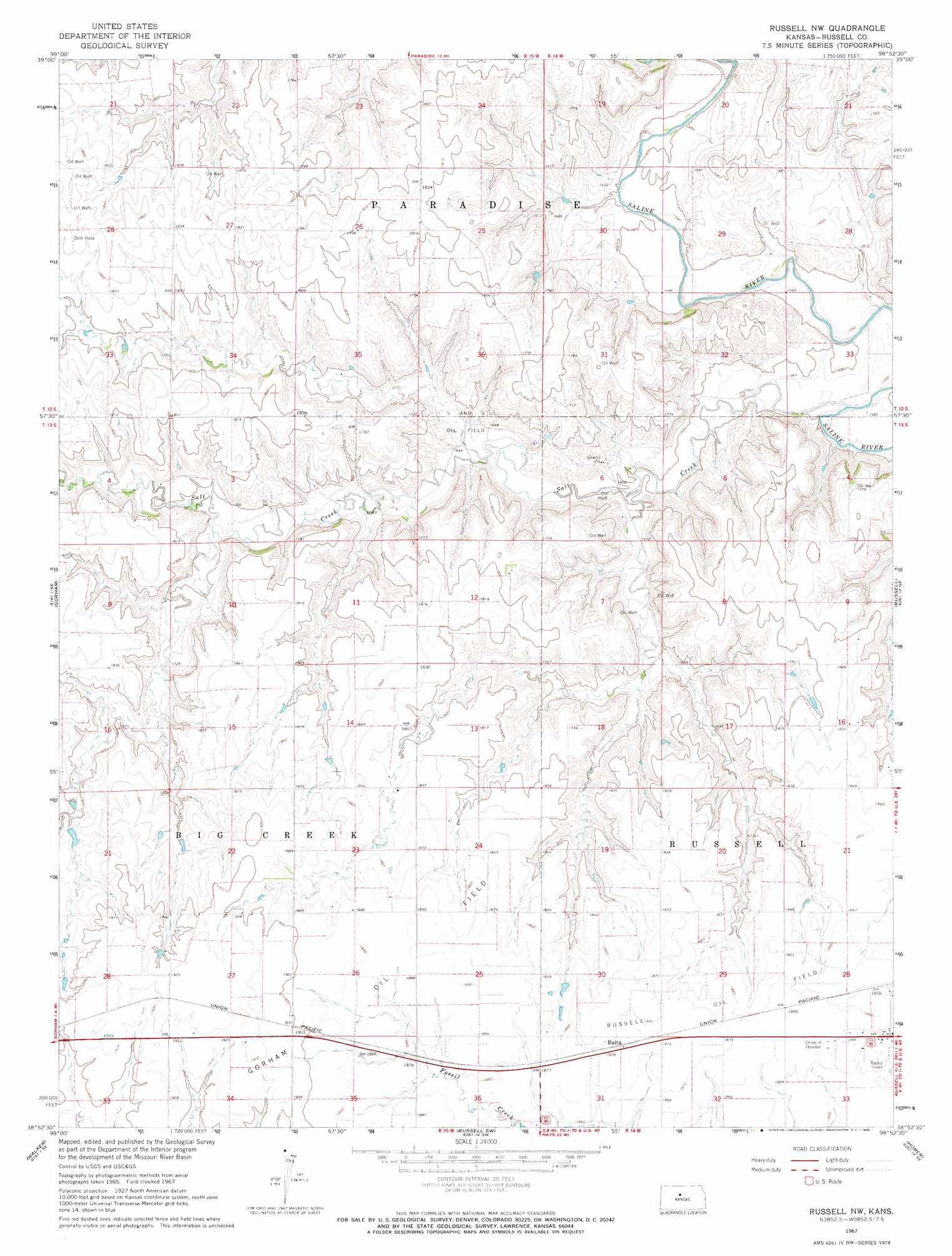
USGS Topo Quad 38098h8 - 1:24,000 scale
| Topo Map Name: | Russell Nw |
| USGS Topo Quad ID: | 38098h8 |
| Print Size: | ca. 21 1/4" wide x 27" high |
| Southeast Coordinates: | 38.875° N latitude / 98.875° W longitude |
| Map Center Coordinates: | 38.9375° N latitude / 98.9375° W longitude |
| U.S. State: | KS |
| Filename: | o38098h8.jpg |
| Download Map JPG Image: | Russell Nw topo map 1:24,000 scale |
| Map Type: | Topographic |
| Topo Series: | 7.5´ |
| Map Scale: | 1:24,000 |
| Source of Map Images: | United States Geological Survey (USGS) |
| Alternate Map Versions: |
Russell NW KS 1967, updated 1968 Download PDF Buy paper map Russell NW KS 2009 Download PDF Buy paper map Russell NW KS 2012 Download PDF Buy paper map Russell NW KS 2015 Download PDF Buy paper map |
1:24,000 Topo Quads surrounding Russell Nw
Codell |
Natoma |
Paradise Nw |
Paradise Ne |
Vincent |
Turkville |
Fairport |
Paradise |
Waldo |
Luray |
Catharine |
Gorham |
Russell Nw |
Russell |
Dorrance Nw |
Victoria |
Walker |
Russell Sw |
Homer |
Dorrance Sw |
Pfeifer |
Otis Ne |
Galatia |
Susank |
Beaver |
> Back to 38098e1 at 1:100,000 scale
> Back to 38098a1 at 1:250,000 scale
> Back to U.S. Topo Maps home
Russell Nw topo map: Gazetteer
Russell Nw: Oilfields
Gorham Oil Field elevation 575m 1886′Russell Oil Field elevation 574m 1883′
S and S Oil Field elevation 513m 1683′
Russell Nw: Populated Places
Balta elevation 572m 1876′Russell Nw: Streams
Salt Creek elevation 481m 1578′Russell Nw digital topo map on disk
Buy this Russell Nw topo map showing relief, roads, GPS coordinates and other geographical features, as a high-resolution digital map file on DVD: