Larned Topo Map Kansas
To zoom in, hover over the map of Larned
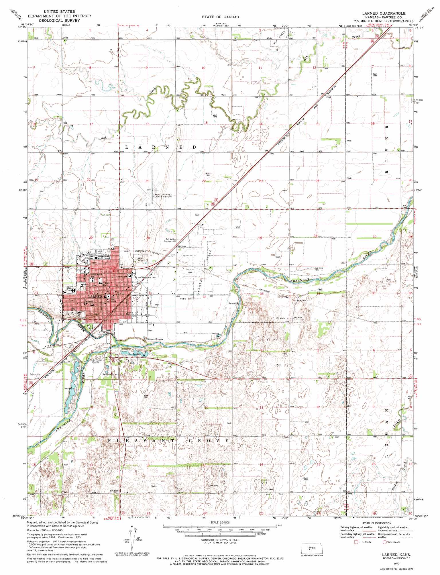
USGS Topo Quad 38099b1 - 1:24,000 scale
| Topo Map Name: | Larned |
| USGS Topo Quad ID: | 38099b1 |
| Print Size: | ca. 21 1/4" wide x 27" high |
| Southeast Coordinates: | 38.125° N latitude / 99° W longitude |
| Map Center Coordinates: | 38.1875° N latitude / 99.0625° W longitude |
| U.S. State: | KS |
| Filename: | o38099b1.jpg |
| Download Map JPG Image: | Larned topo map 1:24,000 scale |
| Map Type: | Topographic |
| Topo Series: | 7.5´ |
| Map Scale: | 1:24,000 |
| Source of Map Images: | United States Geological Survey (USGS) |
| Alternate Map Versions: |
Larned KS 1970, updated 1972 Download PDF Buy paper map Larned KS 2009 Download PDF Buy paper map Larned KS 2012 Download PDF Buy paper map Larned KS 2015 Download PDF Buy paper map |
1:24,000 Topo Quads surrounding Larned
Rush Center |
Timken |
Albert |
Heizer |
Great Bend Ne |
Rush Center Se |
Ash Valley |
Albert Se |
Pawnee Rock |
Great Bend |
Sanford |
Fort Larned |
Larned |
Radium |
Seward |
Rozel Se |
Garfield |
Zook |
Saint John Sw |
Saint John North |
Lewis |
Belpre Nw |
Belpre |
Macksville |
Saint John South |
> Back to 38099a1 at 1:100,000 scale
> Back to 38098a1 at 1:250,000 scale
> Back to U.S. Topo Maps home
Larned topo map: Gazetteer
Larned: Airports
Larned-Pawnee County Airport elevation 613m 2011′Larned: Oilfields
Ash Creek Oil Field elevation 600m 1968′Larned Oil Field elevation 607m 1991′
Larned: Populated Places
Larned elevation 611m 2004′Larned: Streams
Hubbard Creek elevation 605m 1984′Pawnee River elevation 605m 1984′
Larned digital topo map on disk
Buy this Larned topo map showing relief, roads, GPS coordinates and other geographical features, as a high-resolution digital map file on DVD: