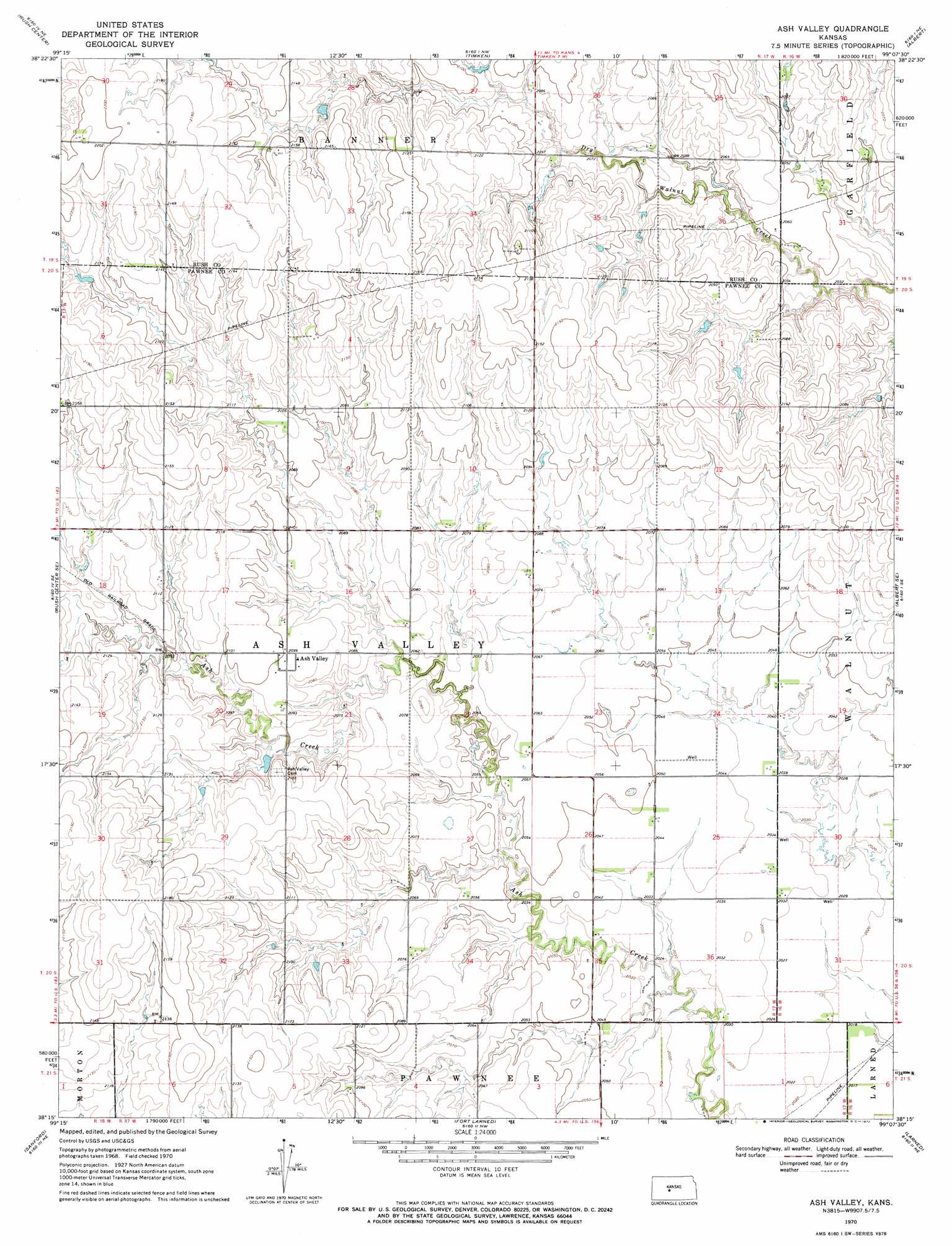
Ash Valley Topo Map Kansas
To zoom in, hover over the map of Ash Valley
USGS Topo Quad 38099c2 - 1:24,000 scale
| Topo Map Name: | Ash Valley |
| USGS Topo Quad ID: | 38099c2 |
| Print Size: | ca. 21 1/4" wide x 27" high |
| Southeast Coordinates: | 38.25° N latitude / 99.125° W longitude |
| Map Center Coordinates: | 38.3125° N latitude / 99.1875° W longitude |
| U.S. State: | KS |
| Filename: | o38099c2.jpg |
| Download Map JPG Image: | Ash Valley topo map 1:24,000 scale |
| Map Type: | Topographic |
| Topo Series: | 7.5´ |
| Map Scale: | 1:24,000 |
| Source of Map Images: | United States Geological Survey (USGS) |
| Alternate Map Versions: |
Ash Valley KS 1970, updated 1972 Download PDF Buy paper map Ash Valley KS 2009 Download PDF Buy paper map Ash Valley KS 2012 Download PDF Buy paper map Ash Valley KS 2015 Download PDF Buy paper map |
1:24,000 Topo Quads surrounding Ash Valley
Hargrave |
La Crosse |
Bison |
Otis |
Olmitz |
Nekoma |
Rush Center |
Timken |
Albert |
Heizer |
Rush Center Sw |
Rush Center Se |
Ash Valley |
Albert Se |
Pawnee Rock |
Rozel |
Sanford |
Fort Larned |
Larned |
Radium |
Rozel Sw |
Rozel Se |
Garfield |
Zook |
Saint John Sw |
> Back to 38099a1 at 1:100,000 scale
> Back to 38098a1 at 1:250,000 scale
> Back to U.S. Topo Maps home
Ash Valley digital topo map on disk
Buy this Ash Valley topo map showing relief, roads, GPS coordinates and other geographical features, as a high-resolution digital map file on DVD: